Belinț
|
Belinț Belintz, Belentz Belence |
||||
|
||||
| Basic data | ||||
|---|---|---|---|---|
| State : |
|
|||
| Historical region : | Banat | |||
| Circle : | Timiș | |||
| Coordinates : | 45 ° 45 ' N , 21 ° 46' E | |||
| Time zone : | EET ( UTC +2) | |||
| Area : | 63.20 km² | |||
| Residents : | 2,790 (2013) | |||
| Population density : | 44 inhabitants per km² | |||
| Postal code : | 307045 | |||
| Telephone code : | (+40) 02 56 | |||
| License plate : | TM | |||
| Structure and administration (as of 2016) | ||||
| Community type : | local community | |||
| Structure : | Belinț, Babșa , Chizătău , Gruni | |||
| Mayor : | Gheorghe-Florin Laza ( PNL ) | |||
| Website : | ||||
Belinț (German: Belintz , Belentz , Hungarian: Belence ) is a municipality in Timiș County , in the Banat region , in south-western Romania . The Belinț municipality also includes the villages of Babșa, Chizătău and Gruni .
Geographical location
Belinț is located in the east of Timiș County, on the DN6 national road , 14.5 kilometers from Lugoj and 45.5 kilometers from Timișoara .
Neighboring places
| Șanovița | Babșa | Târgovişte |
| Chizatau |

|
Coşteiu |
| Ohaba Forgaci | Boldur | Jabăr |
history
In the 10th century Belinț belonged to the Voivodat Glad and then to the Belu district. The place name had different spellings over the centuries; 1285 Becl , 1368 Belenche , 1482 Belincz , 1723 Bellinz , 1828 Belintz , 1869 Belintiu , 1913 Belencze .
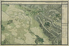
In an Ottoman defter from 1554, the place had 34 houses. Belinț ul de Jos and Belinț ul de Sus belonged to the Horasty family at that time. On the Mercy map, Belintz was a place inhabited by Romanians and belonged to the Lugoj district. After the Peace of Passarowitz (1718), when the Banat became a Habsburg crown domain , Belintz was part of the Temescher Banat . In 1782 Nicolae Defcics and Mihai Conrad bought the domain from the Vienna Court Chamber and in 1892 Belintz was owned by the Iankovici family (Doctorovics).
After the Austro-Hungarian Compromise (1867), the Banat was annexed to the Kingdom of Hungary within the dual monarchy of Austria-Hungary .
At the beginning of the 20th century, the law for the Magyarization of place names (Ga. 4/1898) was applied. The official place name was Belence . The Hungarian place names remained valid in the Kingdom of Romania until the administrative reform of 1923 when the Romanian place names were introduced.
On June 4, 1920, the Banat was divided into three parts as a result of the Treaty of Trianon . The largest, eastern part, to which Belinț also belongs, fell to the Kingdom of Romania .
Demographics
The population development of the Belinț municipality:
| census | Ethnicity | |||||||
|---|---|---|---|---|---|---|---|---|
| year | Residents | Romanians | Hungary | German | Other | |||
| 1880 | 6590 | 6308 | 71 | 169 | 42 | |||
| 1910 | 6176 | 5432 | 518 | 165 | 61 | |||
| 1930 | 4981 | 4476 | 329 | 130 | 46 | |||
| 1977 | 4098 | 3998 | 46 | 33 | 21st | |||
| 2002 | 3045 | 2990 | 31 | 18th | 6th | |||
Web links
- cjtimis.ro , Belinṭ on the Timiṣ County Council's website
- ghidulprimariilor.ro , Belinṭ Citizens' Registration Office
- belint.ro , story of Belinṭ
Individual evidence
- ↑ Mayoral elections 2016 in Romania ( MS Excel ; 256 kB)
- ^ Gerhard Seewann : History of the Germans in Hungary , Volume 2 1860 to 2006, Herder Institute, Marburg 2012
- ↑ kia.hu , (PDF; 982 kB) E. Varga: Statistics of the number of inhabitants by ethnic group in the Timiș district according to censuses from 1880 - 2002


