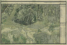
Mănăştiur
|
Mănăştiur Monostor Bégamonostor |
||||
|
||||
| Basic data | ||||
|---|---|---|---|---|
| State : |
|
|||
| Historical region : | Banat | |||
| Circle : | Timiș | |||
| Coordinates : | 45 ° 50 ' N , 22 ° 4' E | |||
| Time zone : | EET ( UTC +2) | |||
| Residents : | 1,781 (2002) | |||
| Postal code : | 307275 | |||
| Telephone code : | (+40) 02 56 | |||
| License plate : | TM | |||
| Structure and administration (as of 2016) | ||||
| Community type : | local community | |||
| Structure : | Mănăştiur, Pădurani , Remetea-Luncă , Topla | |||
| Mayor : | Curuț Ionel ( PSD ) | |||
| Postal address : | Str. Principală, no. 297 loc. Mănăştiur, jud. Timiș, RO-307275 |
|||
Mănăştiur (1924: Mănăştur , German: Monostor , Hungarian: Bégamonostor ) is a municipality in Timiș County , in the Banat region , in southwest Romania . The Mănăştiur municipality also includes the villages of Pădurani , Remetea-Luncă and Topla .
Geographical location
Mănăştiur is located in the east of Timiş County, eleven kilometers east of Făget , on the DJ609B Făget- Coşteiu county road and on the Lugoj - Ilia railway line .
Neighboring places
| Remetea-Luncă | Pădurani | Rachita |
| Leucuşeşti |

|
Dumbrava |
| Suzani | Traian Vuia | Bucovăț |
history
A first documentary mention dates from the year 1427. In 1453 the place name "Monostor" appeared in the documents of the Hungarian crown as a Wallachian settlement "districtus volahalis" in Temes County . In 1505 the village appeared under the name "Castellum Monosthor".
The castles Mănăştiur and Margina were both under the command of the Count of Brandenburg, who was married to Beatrix, the widow of Johann Hunyadi . In 1519 Mănăştiur Castle was incorporated into the Temes district, completely destroyed in 1551 by Count Petru Petrovici from Temesch and rebuilt in 1554. Marsigli mentioned the fortress Monostor 1690-1700 in his writings as part of the Făget district.
When the Habsburgs liberated the Banat from Turkish rule in 1717 , the place had 20 chimneys and belonged to the Făget district. In 1779 Mănăştiur belonged to Bulci , Caraş County . In 1880 150 Hungarian families were settled in Mănăştiur.
On June 4, 1920, the Banat was divided into three parts as a result of the Treaty of Trianon . The largest, eastern part, to which Mănăştiur also belonged, fell to the Kingdom of Romania . In the interwar period, the place belonged to Balinț , Severin district .
Demographics
The population development of the municipality of Mănăştiur:
| census | Ethnicity | |||||||
|---|---|---|---|---|---|---|---|---|
| year | Residents | Romanians | Hungary | German | Other | |||
| 1880 | 1563 | 1486 | 2 | 57 | 18th | |||
| 1910 | 2287 | 1966 | 294 | 5 | 22nd | |||
| 1930 | 2220 | 1776 | 238 | 18th | 188 | |||
| 1977 | 2094 | 1875 | 198 | 8th | 13 | |||
| 2002 | 1781 | 1597 | 104 | 3 | 77 | |||
Web links
- youtube.com , Mănăştiur on YouTube
- ghidulprimariilor.ro , Mănăştiur City Hall
Individual evidence
- ↑ Mayoral elections 2016 in Romania ( MS Excel ; 256 kB)
- ↑ kia.hu , (PDF; 982 kB) E. Varga: Statistics of the number of inhabitants by ethnic group in the Timiș district according to censuses from 1880 - 2002


