Coşteiu
|
Coşteiu Kastely, Kostély |
||||
|
||||
| Basic data | ||||
|---|---|---|---|---|
| State : |
|
|||
| Historical region : | Banat | |||
| Circle : | Timiș | |||
| Coordinates : | 45 ° 44 ' N , 21 ° 51' E | |||
| Time zone : | EET ( UTC +2) | |||
| Area : | 83.63 km² | |||
| Residents : | 3,668 (2013) | |||
| Population density : | 44 inhabitants per km² | |||
| Postal code : | 307125 | |||
| Telephone code : | (+40) 02 56 | |||
| License plate : | TM | |||
| Structure and administration (as of 2016) | ||||
| Community type : | local community | |||
| Structure : | Coşteiu, Hezeriş , Păru , Țipari , Valea Lungă Română | |||
| Mayor : | Petru Carebia ( PSD ) | |||
| Website : | ||||
Coșteiu (Hungarian: Kastely , Kostély ) is a municipality in Timiș County , in the Banat region , in southwestern Romania . Coşteiu was created by merging the villages of Coşteiu Mare (1924: Coşteiul Mare , Hungarian: Nagykastély ) Coşteiu Mic and Sâlha . The villages of Hezeriș , Păru , Țipari and Valea Lungă Română also belong to the municipality of Coşteiu .
Geographical location
Coşteiu is located in the southeast of the Timiș County, 7 kilometers northeast of Lugoj, on the national road DN6 Lugoj - Timișoara .
Neighboring places
| Babșa | Țipari | Cliciova |
| Belinț |

|
Valea Lungă Română |
| Boldur | Lugoj | Hezeriș |
history
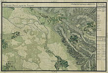
The place was first mentioned in a document in 1597. The village was built around a medieval fort. It is to this that it owes its name Kastely . On the Josephine land survey of 1717, the place was listed under the name Gustik . After the Peace of Passarowitz (1718), when the Banat became a Habsburg crown domain , Kastely was part of the Temescher Banat .
An important role in the history of Costeiu has the Begakanal . Work on the canal began in 1728. To regulate the Bega, the Dutch engineer Maximilian Emmanuel Fremaut built a dam near Coşteiu between 1758 and 1760 to regulate the amount of water from the Temesch into the Bega .
After the Austro-Hungarian Compromise (1867), the Banat was annexed to the Kingdom of Hungary within the dual monarchy of Austria-Hungary . At the beginning of the 20th century, the law for the Magyarization of place names (Ga. 4/1898) was applied. The official place name was Kastely . The Hungarian place names remained valid in the Kingdom of Romania until the administrative reform of 1923 when the Romanian place names were introduced.
On June 4, 1920, the Banat was divided into three parts as a result of the Treaty of Trianon . The largest, eastern part, to which Kastely also belongs, fell to the Kingdom of Romania . Since then the official name of the place is Coşteiu .
Demographics
The population development of the municipality of Coşteiu:
| census | Ethnicity | |||||||
|---|---|---|---|---|---|---|---|---|
| year | Residents | Romanians | Hungary | German | Other | |||
| 1880 | 4456 | 4376 | 29 | 47 | 4th | |||
| 1910 | 6373 | 4281 | 2021 | 34 | 37 | |||
| 1930 | 5590 | 3876 | 1610 | 26th | 78 | |||
| 1977 | 4535 | 3642 | 814 | 19th | 60 | |||
| 2002 | 3830 | 3171 | 501 | 12 | 146 | |||
Web links
- ghidulprimariilor.ro , Citizens Registration Office Coșteiu
- cjtimis.ro , Coșteiu on the Timiș County Council website
- youtube.com , Coșteiu on YouTube
Individual evidence
- ↑ Mayoral elections 2016 in Romania ( MS Excel ; 256 kB)
- ^ Gerhard Seewann : History of the Germans in Hungary , Volume 2 1860 to 2006, Herder Institute, Marburg 2012
- ↑ kia.hu , (PDF; 982 kB) E. Varga: Statistics of the number of inhabitants by ethnic group in the Timiș district according to censuses from 1880 - 2002


