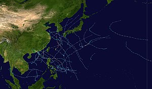
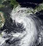
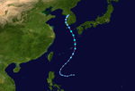
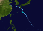
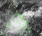
The Pacific typhoon season , unlike the Pacific or Atlantic hurricane season, has no official limits; it lasted all year in 1999 , although most tropical cyclones in the northwestern Pacific Ocean form between May and November.
The Pacific typhoon season is limited to the area of the Pacific Ocean north of the equator and west of the date line . Storms that form east of the dateline and north of the equator are called hurricanes if they exceed the strength of a tropical storm; these storms are part of the Pacific hurricane season . Tropical storms that form throughout the western Pacific Basin area are given a name by the Joint Typhoon Warning Center . Tropical low pressure areas in this area are given the suffix “W” to their serial number. Tropical lows that move into the area of responsibility of the Philippine Atmospheric, Geophysical and Astronomical Services Administration (PAGASA) or are formed there are given a designation by this institution. This can lead to the same storm being given two different names.
Storms
Tropical storm Hilda (Auring)
| Tropical Depression ( JMA )
|
| Tropical storm
|
|
|
| Duration
|
January 4th - January 7th
|
| intensity
|
30 kn (55 km / h ) (10 minutes) , 1000 hPa
|
The Joint Typhoon Warning Center (JTWC) issued a warning early January 4 of a developing broad circulation stretching off the northwest coast of Borneo . This developed into a tropical depression and slowly moved north from the coast of Borneo and became tropical storm Hilda on the morning of January 6th. A short time later, the storm reached its peak with wind speeds of 65 km / h. Hilda drifted north into an area of increasing wind shear that caused Hilda to disintegrate the next day. This system was run by both the Japan Meteorological Agency and PAGASA , but it was only classified as a tropical depression. PAGASA called the storm Auring .
It was reported from Malaysia that tropical storm Hilda caused heavy rains to hit Sabah, causing floods and landslides, killing six people. Property damage to damaged roads in Malaysia was given as 1.3 million US dollars , the equivalent of 15 million ringgit in 1999 .
Tropical storm Iris (Bebeng)
| Tropical Depression ( JMA )
|
| Tropical storm
|
|
|
| Duration
|
February 14th - February 19th
|
| intensity
|
30 kn (55 km / h ) (10 minutes) , 1004 hPa
|
A monsoon depression began to develop between Pohnpei and Chuuk on February 10 en route west . The JTWC issued a warning on February 13 as the low passed near Palau . The storm is slowly gathering strength as it moved to the Philippines and turned into tropical storm Iris on February 17, without increasing any further. After the storm turned northwards under the influence of a subtropical front in the east, it got into an area with strong wind shear and deteriorated visibly. On February 19, Iris disintegrated 220 km east of Luzon.
PAGASA classified this storm as a tropical low pressure area and named it Bebeng . Iris had no impact on land.
Tropical Storm Jacob (Karing)
| Tropical Depression ( JMA )
|
| Tropical storm
|
|
|
| Duration
|
April 6th - April 10th
|
| intensity
|
30 kn (55 km / h ) (10 minutes) , 1007 hPa
|
A low pressure area about 220 km west of Yap developed into a tropical low on April 6th. It gradually developed as it migrated westward and became a severe depression with winds of around 55 km / h. Then an acceleration began in a northwest direction and the system developed into a weak tropical storm during this phase. This course took the storm into a region with more wind shear, thereby losing the status of a tropical storm. The low circulation collapsed completely and the system reached southern Luzon on April 10th . The system was christened Karing by PAGASA and managed as a tropical low pressure area.
Rainfall from Jacob ranged from 80mm to 400mm in some locations, but minimal damage was recorded on land.
Severe Tropical Storm Kate (Diding)
| Severe Tropical Storm ( JMA )
|
| Category 1 typhoon
|
|
|
| Duration
|
April 22nd - April 28th
|
| intensity
|
55 kn (100 km / h ) (10 minutes) , 980 hPa
|
On April 22nd, a tropical disturbance that had formed in the Philippine Sea moved across Mindanao and intensified overland into a tropical depression. The low soon flooded on its way north to the east of the Philippines and was classified as Tropical Storm Kate the next day. The forecast of the JTWC originally assumed only a slight intensification and predicted a movement in a north-northeast direction in an area that is unfavorable for further development. Instead, Kate took a more northerly course and entered an area with minimal wind shear. On April 26th, Kate turned into a typhoon, the first of the year, and soon reached its highest wind speed of around 140 km / h. Later that day, the forward movement of the typhoon accelerated and it passed Iwo Jima just 9 km north. Kate then began to lose its convection and became extra-tropical on April 28, northeast of Iwo Jima.
Both JMA and PAGASA rated Kate as a tropical storm during the peak, in both cases the first tropical storm of the season. PAGASA named the depression Diding shortly after it was formed and classified it as a tropical storm even before the JTWC. Kate brought heavy rainfall to the northeast of the country, and in some places the rainfall added up to 260mm. The constant peak wind speeds were measured on Iwo Jima with 95 km / h and some gusts reached 126 km / h. There are no damage reports available for the Philippines or Iwo Jima.
Typhoon Leo
| Typhoon ( JMA )
|
| Category 3 typhoon
|
|
|
| Duration
|
April 27th - May 2nd
|
| intensity
|
110 kn (205 km / h ) (10 minutes) , 935 hPa
|
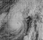
At the end of April a cyclone began to develop within a monsoon pressure area and turned into a tropical low pressure area about 710 km west of Manila in the South China Sea on April 27 . It strengthened as it moved west and was named Tropical Storm Leo the following day. The storm then moved in a cyclonic manner to intensify off the Vietnamese coast and became a typhoon as it migrated northeast. As the typhoon moved towards China, Leo came under a high pressure front at high altitude and rapidly intensified to its peak with winds of 205 km / h. However, this phase did not last very long, as the storm got into an area with strong wind shear as it moved north-east and Leo weakened on the further north. At the time of the landfall on May 2nd, Leo was classified only as a tropical depression. The convection and circulation of the storm were spatially separated from each other. The system soon dissolved over land.
As Typhoon Leo developed, the rainy ribbon structures brought rainfall of up to 130mm to various areas in Vietnam. High waves as a result of the typhoon sank a ship south of Hong Kong and only 7 of the 21 people on board were rescued. Wind speeds of 90 km / h were measured on Waglan Island as Leo passed Hong Kong and the storm dumped over 100 mm of rainfall in the area. The damage in Hong Kong was minor and the 14 injured were mostly caused by traffic accidents caused by rain.
Typhoon Maggie (Etang)
| Typhoon ( JMA )
|
| Category 3 typhoon
|
|
|
| Duration
|
June 1st - June 8th
|
| intensity
|
75 kn (140 km / h ) (10 minutes) , 955 hPa
|
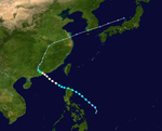
The sixth tropical depression of the season formed on June 1st in the monsoon trough east of the Philippines. The system intensified as it moved north and was classified as Typhoon Maggie 36 hours after it was formed. The typhoon grew stronger as it headed northwest on the Luzon Strait and peaked on June 5th with wind speeds of 195 km / h. The typhoon turned further west, where it was affected by the land area of the island of Taiwan and began to slowly weaken. Maggie reached southeast China, east of Hong Kong, as a typhoon with winds of 150 km / h on June 6th. The storm then migrated along the Chinese coast and weakened in the process. Maggie passed Hong Kong north and then turned into the mouth of the Pearl River to dissolve inland on June 8th. Both the JMA and PAGASA rated Maggie as a typhoon, and PAGASA's name for the storm was Etang .
Typhoon Maggie brought rains to the Philippines, causing landslides there, killing three people. Two people died in Taiwan and others went missing. In addition, more than 100,000 households were cut off from electricity, and agricultural damage on the island amounted to over $ 18 million. Maggie brought sustained winds of up to 80 km / h and 85 mm of precipitation in Hong Kong. Two oil tankers sank in the port. One of them was fully loaded and the leaking oil polluted a nearby area of the bank. The damage caused by Maggie was minor in Hong Kong, with five people injured in the storm. The storm killed four people and damaged over 3,000 homes in Guangdong . At least 120 ships were also affected and the direct economic damage as a result of the storm within the province amounted to more than $ 150 million. Maggie also caused rains in northern Vietnam, which caused local flooding with a rainfall of up to 100 mm.
Unnamed Tropical Storm (07W)
| Tropical Storm ( JMA )
|
| Tropical depression
|
|
|
| Duration
|
July 15 - July 18
|
| intensity
|
35 kn (65 km / h ) (10 minutes) , 996 hPa
|
An area of choppy weather northeast of Guam slowly developed as it moved west and became Tropical Depression 07W on July 15. Shortly after its formation, it reached its greatest intensity and kept its wind speed at 55 km / h for the next two days when it moved towards Honshu . Increased wind shear caused the system to weaken as it turned to the northeast. The low broke up southeast of Honshu on July 18, without ever posing a threat to land.
Tropical Depression 08W
| Tropical depression
|
|
|
| Duration
|
July 21 - July 22
|
| intensity
|
30 kn (55 km / h ) (1 minute) , 1000 hPa
|
A tropical fault moving north east of Okinawa was progressing better as it neared the main Japanese islands. On July 21st, it began to intensify and then became Tropical Depression 08W in northeast Okinawa. The depression increased slightly over the East China Sea . After the storm hit the mainland in South Korea on July 22, the storm turned extra-tropical when it crossed the Korean Peninsula . The low dissolved over the Sea of Japan .
Severe Tropical Storm Neil (Helming)
| Severe Tropical Storm ( JMA )
|
| Tropical storm
|
|
|
| Duration
|
July 25th - July 28th
|
| intensity
|
50 kn (95 km / h ) (10 minutes) , 980 hPa
|
On July 23, a tropical disturbance began to develop within the monsoon trough in the Philippine Sea. The convection increased noticeably as the disturbance moved north and on July 25 the ninth tropical depression of the season formed south of Okinawa. The system passed near the Japanese island and was soon classified as Tropical Storm Neil. The storm turned slightly west towards the Korean Peninsula and peaked with winds of 75 km / h on July 26th. Neils reached the mainland southwest of Suncheon the next day as a weak tropical storm, which soon came back to sea as a tropical low over the Yellow Sea . There, Neil came under the influence of a subtropical channel that turned the system back towards South Korea. Neil hit the coast again on July 28, 35 km southwest of Seoul , and then quickly disintegrated over land.
Neil has been classified as a tropical storm by both JMA and PAGASA and PAGASA named Neil Helming . Unusually, PAGASA pinpointed the climax of the storm on July 22nd, while the JTWC Neil was still passing as a developing tropical fault. This difference is due to differing opinions of the two weather observation centers about where the center of the storm was. Damage from floods and gusts of wind due to Neil was reported from Japan and a ferry ran aground near Kannoura . The eight-man crew perished in the sinking of a fishing boat off the coast of South Korea. On the Jeju-do the gusts of wind reached speeds of up to 95 km / h and the amount of rain during the peak of Neil was more than 200 mm. As the storm broke up over South Korea, it caused floods that killed at least seven people and left 7,000 homeless.
Unnamed Tropical Storm (10W)
| Tropical Storm ( JMA )
|
| Tropical depression
|
|
|
| Duration
|
July 25th - July 27th
|
| intensity
|
40 kn (75 km / h ) (10 minutes) , 985 hPa
|
Tropical disturbance began to develop on July 23 within the same monsoon channel in the South China Sea that had produced tropical storm Neil further east. The fault became a tropical depression late on July 25th and turned northward towards the Chinese coast. The system did not strengthen much further and reached the mainland on July 27th near Shanwei as a minimal tropical depression. The low then moved inland where it dissolved. The JMA rated 10W as a tropical storm, with ten-minute peak wind speeds of 75 km / h. It was the second system in 1999 that was classified as a tropical storm by the JMA, while the JTWC classified the system as a low pressure area.
As the low pressure area passed Hong Kong, around 31 mm of precipitation fell and the sustained winds measured on Waglan Island were 72 km / h. There was no significant damage over land in connection with the low pressure area.
Typhoon Olga (Ising)
| Typhoon ( JMA )
|
| Category 1 typhoon
|
|
|
| Duration
|
July 29th - August 3rd
|
| intensity
|
65 kn (120 km / h ) (10 minutes) , 970 hPa
|
On July 26, a fault began to develop on the eastern end of a well-formed monsoon channel east of the Philippines. The convection within this fault increased as it moved north, and on July 29th, Tropical Depression 11W formed. The system continued to intensify and was classified as a typhoon two days later as it approached Okinawa . After Olga hit the Japanese island on August 1, the system weakened slightly as it moved across the island. It continued to migrate north-northwest, intensifying to its peak, which it reached with winds of 150 km / h as it approached Korea. The storm began to weaken as it passed west of Jeju-do on August 3 and landed for the second time on the T'aean Peninsula. Then it moved northwards over the Yellow Sea and finally landed one last time in North Korea the next. Olga was a strong tropical storm and reached wind speeds of 100 km / h and shortly afterwards became extra-tropical. Olga was classified as a typhoon by both PAGASA and PAGASA named the storm Ising before the JTWC issued its first warning about the evolving system.
Though Typhoon Olga had not approached the Philippines directly. he was responsible for heavy rains there, which killed 160 people and made 80,000 homeless in much of Luzon . Olga moved across Okinawa at wind speeds of 80 km / h, but nothing is known of any damage on the island. On the Korean Peninsula, the heavy rainfalls added up to precipitation amounts of up to 600 mm, with the highest values occurring in the border area between North and South Korea. The resulting floods in South Korea caused 64 deaths. Individual gusts of wind of 96 km / h were recorded near Seoul . The floods destroyed around 400,000 square kilometers of rice cultivation areas and 8,500 houses in South Korea , leaving 25,000 homeless. The Red Cross reported that 42 people were killed and 40,000 left homeless in North Korea, and that the floods worsened existing food shortages. Typhoon Olga brought the heaviest rainfall in North and South Korea in 25 years, causing damage of $ 657 million there.
Tropical storm Paul
| Tropical Storm ( JMA )
|
| Tropical storm
|
|
|
| Duration
|
August 3 - August 8
|
| intensity
|
45 kn (85 km / h ) (10 minutes) , 980 hPa
|
In early August, a low-altitude cyclone developed within a monsoon vortex southwest of Guam . On August 2, the JTWC first issued indications of the developing fault and on the next day classified the system as a tropical depression 12W, which intensified further and was upgraded to Tropical Storm Paul on August 4 and merged with the eddy from which he had formed. Paul reached his greatest intensity with wind speeds of 95 km / h and was east of Okinawa. Paul turned briefly in a northeasterly direction and then weakened back to a tropical depression. The low moved toward the western shore of the south coast of Kyushu on August 6, before dissolving in the Yellow Sea on August 6 .
Tropical Storm Paul was extremely unusual because it developed from and then combined with a monsoon vortex. Such connections are very rare and it is far more common for tropical storms that form in this way to then move independently of the non-tropical system. Paul was also rated a tropical storm by the JMA, which also reported that the storm caused landslides and flooding in western Japan.
Tropical Storm Rachel
| Tropical Storm ( JMA )
|
| Tropical storm
|
|
|
| Duration
|
August 6th - August 9th
|
| intensity
|
35 kn (65 km / h ) (10 minutes) , 992 hPa
|
A tropical fault formed within a monsoon channel off the Chinese coast on August 6, and it intensified and was named Tropical Storm Rachel as it moved towards Taiwan. Rachel weakened to a tropical low before reaching the island, however, and dissolved over the Chungyang Mountains on August 7th . The remnants of the system migrated further northeast into the East China Sea, where the system re-formed the next day as it approached Okinawa. Rachel briefly became a tropical storm for the second time before turning northwest. Then he got under increasingly unfavorable conditions and weakened quickly on August 9th. Nothing is known of any damage caused by Rachel.
Tropical Depression 14W
| Tropical depression
|
|
|
| Duration
|
August 8th - August 10th
|
| intensity
|
25 kn (45 km / h ) (1 minute) , 1000 hPa
|
Tropical depression 14W formed on August 8, 120 km north of Iwo Jima . The low moved northward under the influence of a subtropical front over northern Japan and turned northwest on August 9, then accelerated its winds to 45 km / h before reaching the mainland at Owase . The low pressure area weakened over Honshū and shortly thereafter dissolved over the Sea of Japan .
Tropical Depression 15W
| Tropical depression
|
|
|
| Duration
|
August 16 - August 18
|
| intensity
|
25 kn (45 km / h ) (1 minute) , 1002 hPa
|
A tropical disturbance developed in the East China Sea on August 15 and gradually drifted towards Kyushu . The system intensified and became tropical depression 15W the next day. The fourth warning from the JTWC saw the cyclone closer to the coast, where it finally hit the mainland near Ushibuka on August 17 . The low then migrated across the island and reached the Sea of Japan about later that day and weakened there. The storm broke up on August 18, but the remains were noticeable for another two days.
Severe Tropical Storm Sam (Luding)
| Severe Tropical Storm ( JMA )
|
| Category 1 typhoon
|
|
|
| Duration
|
August 18 - August 23
|
| intensity
|
55 kn (100 km / h ) (10 minutes) , 980 hPa
|
On August 17th, circulation within the monsoon channel in the Philippine Sea began to better organize and the JTWC issued information. The evolving system migrated northwest and nine hours later was classified as Tropical Depression 16W. As the cyclone intensified, the low was upgraded to Tropical Storm Sam on August 19th. A subtropical gully in the north changed course in a westerly direction towards Luzon. The storm moved over the north of the island on August 20 and entered the South China Sea. Sam reached typhoon strength the following day and intensified as it approached the Chinese coast. The typhoon hit the mainland 19 km northeast of Hong Kong and the typhoon peaked on August 22 with wind speeds of 140 km / h. Sam continued on his way northwest over mainland China and disbanded about 24 hours later. PAGASA named the developing storm Luding just before the JTWC began issuing notices.
Typhoon Sam was responsible for seven deaths in the Philippines and flooding from the rainfall left 4,000 people homeless. The landslides blocked some of the main roads in Baguio City . Sam was the rainiest tropical cyclone to hit Hong Kong since records began in 1884. The rainfall of over 616 mm had exceeded the previous record from 1926. Sustained peak wind speeds of 96 km / h had been measured on Waglan Island when the typhoon passed over the area. The heavy rain caused flash floods and more than 150 landslides within Hong Kong. One person was killed and more than 1,000 were forced to evacuate. A total of 328 people were injured in various incidents related to the storm, and the total damage in Hong Kong came to approximately $ 17 million. In addition to the direct victims of the storm, three dead and over 200 injured are to be expected from China Airlines flight 642 , which crash-landed on arrival at Hong Kong International Airport . At the time of the accident, gusts of more than 65 km / h were measured at the airport . After Sam reached China, the storm killed at least 17 people there and injured another 100 people in Guangdong . The direct economic damage in the province amounted to $ 18 million.
Severe tropical storm Tanya
| Severe Tropical Storm ( JMA )
|
| Category 1 typhoon
|
|
|
| Duration
|
August 19 - August 24
|
| intensity
|
50 kn (95 km / h ) (10 minutes) , 1000 hPa
|
The Tropical Depression 17-W formed unusually far north, beyond the 30th parallel. It arises from a westward moving area with low air pressure. The very compact system intensified on the way to the west under the influence of a subtropical front in the north and the JTWC classified the low on the morning of August 20 as Tropical Storm Tanya. Tanya continued the slow intensification and Typhoon Tanya peaked on August 22nd with winds reaching 130 km / h. The next day, Tanya began lurching due to weakness in the northern front and emerging wind shear weakened the storm. This weakened further when the conversion to an extra-tropical cyclone occurred and on August 24th the JTWC issued its final warning about the cyclone.
Tanya was also watched by the JMA, which rated the storm at its summit as a severe tropical storm. Post-season post-season re-analysis found that the initial intensity of the system was higher, so Tanya was already a tropical storm before the JTWC began issuing warnings. Typhoon Tanya had no impact on land.
Severe tropical storm Dora
| Severe Tropical Storm ( JMA )
|
| Tropical storm
|
|
|
| Duration
|
August 20 - August 23
|
| intensity
|
50 kn (95 km / h ) (10 minutes) , 990 hPa
|
- → Main article: Hurricane Dora (1999)
Hurricane Dora, the strongest storm of the 1999 Pacific hurricane season , crossed the international dateline into the western Pacific on August 20 . The last warning from the Central Pacific Hurricane Center , when Dora was still in the Central Pacific, was of a minimal hurricane. When the storm crossed the date line, the JTWC assumed responsibility for the storm and downgraded it to a tropical storm in its first weather warning. Once in the western Pacific, Dora turned northwest as a tropical storm and weakened even further as the wind shear increased. Dora was downgraded to a tropical depression north of Wake on August 22nd . Moving further north, Dora disbanded the next day.
Dora was the first storm since John in 1994 to exist in all three Pacific Basins. The system did not cause any significant damage anywhere in its migration through the Pacific Ocean.
Tropical Depression 18W
| Tropical depression
|
|
|
| Duration
|
August 21st - August 24th
|
| intensity
|
30 kn (55 km / h ) (1 minute) , 1000 hPa
|
On August 21, a small cyclone formed at the southern end of a westward moving line of wind shear, about 1200 km east of Tokyo . The low pressure area intensified slightly and peaked with wind speeds of 55 km / h the next day before the increasing wind shear took a toll on the system. The tropical depression became extra-tropical the next day east of Japan without coming close to land.
Typhoon Virgil
| Category 1 typhoon
|
|
|
| Duration
|
August 24th - August 29th
|
| intensity
|
70 kn (130 km / h ) (1 minute) , 972 hPa
|
On August 23, Jima formed at the end of a series of shears north of Iwo Jima . The vertical wind shear began to weaken and the JTWC began issuing Tropical Depression Warnings 19W the next. The storm turns to the southwest and intensified rapidly from the status of a tropical low pressure area to its peak as a typhoon on August 25 with wind speeds of 130 km / h within just twelve hours. Virgil held the typhoon strength for more than a day, but then got into a high-shear environment and began to weaken again. Under the influence of a passing front system, the direction of forward movement turned clockwise in a northeasterly direction. The storm broke up on August 29th without getting any closer to the land. The JMA observed Typhoon Virgil and classified it as a minimal severe tropical storm at its peak.
Tropical Storm Wendy (Mameng)
| Tropical storm
|
|
|
| Duration
|
September 1st - September 4th
|
| intensity
|
40 kn (75 km / h ) (1 minute) , 994 hPa
|
At the end of August, an extensive area of convection developed over a low pressure area in the Philippine Sea east of Luzon. The system evolved into Tropical Depression 20W on September 1, migrating westward. It did not intensify at first because it passed over the edge of the northwestern tip of Luzon on September 2nd. After the storm hit the South China Sea, it turned more west and peaked as Tropical Storm Wendy with winds of 75 km / h. It maintained this strength until it reached the mainland the next day in China, about 220 km east-northeast of Hong Kong. The storm moved inland and soon dissolved. Both JMA and PAGASA observed the storm and PAGASA gave it the name Mameng . PAGASA rated the storm as having stronger winds than the JTWC, although PAGASA uses 10 minute averages when calculating sustained winds, which usually results in lower wind speeds.
Wendy caused heavy rains in southern China that lasted for a week. Up to 500 mm of precipitation was measured in the north of Jiangxi and in the south of Zhejiang . At least 133 people were killed and over 2,600 injured, with Wenzhou particularly hard hit. More than half a million people had to be evacuated and more than 2.2 million people were affected by the storm. A local government official called the storm "the worst storm of the century" . Direct economic damage in the region exceeded $ 275 million. Although mainland China was badly hit, the storm on Hong Kong had little impact.
Typhoon York (Neneng)
| Category 1 typhoon
|
|
|
| Duration
|
September 11th - September 17th
|
| intensity
|
70 kn (130 km / h ) (1 minute) , 972 hPa
|
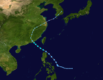
A tropical disturbance developed in the western Philippine Sea on September 10, despite initial development difficulties because it was affected by the land area of Luzon . The fault moved across Luzon to the South China Sea, where it could develop better and was classified as Tropical Depression 21W on the evening of September 11th. The system steadily strengthened as it approached the Chinese coast and the winds reached a top speed of 130 km / h as Typhoon York on September 16. York's course was west of Hong Kong over the mainland and the next day the typhoon broke up. Both JMA and PAGASA ruled York as a tropical storm, PAGASA named the system Neneng .
When the developing low pressure area crossed the Philippines, it brought heavy rains, some of which reached up to 400 mm, causing flooding in the Cagayan Valley . Eighteen people were killed in landslides in northern Luzon. When the typhoon York Hong Kong approaching, the hoisted Hong Kong Observatory , the signal No. 10 to warn the public for the first time since 1983 and left it there for 11 hours, the longest time the signal was left at this level. The constant peak wind speeds on Waglan Island were recorded at 150 km / h and the peak gust of 234 km / h was the highest value ever measured there. A total of 300mm of rain over Hong Kong when York swept directly over the territory and the resulting floods had a severe impact on Hong Kong's agriculture. Two people died in the storm and over 500 were injured, 11 of them seriously. Over 18,000 homes lost power during the storm and 4,000 trees were uprooted. The damage caused by the storm topped $ 10 million and direct economic losses totaled billions of Hong Kong dollars. Traffic was severely disrupted, over 470 flights were canceled, affecting 80,000 passengers.
Two ships ran aground and a freighter sank, the crews were successfully rescued. One person was injured in Macau and 120 incidents caused by the storm were recorded there. After York swept across Hong Kong, the typhoon killed 15 people and injured another 700 in Guangdong ; the economic damage there exceeded the $ 24 million mark. 10,000 people were cut off from the outside world by the floods in China, and more than ten thousand trees were uprooted in Shenzhen .
Tropical storm Zia
| Tropical storm
|
|
|
| Duration
|
September 13th - September 15th
|
| intensity
|
45 kn (85 km / h ) (1 minute) , 997 hPa
|
The JTWC began tracking a fault in a monsoon channel west of the Mariana Islands on September 11th . The fault migrated north without significant development until September 13, when the outflow from the system improved significantly and soon a tropical depression was developing east of Okinawa. The low continued to intensify and was upgraded to Tropical Storm Zia that day as it approached Kyushu . Zia peaked with winds of 85 km / h when it hit Kyushu Island on September 14th. The storm turned northeast and passed over Japan , only to disperse over the center of Honshu the next day .
Tropical Storm Zia brought heavy rain to western Japan, exceeding 500mm in some places. The floods and landslides that followed caused evacuations of more than 14,000 people and cut off over 1,300 tourists in a Japanese mountain town. A total of nine people were killed by Zia in Japan.
Tropical Storm Ann
| Tropical storm
|
|
|
| Duration
|
September 15 - September 20
|
| intensity
|
45 kn (85 km / h ) (1 minute) , 991 hPa
|
Tropical low pressure area 23W formed on September 15 about 165 km east of Okinawa from a fault that moved northwestwards under the influence of a subtropical high pressure area. As the system developed, it turned first northwest and then west, and was named Tropical Storm Ann a day later. As Ann approached mainland China north of Shanghai on September 18, the storm reached its peak with winds of 85 km / h and began to turn more in a northwesterly direction again. The storm began the phase of weakening when it encountered strong wind shear. Ann was caught by a mid-level gully that crossed the region and turned east. The storm quickly weakened over the Yellow Sea and the system broke up on September 20, just off the South Korean coast near Mokpo .
Tropical Storm Ann caused moderate rainfall of up to 100 mm in Anhui , Jiangsu and Shandong on September 18. South Korea and southwest Japan were saturated with up to 200mm of rainfall from Ann and Typhoon Bart , causing flooding and damage to rice fields.
Super Typhoon Beard (Oniang)
| Category 5 super typhoon
|
|
|
| Duration
|
September 17th - September 24th
|
| intensity
|
140 kn (260 km / h ) (1 minute) , 898 hPa
|
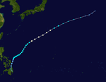
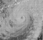
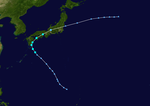
Tropical Depression 24W developed east of Taiwan on September 17th. The storm migrated northwest and was upgraded to Tropical Storm Bart on September 19 and hit typhoon strength the next day. Bart intensified as he turned northeast under the influence of high winds. The typhoon peaked on September 22, with sustained peak winds of 260 km / h as it passed Okinawa 75 km west, making it the only super typhoon of 1999. Bart slowly began to weaken as it pulled north towards Kyushu , which he met on September 23 with wind speeds of 185 km / h. After crossing Kyushu and the far west of Honshū , the storm accelerated its northeastern advance into the Sea of Japan and became extratropical just before reaching north of Hokkaidō . Because Typhoon Bart was formed in PAGASA's area of responsibility, the system was named Oniang before it moved north.
Typhoon Bart claimed at least two lives on the island of Okinawa and caused rainfall in excess of 710 mm. The Kadena Air Base was badly damaged by the typhoon and the damage at the military base amounted to more than 5 million US dollars. Severe floods and landslides in Japan resulted in more than 30 deaths and over 1,000 injuries. More than 800,000 homes were without electricity and 80,000 were damaged by the storm. The worst damage occurred in Kumamoto Prefecture , Kyushu , where 16 people were killed and over 45,000 were damaged. Bart affected all of Japan as less damage was done on Hokkaidō after the storm became extra-tropical. A falling crane killed three workers at the Mitsubishi facility in Hiroshima and injured four others. The Itsukushima Shrine was also affected. Typhoon Bart was the most expensive storm of the typhoon season; the total storm damage was $ 3.5 billion.
Tropical storm cam
| Tropical storm
|
|
|
| Duration
|
September 23rd - September 26th
|
| intensity
|
40 kn (75 km / h ) (1 minute) , 991 hPa
|
A weather disruption in an area south of Hong Kong in the South China Sea began to organize itself early on September 23, and the JTWC began issuing notices about the system. It became the 25th low pressure area of the season and headed northeast as it was under the influence of a front at mid-height on its east side. The low continued to develop and was upgraded to Tropical Storm Cam on September 24th. It reached its peak that day with sustained winds of 75 km / h when the forward movement gradually changed to the north. As it neared the Chinese coast, a strong front to the north of Cam abruptly pushed west, towards Hong Kong, and the system began to weaken. The JTWC issued its final warning when the low was still at sea, just before it hit Hong Kong with winds of 35 km / h. The storm broke up over China on September 26th.
As Tropical Storm Cam approached Hong Kong, HKO named No. 5 for the fifth time that year . 8 signal hoisted. This happened for the first time since 1964. The strongest gust on land was measured at 121 km / h on Tai Mo Shan . Rainfall was moderate in Hong Kong at 41 mm. Cam was responsible for 23 injuries and one death. There were limited flash floods locally and around 150 people had to be temporarily taken to emergency shelters. There were disruptions in air traffic and around 100 flights were canceled or delayed.
Typhoon Dan (Pepang)
| Category 3 typhoon
|
|
|
| Duration
|
October 2nd - October 11th
|
| intensity
|
110 kn (205 km / h ) (1 minute) , 933 hPa
|
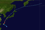
The tropical depression 26W developed on October 1st over the Philippine Sea, about 750 km east of Luzon . The system intensified as it moved west-northwest and was upgraded to Tropical Storm Dan on October 3 and hit typhoon strength the next day. Typhoon Dan reached its greatest strength on October 5th with winds of 205 km / h and it hit the north of Luzon at this strength. The typhoon weakened as it moved into the South China Sea, but gained strength again as it turned north. Typhoon Dan reached the mainland for the second time near Xiamen , China , on October 9, and then weakened overland. Dan turned northeast and grew weaker. As a tropical low, Dan crossed the Yellow Sea late on October 10th, but was absorbed by a front system the next morning. Both JMA and PAGASA rated this storm as a typhoon and Pagasa's name was Pepang .
Typhoon Dan caused heavy rain with amounts of rain of up to 500 mm in both northern Luzon and southern Taiwan . The flash floods affected 2,600 homes in the Philippines and killed at least five people. The damage to agriculture in the Philippines was more than $ 2 million. Southern Taiwan had not yet fully recovered from the previous month's Chi-Chi earthquake , and Dan dealt a blow to those efforts. The typhoon broke a levee in Kaohsiung and another in Tainan , both of which had already been damaged by the earthquake. Dan caused a lot of fallen trees on Kinmen, cutting off power for more than 70% of the island's population. Several fishing boats were sunk and houses damaged in the storm on Penghu . 34 people were killed in the storm in Fujian and around 1,400 others were injured. 1,500 homes were destroyed in the province and the damage totaled $ 240 million. Dan was the most momentous typhoon to hit Xiamen in 46 years, killing five people and injuring over 100 in the city.
Tropical Storm Eve (Rening)
| Tropical storm
|
|
|
| Duration
|
October 15 - October 19
|
| intensity
|
35 kn (65 km / h ) (1 minute) , 997 hPa
|
An extensive area of convection in northeast Mindanao Island began to develop on October 15 as it moved west and was classified as Tropical Depression 27W. It moved right across Samar and towards the middle of the Philippines. After reaching the South China Sea on October 18, the low turned west, responding to a front over south-east China that grew stronger at medium altitude. As the system neared the Vietnamese coast, it intensified and was promoted to Tropical Storm Eve. Eve reached the mainland on October 19, 110 km southeast of Da Nang, as a weak tropical storm and the system quickly disintegrated over land. Eve was rated as a tropical storm by both JMA and PAGASA, and the system's Filipino name was Rening .
In the middle of Vietnam, Tropical Storm Eve caused heavy rainfalls, with rainfall measured in Huế 290 mm and up to 470 mm in parts of Hà Tĩnh province . Eve was the first in a series of storms that brought torrential rainfall to the area, causing severe flooding , killing 793 people and leaving more than 55,000 homeless. The floods caused nearly $ 300 million in direct damage.
Tropical Depression 28W
| Tropical depression
|
|
|
| Duration
|
November 5th - November 6th
|
| intensity
|
30 kn (55 km / h ) (1 minute) , 1000 hPa
|
On November 5th, tropical disturbance began to develop some 45 km southeast of Agrihan from the tail end of a frontal system that reached into Japan. This intensified the next day to the tropical low pressure area 28W and moved along the front system in a north-east direction and reached its peak with winds of 55 km / h. The low did not develop any further; however, its migratory speed accelerated and it became an extra-tropical low pressure area 18 hours after its formation. The system had no impact on land.
Tropical Storm Frankie (Sendang)
| Tropical storm
|
|
|
| Duration
|
November 6th - November 11th
|
| intensity
|
35 kn (65 km / h ) (1 minute) , 997 hPa
|
A fault northwest of Koror in the Philippine Sea developed on November 6 en route west to Tropical Depression 29W. Under the influence of a subtropical front in the north, the low Samar quickly crossed in a westerly direction on November 8th and intensified over the central Philippines to form Tropical Storm Frankie. The influence of a high pressure front developing in the southeast brought Frankie to a virtual standstill over the Sibuyan Sea . Due to increasing wind shear and the effect of land areas, Frankie weakened noticeably and broke up on November 11th. PAGASA listed Frankie as a tropical storm under the name Sendang , the JMA rated Frankie as a tropical depression.
Frankie caused heavy rains in the central Philippines with rainfall of up to 300mm, which hampered the rice harvest . Floods from the storm forced the evacuation of 300 families in Calbayog .
Typhoon Gloria (Trining)
| Category 1 typhoon
|
|
|
| Duration
|
November 13th - November 16th
|
| intensity
|
65 kn (120 km / h ) (1 minute) , 976 hPa
|
In mid-November, at the end of a series of wind shears, a permanent area with circulating currents formed east of Samar . This began to develop better when it moved north on November 12th and was classified as a tropical depression the following day. The cyclone slowly continued to intensify and was closest classified as Tropical Storm Gloria when it was well east of Luzon. Gloria began to accelerate forward motion due to the influence of high air currents and maintained its strength. The storm passed Okinawa east on November 15, when the shear was noticeably reduced, allowing a rapid intensification to the typhoon. Gloria briefly reached its greatest intensity with winds of 120 km / h before the typhoon weakened and began to take on extra-tropical characteristics. On November 16, Gloria became completely extra-tropical after weakening to a tropical storm.
Both JMA and PAGASA observed Gloria, PAGASA's name for the storm was Trining . The JMA classified Gloria as a severe tropical storm during its peak on November 15. Typhoon Gloria did not get anywhere near land.
Tropical Depression 31W
| Tropical depression
|
|
|
| Duration
|
December 1st - December 4th
|
| intensity
|
30 kn (55 km / h ) (1 minute) , 1000 hPa
|
A suspicious low-pressure area near Palawan organized itself better as it moved away from the island to the northwest and was classified as Tropical Depression 31W at the beginning of December 1. A subtropical front to the north of the system determined the movement of the system as it migrated to the southwest through the South China Sea and peaked off the coast of Vietnam with winds of 55 km / h. On the morning of December 3, when the storm was at the southern tip of Vietnam, it turned northwest and set course for the Malay Peninsula . The low landed northeast of Ko Phuket in Thailand on December 4, and the JTWC suspended warnings as the low continued to weaken inland. The remnants still got through the Andaman Sea , but could not develop again.
Tropical Depression 32W
| Tropical depression
|
|
|
| Duration
|
December 9th - December 13th
|
| intensity
|
30 kn (55 km / h ) (1 minute) , 1000 hPa
|
The tropical depression 32W developed on December 9th in the South China Sea between Palawan and Borneo and slowly migrated west. After the low reached its peak with wind speeds of 55 km / h, its train speed accelerated. On December 11th, the system was south of Vietnam , where it was more sheared. Shortly afterwards, the system disbanded without first approaching the mainland.
Tropical Depression 33W
| Tropical depression
|
|
|
| Duration
|
December 14th - December 16th
|
| intensity
|
30 kn (55 km / h ) (1 minute) , 1000 hPa
|
On December 14th, Tropical Depression 33W formed out of a persistent trough some 425 km east of Cam Ranh Bay in Vietnam . A high level of wind shear limited the storm force to 55 km / h, which the system maintained as it moved westward towards Vietnam. Shortly before reaching the mainland, the storm turned north and soon afterwards dissolved over Vietnam under the influence of increased wind shear and the influence of the mainland. The effects of the storm in Vietnam are unknown.
Storm names
The tropical cyclones in the western Pacific Ocean were named by the Joint Typhoon Warning Center until the end of the 1999 season . This was also the last year the lists below were used. The first storm of 1999 was called Hilda and the last was called Gloria. The specific abbreviations for the low pressure areas used in the West Pacific Basin are also given here to show that, for example, Tropical Storm 01W Hilda and Auring are one and the same storm.
- Ann 23W
- Beard 24W
- Cam 25W
- Dan 26W
- Eve 27W
- Frankie 29W
- Gloria 30W
Herb Ian Joy Kirk Lisa Marty Niki Orson Piper Rick Sally Tom Violet Willie Yates Zane
|
Able Beth Carlo Dale Ernie Remote Greg Hannah Isa Jimmy Kelly Levi Marie Nestor opal Peter Rosie Scott Tina Victor Winnie Yule Zita
|
Amber Bing Cass David Ella Fritz Ginger Hank Ivan Joan Keith Linda Mort Nichole Otto penny Rex Stella Todd Vicki Waldo Yanni Zeb
|
Alex Babs chip Dawn Elvis Faith Gil - Hilda 01W
- Iris 02W
- Jacob 03W
- Kate 04W
- Leo 05W
- Maggie 06W
- Neil 09W
- Olga 11W
- Paul 12W
- Rachel 13W
- Sam 16W
- Tanya 17W
- Virgil 19W
- Wendy 20W
- York 21W
- Zia 22W
|
A storm from the eastern Pacific, Hurricane Dora (07E) migrated first into the central Pacific and then via the dateline into the western Pacific, where the storm is known as Tropical Storm Dora.
Philippines
The Philippine Atmospheric, Geophysical and Astronomical Services Administration (PAGASA) uses its own scheme for naming tropical cyclones within their observation area. The lists are reused every four years. This list is identical to the list for the 1995 Pacific typhoon season , with the exception of Rening, who replaced Rosing.
- Auring 01W
- Bebeng 02W
- Karing 03W
- Diding 04W
- Etang 06W
|
- Gening
- Helming 09W
- Ising 11W
- Luding 16W
- Mameng 20W
|
- Neneng 21W
- Oniang 24W
- Pepang 26W
- Rening 27W
- Sendang 29W
|
- Trining 30W
Ulding (not used) Warling (not used) Yayang (not used) Ading (not used)
|
Barang (not used) Krising (not used) Dadang (not used) Erling (not used) Goying (not used)
|
See also
Web links
Footnotes
-
↑ a b Joint Typhoon Warning Center : Tropical Storm Hilda (01W) . In: 1999 Annual Tropical Cyclone Report . Archived from the original on August 10, 2009. Info: The archive link was inserted automatically and has not yet been checked. Please check the original and archive link according to the instructions and then remove this notice. Retrieved November 25, 2008.
 @1@ 2Template: Webachiv / IABot / metocph.nmci.navy.mil
-
^ Gary, Padgett: Monthly Global Tropical Cyclone Summary: January 1999 . March 18, 2008. Retrieved November 25, 2008.
-
↑ Borneo Bulletin: Hilda causes RM15 mil in road damages in Sabah. January 11, 1999
-
^ A b Gary Padgett: Monthly Global Tropical Cyclone Summary: February 1999 . March 18, 2008. Retrieved November 25, 2008.
-
^ Joint Typhoon Warning Center : Tropical Storm Iris (02W) . In: 1999 Annual Tropical Cyclone Report . Archived from the original on September 13, 2008. Info: The archive link was inserted automatically and has not yet been checked. Please check the original and archive link according to the instructions and then remove this notice. Retrieved November 25, 2008.
 @1@ 2Template: Webachiv / IABot / metocph.nmci.navy.mil
-
^ Joint Typhoon Warning Center : Tropical Storm Jacob (03W) . In: 1999 Annual Tropical Cyclone Report . Archived from the original on September 13, 2008. Info: The archive link was inserted automatically and has not yet been checked. Please check the original and archive link according to the instructions and then remove this notice. Retrieved November 25, 2008.
 @1@ 2Template: Webachiv / IABot / metocph.nmci.navy.mil
-
^ A b Gary Padgett: Monthly Global Tropical Cyclone Summary: April 1999 . March 18th. Retrieved November 25, 2008.
-
^ Climate Prediction Center : Weekly Global Climate Highlights . April 10, 1999. Retrieved November 25, 2008.
-
^ A b Joint Typhoon Warning Center : Typhoon Kate (04W) . In: 1999 Annual Tropical Cyclone Report . Archived from the original on September 13, 2008. Info: The archive link was inserted automatically and has not yet been checked. Please check the original and archive link according to the instructions and then remove this notice. Retrieved November 25, 2008.
 @1@ 2Template: Webachiv / IABot / metocph.nmci.navy.mil
-
^ Climate Prediction Center : Weekly Global Climate Highlights . April 24, 1999. Retrieved November 25, 2008.
-
^ Joint Typhoon Warning Center : Typhoon Leo (05W) . In: 1999 Annual Tropical Cyclone Report . Archived from the original on October 24, 2008. Info: The archive link was inserted automatically and has not yet been checked. Please check the original and archive link according to the instructions and then remove this notice. Retrieved November 25, 2008.
 @1@ 2Template: Webachiv / IABot / metocph.nmci.navy.mil
-
^ Climate Prediction Center : Weekly Global Climate Highlights . May 1, 1999. Retrieved November 25, 2008.
-
↑ Tropical cyclones in 1999 ( Chinese , PDF (14.23 MB)) Hong Kong Observatory. Pp. 36-40. 2000. Retrieved January 29, 2011.
-
↑ a b Joint Typhoon Warning Center : Typhoon Maggie (06W) . In: 1999 Annual Tropical Cyclone Report . Archived from the original on September 13, 2008. Info: The archive link was inserted automatically and has not yet been checked. Please check the original and archive link according to the instructions and then remove this notice. Retrieved November 25, 2008.
 @1@ 2Template: Webachiv / IABot / metocph.nmci.navy.mil
-
^ Gary Padgett: Monthly Global Tropical Cyclone Summary: June 1999 . March 18, 2008. Retrieved November 25, 2008.
-
↑ Tropical cyclones in 1999 ( Chinese , PDF (14.23 MB)) Hong Kong Observatory. Pp. 42-49. 2000. Retrieved January 29, 2011.
-
↑ Weekly Weather and Crop Bulletin ( English , PDF (6.00 MB)) United States Department of Agriculture . P. 26, June 15, 1999. Retrieved January 29, 2011.
-
^ Joint Typhoon Warning Center : Tropical Depression 07W . In: 1999 Annual Tropical Cyclone Report . Archived from the original on September 13, 2008. Info: The archive link was inserted automatically and has not yet been checked. Please check the original and archive link according to the instructions and then remove this notice. Retrieved November 25, 2008.
 @1@ 2Template: Webachiv / IABot / metocph.nmci.navy.mil
-
^ Joint Typhoon Warning Center : Tropical Depression 08W . In: 1999 Annual Tropical Cyclone Report . Archived from the original on September 13, 2008. Info: The archive link was inserted automatically and has not yet been checked. Please check the original and archive link according to the instructions and then remove this notice. Retrieved November 25, 2008.
 @1@ 2Template: Webachiv / IABot / metocph.nmci.navy.mil
-
↑ a b Joint Typhoon Warning Center : Tropical Storm Neil (09W) . In: 1999 Annual Tropical Cyclone Report . Archived from the original on September 13, 2008. Info: The archive link was inserted automatically and has not yet been checked. Please check the original and archive link according to the instructions and then remove this notice. Retrieved November 25, 2008.
 @1@ 2Template: Webachiv / IABot / metocph.nmci.navy.mil
-
^ A b c d Gary Padgett: Monthly Global Tropical Cyclone Summary: July 1999 . January 4, 2007. Retrieved November 25, 2008.
-
↑ CNN : Earthweek - A Diary of the Planet . August 6, 1999. Retrieved November 25, 2008.
-
^ Joint Typhoon Warning Center : Tropical Depression 10W . In: 1999 Annual Tropical Cyclone Report . Archived from the original on September 13, 2008. Info: The archive link was inserted automatically and has not yet been checked. Please check the original and archive link according to the instructions and then remove this notice. Retrieved November 25, 2008.
 @1@ 2Template: Webachiv / IABot / metocph.nmci.navy.mil
-
↑ Tropical cyclones in 1999 ( Chinese , PDF (14.23 MB)) Hong Kong Observatory. Pp. 50-54. 2000. Retrieved January 29, 2011.
-
↑ a b c Joint Typhoon Warning Center : Typhoon Olga (11W) . In: 1999 Annual Tropical Cyclone Report . Archived from the original on September 13, 2008. Info: The archive link was inserted automatically and has not yet been checked. Please check the original and archive link according to the instructions and then remove this notice. Retrieved November 25, 2008.
 @1@ 2Template: Webachiv / IABot / metocph.nmci.navy.mil
-
^ A b Dartmouth Flood Observatory: 1999 Flood Archive . May 25, 2006. Retrieved November 25, 2008.
-
↑ Weekly Weather and Crop Bulletin ( English , PDF (6.82 MB)) United States Department of Agriculture . August 10, 1999. Retrieved January 29, 2011.
-
↑ BBC News : High alert as typhoon threatens . August 6, 1999. Retrieved November 25, 2008.
-
↑ a b Joint Typhoon Warning Center : Tropical Storm Paul (12W) . In: 1999 Annual Tropical Cyclone Report . Archived from the original on September 13, 2008. Info: The archive link was inserted automatically and has not yet been checked. Please check the original and archive link according to the instructions and then remove this notice. Retrieved November 25, 2008.
 @1@ 2Template: Webachiv / IABot / metocph.nmci.navy.mil
-
^ Joint Typhoon Warning Center : Typhoon Rachel (13W) . In: 1999 Annual Tropical Cyclone Report . Archived from the original on September 13, 2008. Info: The archive link was inserted automatically and has not yet been checked. Please check the original and archive link according to the instructions and then remove this notice. Retrieved November 25, 2008.
 @1@ 2Template: Webachiv / IABot / metocph.nmci.navy.mil
-
^ Joint Typhoon Warning Center : Tropical Depression 14W . In: 1999 Annual Tropical Cyclone Report . Archived from the original on September 13, 2008. Info: The archive link was inserted automatically and has not yet been checked. Please check the original and archive link according to the instructions and then remove this notice. Retrieved November 25, 2008.
 @1@ 2Template: Webachiv / IABot / metocph.nmci.navy.mil
-
^ Joint Typhoon Warning Center : Tropical Depression 15W . In: 1999 Annual Tropical Cyclone Report . Archived from the original on September 13, 2008. Info: The archive link was inserted automatically and has not yet been checked. Please check the original and archive link according to the instructions and then remove this notice. Retrieved November 25, 2008.
 @1@ 2Template: Webachiv / IABot / metocph.nmci.navy.mil
-
↑ a b c Joint Typhoon Warning Center : Typhoon Sam (16W) . In: 1999 Annual Tropical Cyclone Report . Archived from the original on September 13, 2008. Info: The archive link was inserted automatically and has not yet been checked. Please check the original and archive link according to the instructions and then remove this notice. Retrieved November 25, 2008.
 @1@ 2Template: Webachiv / IABot / metocph.nmci.navy.mil
-
^ A b c Gary Padgett: Monthly Global Tropical Cyclone Summary: August 1999 . January 4, 2007. Retrieved November 25, 2008.
-
↑ a b Tropical cyclones in 1999 ( Chinese , PDF (14.23 MB)) Hong Kong Observatory. Pp. 56-66. 2000. Retrieved January 29, 2011.
-
↑ Aircraft Accident Report 1/2004 ( English , PDF (822 kB)) Civil Aviation Department Hong Kong. December 2004. Retrieved January 29, 2011.
-
^ A b Joint Typhoon Warning Center : Typhoon Tanya (17W) . In: 1999 Annual Tropical Cyclone Report . Archived from the original on September 13, 2008. Info: The archive link was inserted automatically and has not yet been checked. Please check the original and archive link according to the instructions and then remove this notice. Retrieved November 25, 2008.
 @1@ 2Template: Webachiv / IABot / metocph.nmci.navy.mil
-
^ Joint Typhoon Warning Center : Hurricane Dora (07E) . In: 1999 Annual Tropical Cyclone Report . Archived from the original on September 13, 2008. Info: The archive link was inserted automatically and has not yet been checked. Please check the original and archive link according to the instructions and then remove this notice. Retrieved November 25, 2008.
 @1@ 2Template: Webachiv / IABot / metocph.nmci.navy.mil
-
^ Miles B. Lawrence & Todd B. Kimberlain: Preliminary Report. Hurricane Dora . National Hurricane Center. February 10, 2000. Retrieved November 25, 2008.
-
^ Joint Typhoon Warning Center : Tropical Depression 18W . In: 1999 Annual Tropical Cyclone Report . Archived from the original on September 13, 2008. Info: The archive link was inserted automatically and has not yet been checked. Please check the original and archive link according to the instructions and then remove this notice. Retrieved November 25, 2008.
 @1@ 2Template: Webachiv / IABot / metocph.nmci.navy.mil
-
^ Joint Typhoon Warning Center : Typhoon Virgil (19W) . In: 1999 Annual Tropical Cyclone Report . Archived from the original on September 13, 2008. Info: The archive link was inserted automatically and has not yet been checked. Please check the original and archive link according to the instructions and then remove this notice. Retrieved November 25, 2008.
 @1@ 2Template: Webachiv / IABot / metocph.nmci.navy.mil
-
↑ a b Joint Typhoon Warning Center : Tropical Storm Wendy (20W) . In: 1999 Annual Tropical Cyclone Report . Archived from the original on September 13, 2008. Info: The archive link was inserted automatically and has not yet been checked. Please check the original and archive link according to the instructions and then remove this notice. Retrieved November 25, 2008.
 @1@ 2Template: Webachiv / IABot / metocph.nmci.navy.mil
-
^ Climate Prediction Center : Weekly Global Climate Highlights . September 11, 1999. Archived from the original on October 11, 2006. Info: The archive link was automatically inserted and not yet checked. Please check the original and archive link according to the instructions and then remove this notice. Retrieved November 25, 2008.
 @1@ 2Template: Webachiv / IABot / www.cpc.ncep.noaa.gov
-
↑ China Daily : Wendy Death Toll Hits 133 . September 7, 1999. Retrieved November 25, 2008.
-
^ Joint Typhoon Warning Center : Typhoon York (21W) . In: 1999 Annual Tropical Cyclone Report . Archived from the original on September 13, 2008. Info: The archive link was inserted automatically and has not yet been checked. Please check the original and archive link according to the instructions and then remove this notice. Retrieved November 25, 2008.
 @1@ 2Template: Webachiv / IABot / metocph.nmci.navy.mil
-
^ A b c Gary Padgett: Monthly Global Tropical Cyclone Summary: September 1999 . January 4, 2007. Retrieved November 25, 2008.
-
↑ Weekly Weather and Crop Bulletin ( English , PDF (5.32 MB)) United States Department of Agriculture . P. 26, September 14, 1999. Retrieved January 29, 2011.
-
↑ a b Tropical cyclones in 1999 ( Chinese , PDF; 13.2 MB) Hong Kong Observatory. Pp. 73-83. Retrieved January 29, 2011.
-
↑ BBC News : China typhoon strands thousands . September 17, 1999. Retrieved November 25, 2008.
-
^ Joint Typhoon Warning Center : Tropical Storm Zia (22W) . In: 1999 Annual Tropical Cyclone Report . Archived from the original on September 13, 2008. Info: The archive link was inserted automatically and has not yet been checked. Please check the original and archive link according to the instructions and then remove this notice. Retrieved November 25, 2008.
 @1@ 2Template: Webachiv / IABot / metocph.nmci.navy.mil
-
^ Joint Typhoon Warning Center : Tropical Storm Ann (23W) . In: 1999 Annual Tropical Cyclone Report . Archived from the original on September 13, 2008. Info: The archive link was inserted automatically and has not yet been checked. Please check the original and archive link according to the instructions and then remove this notice. Retrieved November 25, 2008.
 @1@ 2Template: Webachiv / IABot / metocph.nmci.navy.mil
-
^ Climate Prediction Center : Weekly Global Climate Highlights . September 18, 1999. Retrieved November 25, 2008.
-
↑ Weekly Weather and Crop Bulletin ( English , PDF (4.01 MB)) United States Department of Agriculture . S. September 21, 28, 1999. Retrieved January 29, 2011.
-
↑ a b Joint Typhoon Warning Center : Super Typhoon Beard (24W) . In: 1999 Annual Tropical Cyclone Report . Archived from the original on September 13, 2008. Info: The archive link was inserted automatically and has not yet been checked. Please check the original and archive link according to the instructions and then remove this notice. Retrieved November 25, 2008.
 @1@ 2Template: Webachiv / IABot / metocph.nmci.navy.mil
-
↑ Major D. Lehosit: Super Typhoon Bart Blasts Kadena ( English , PDF (2.4 MB)) In: The Civil Engineer - US Air Force . P. 8. Winter 1999-2000. Archived from the original on April 15, 2007. Retrieved January 29, 2011.
-
↑ Fire and Disaster Management Agency: 平 成 11 年 9 月 21 日 か ら の 大雨 に よ る 被害 状況 に つ い て (第 30 報) ~ 台風 第 18 号 の の を 含 む ( Japanese ) October 19, 1999. Accessed November 25, 2008.
-
^ Radio Telefís Éireann : 26 killed in typhoon off the west coast of Japan . September 24, 1999. Retrieved November 25, 2008.
-
↑ Annual Review: Natural Catastrophes 2001. ( English , PDF (1.28 MB)) Münchener Rückversicherungs-Gesellschaft . S. 17. 2002. Archived from the original on September 28, 2007. Info: The archive link was inserted automatically and has not yet been checked. Please check the original and archive link according to the instructions and then remove this notice. Retrieved January 29, 2011.
 @1@ 2Template: Webachiv / IABot / www.tsarp.org
-
^ Joint Typhoon Warning Center : Tropical Storm Cam (25W) . In: 1999 Annual Tropical Cyclone Report . Archived from the original on September 13, 2008. Info: The archive link was inserted automatically and has not yet been checked. Please check the original and archive link according to the instructions and then remove this notice. Retrieved November 25, 2008.
 @1@ 2Template: Webachiv / IABot / metocph.nmci.navy.mil
-
↑ Tropical cyclones in 1999 ( Chinese , PDF (14.23 MB)) Hong Kong Observatory. Pp. 85-90. 2000. Retrieved January 29, 2011.
-
↑ a b Joint Typhoon Warning Center : Typhoon Dan (26W) . In: 1999 Annual Tropical Cyclone Report . Archived from the original on September 13, 2008. Info: The archive link was inserted automatically and has not yet been checked. Please check the original and archive link according to the instructions and then remove this notice. Retrieved November 25, 2008.
 @1@ 2Template: Webachiv / IABot / metocph.nmci.navy.mil
-
^ A b Gary Padgett: Monthly Global Tropical Cyclone Summary: October 1999 . January 4, 2007. Retrieved November 25, 2008.
-
^ Climate Prediction Center : Weekly Global Climate Highlights . October 9, 1999. Retrieved November 25, 2008.
-
↑ a b Tropical cyclones in 1999 ( Chinese , PDF (14.23 MB)) Hong Kong Observatory. Pp. 92-95. 2000. Retrieved January 29, 2011.
-
↑ Taipei Times: Typhoon Dan downs power lines, uproots trees in the south . October 10, 1999. Retrieved November 25, 2008.
-
^ Joint Typhoon Warning Center : Tropical Storm Eve (27W) . In: 1999 Annual Tropical Cyclone Report . Archived from the original on September 13, 2008. Info: The archive link was inserted automatically and has not yet been checked. Please check the original and archive link according to the instructions and then remove this notice. Retrieved November 25, 2008.
 @1@ 2Template: Webachiv / IABot / metocph.nmci.navy.mil
-
↑ Asian Disaster Preparedness Center: The role of local institutions in reducing vulnerability to recurrent natural disasters and in sustainable livelihoods development: Vietnam case study . In: Local Institutions Response to 1999 Flood Event in Central Vietnam . FAO . November 30, 2003. Retrieved November 25, 2008.
-
↑ IFRC : Post-flood recovery in Viet Nam ( English , PDF) In: World Disasters Report 2001 . Archived from the original on July 2, 2006. Retrieved November 25, 2008.
-
^ Joint Typhoon Warning Center : Tropical Depression 28W . In: 1999 Annual Tropical Cyclone Report . Archived from the original on September 13, 2008. Info: The archive link was inserted automatically and has not yet been checked. Please check the original and archive link according to the instructions and then remove this notice. Retrieved November 25, 2008.
 @1@ 2Template: Webachiv / IABot / metocph.nmci.navy.mil
-
^ Joint Typhoon Warning Center : Tropical Storm Frankie (29W) . In: 1999 Annual Tropical Cyclone Report . Archived from the original on September 13, 2008. Info: The archive link was inserted automatically and has not yet been checked. Please check the original and archive link according to the instructions and then remove this notice. Retrieved November 25, 2008.
 @1@ 2Template: Webachiv / IABot / metocph.nmci.navy.mil
-
^ A b Gary Padgett: Monthly Global Tropical Cyclone Summary: November 1999 . January 4, 2007. Retrieved November 25, 2008.
-
↑ Weekly Weather and Crop Bulletin ( English , PDF (3.14 MB)) USDA . S. 20. November 16, 1999. Retrieved January 29, 2011.
-
↑ CNN : Earthweek - A Diary of the Planet . November 12, 1999. Retrieved November 25, 2008.
-
^ Joint Typhoon Warning Center : Typhoon Gloria (30W) . In: 1999 Annual Tropical Cyclone Report . Archived from the original on September 13, 2008. Info: The archive link was inserted automatically and has not yet been checked. Please check the original and archive link according to the instructions and then remove this notice. Retrieved November 25, 2008.
 @1@ 2Template: Webachiv / IABot / metocph.nmci.navy.mil
-
^ Joint Typhoon Warning Center : Tropical Depression 31W . In: 1999 Annual Tropical Cyclone Report . Archived from the original on September 13, 2008. Info: The archive link was inserted automatically and has not yet been checked. Please check the original and archive link according to the instructions and then remove this notice. Retrieved November 25, 2008.
 @1@ 2Template: Webachiv / IABot / metocph.nmci.navy.mil
-
^ Joint Typhoon Warning Center : Tropical Depression 32W . In: 1999 Annual Tropical Cyclone Report . Archived from the original on September 13, 2008. Info: The archive link was inserted automatically and has not yet been checked. Please check the original and archive link according to the instructions and then remove this notice. Retrieved November 25, 2008.
 @1@ 2Template: Webachiv / IABot / metocph.nmci.navy.mil
-
^ Joint Typhoon Warning Center : Tropical Depression (TD) 33W . In: 1999 Annual Tropical Cyclone Report . Archived from the original on September 13, 2008. Info: The archive link was inserted automatically and has not yet been checked. Please check the original and archive link according to the instructions and then remove this notice. Retrieved November 25, 2008.
 @1@ 2Template: Webachiv / IABot / metocph.nmci.navy.mil
