
Leogang
|
Leogang
|
||
|---|---|---|
| coat of arms | Austria map | |
 |
|
|
| Basic data | ||
| Country: | Austria | |
| State : | Salzburg | |
| Political District : | Zell am See | |
| License plate : | ZE | |
| Surface: | 90.36 km² | |
| Coordinates : | 47 ° 25 ′ N , 12 ° 45 ′ E | |
| Height : | 788 m above sea level A. | |
| Residents : | 3,358 (January 1, 2020) | |
| Population density : | 37 inhabitants per km² | |
| Postcodes : | 5760, 5771 | |
| Area code : | 06583 | |
| Community code : | 5 06 09 | |
| NUTS region | AT322 | |
| Address of the municipal administration: |
Leogang No. 4 5771 Leogang |
|
| Website: | ||
| politics | ||
| mayor | Josef Grießner ( ÖVP ) | |
|
Municipal Council : (2019) (19 members) |
||
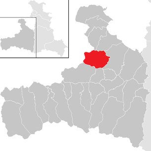
| Location of Leogang in the Zell am See district | ||
  |
||
.JPG) Leoganger Steinberge |
||
| Source: Municipal data from Statistics Austria | ||

Leogang is a municipality in the state of Salzburg in the Zell am See district in Austria with 3358 inhabitants (as of January 1, 2020).
geography
The community takes up the entire Leogang valley . Leogang is located in Pinzgau between the Leogang Steinberge , the highest peak of which is the Birnhorn ( 2634 m above sea level ) in the north, and the Asitz in the south. There Leogang is located northwest of the Schultersbachhöhe (1520 m) on the Leoganger Ache . Leogang borders on Tyrol , the road to Hochfilzen leads over the Grießenpass at an altitude of 1000 m .
Community structure
The municipal area includes the following 16 localities (population in brackets as of October 31, 2011), which are spread across the six cadastral communities of Ecking, Grießen, Leogang, Pirzbichl, Schwarzleo and Sonnberg. 13 of the 16 localities still have associated districts that bear topographical labels such as desert, hamlet, hunting lodge, Rotte, settlement, ski hut, guest house, hotel or alpine inn. Also pastures and huts are counted among the districts:
![]() Map with all coordinates: OSM | WikiMap
Map with all coordinates: OSM | WikiMap
| Locality | Topo. Code |
Population 2011-10-31 |
Cadastral municipality |
Coordinates | associated districts (topographical identification) |
|---|---|---|---|---|---|
| Ecking | D. | 170 | Ecking | 47 ° 26 ′ 44.8 " N , 012 ° 48 ′ 03.4" E | Loibering (W) |
| Otting | R. | 37 | Ecking | 47 ° 26 '38.7 " N , 012 ° 47' 06.3" O | - |
| Sinning | D. | 220 | Ecking | 47 ° 26 ′ 42.0 " N , 012 ° 46 ′ 31.1" E | Aignerweber (E) |
| Ullach | ZH | 108 | Ecking | 47 ° 26 '56.4 " N , 012 ° 45' 55.4" E | Gunzenreit (E) • Mitterbrand (W) Almen: Kurzckhütte • Lettlkaserhütte • Stoffenalm |
| mountain | ZH | 45 | Semolina | 47 ° 26 '52.5 " N , 012 ° 41' 51.4" E | Adam (E) • Eder (W) • Maurerkopfachhütte (Jhtt) Almen: Ederalm • Gotthardalm • Hirscherwaldalm • Maureralm • Reiteralm |
| Semolina | ZH | 82 | Semolina | 47 ° 27 '10.7 " N , 012 ° 39' 55.4" E | Grießner Sonnseite (W) • Pucher (E) • Spielbachhütte (Jhtt) Almen: Grießner Almen • Grießner Schafalm • Hartlalphütte • Kugleralpe • Martlhütte • Michlbauerhütte • Tödlingalm |
| Brain rush | ZH | 447 | Leogang | 47 ° 26 '09.9 " N , 012 ° 46' 38.4" O | Hainz (W) • Ofenlehen (R) • Ried (W) • Stadlbauersiedlung (Sdlg) Alms: Brunnaualm • Durchenalm • Ederalm • Franzlalm • Hainzalm • Sinnlehenalm |
| Leogang | D. | 363 | Leogang | 47 ° 26 '19.9 " N , 012 ° 45' 36.5" E | Above ground (E) |
| Madreit | ZH | 91 | Pirzbichl | 47 ° 25 '54.9 " N , 012 ° 45' 35.1" E | Hörl (E) • Klammbachstube (Jhtt) • Permannsegg (E) • Scheideckhütte (Jhtt) • Wimbach (R) Almen: Durchenalm |
| Pirzbichl | ZH | 70 | Pirzbichl | 47 ° 25 '54.5 " N , 012 ° 44' 54.9" E | Asitzhütte (Schih) • Grundner Holzstube (Jhtt) • Hammersbichl (E) • Lederstall (E) • Sappenmais (E) • Sommerau (E) • Streckau (Gh) |
| Rain | R. | 244 | Pirzbichl | 47 ° 26 '06.7 " N , 012 ° 44' 05.7" O | Embach (E) • Finsterbachhütte (Jhtt) • Krallerhof (Hot) • Stocking (E) Almen: Kühbichlalm |
| Schwarzleo | ZH | 49 | Schwarzleo | 47 ° 26 '04.3 " N , 012 ° 41' 30.0" E | Bärentalhütte (Jhtt) • Jägermeisterhütte (Jhtt) • Lehenbrand (E) • Mardeckhütte (Jhtt) • Pucherhäusl (E) • Rastboden (E) • Stöcklalm (Agh) Almen: Abergalm • Adamalm • Alpbachalm • Brandstattalm • Hauserpeteralm • Hundalm • Inschlagalm • Krüneck • Lindlalm • Oberhofalm • Rotwandalm • Scheltaualm • Schmöllnalm • Spielbergalmen • Thomanalm • Tödlingalmhütte • Vorderriedalm • Wimbachalm |
| Huts | D. | 144 | Sonnberg | 47 ° 26 '29.2 " N , 012 ° 42' 36.9" E | Burgstein (E) • Forsthofalm (Gh) |
| Rose Valley | D. | 213 | Sonnberg | 47 ° 26 ′ 29.1 ″ N , 012 ° 46 ′ 03.3 ″ E | - |
| Sonnberg | ZH | 618 | Sonnberg | 47 ° 26 ′ 41.5 " N , 012 ° 45 ′ 31.9" E | Badhaussiedlung (Sdlg) • Priesteregg (W) • Reiter (E) • Riedl (W) Almen: Hasleben • Priestereggalm • Reiteralm • Riedlalm |
| Sonnrain | Sdlg | 188 | Sonnberg | 47 ° 26 '24.7 " N , 012 ° 45' 12.8" E | - |
| Leogang municipality | 3089 | 6 cadastral communities |
47 ° 25 ′ 00.0 ″ N , 012 ° 45 ′ 00.0 ″ E |

The following area information is available for the six cadastral communities:
|

The values of the population density are very different in the individual cadastral communities.
Partial areas of the two southern cadastral communities Pirzbichl and Schwarzleo along the southern boundary of the municipality belong to the Bavarian Saalforsten , especially to the Leogang district. The four forest districts Wimbach and Saubach, Schwarzbach and Klamm, Maisbach and Finsterbach with a total area of 11.144 km² belong to the cadastral municipality of Pirzbichl, and thus take up more than half of its area. The eight forest districts Krinnbach, Walchersbach, Pründlkendl, Arzeck, Mardeck, Spielberg, Ochseneck and Käsersbach with a total area of 11.391 km² also belong to the cadastral community of Schwarzleo, to the west. Here, too, the forest areas in the hall take up more than half of the cadastral community.
Within 15 of the 16 localities (except the newer locality Sonnrain) there are a total of 147 historical farm names , such as B. Wimmgut for house number 31 in the village of Rosental, the forester's house in the Leogang district of the Saalforste.
Further building names, especially for the village of Hütten, can be found in a book from 1953.
As in all rural areas of Austria, house numbers are assigned within the localities after the houses have been built (therefore, apart from the information about the localities in the address, they are not a guide).
Population development

history


Leogang was first mentioned in documents as Liuganga in 930. Leogang is one of the oldest mining sites in the Salzburg region, and a miners' chapel testifies to the mining tradition. Today the place is called "Loigom" in dialect.
In Leogang there was a Protestant center. When Leopold von Firmian became Archbishop of Salzburg in 1727 and promoted the Counter Reformation, they secretly planned to resist. On August 5, 1731 the Protestants swore at the Schwarzacher Salt Licks to remain true to the Lutheran faith. On October 31, 1731, the Archbishop issued the emigration patent , as a result of which 4,000 to 5,000 servants and maids had to leave the country. In the following year, craftsmen and farmers left the Salzburg region. They moved to Protestant Prussia in 16 trains, with about 25% of the exiles dying during the exodus. The Protestant miners had largely left, as they were not subject to any master and did not have to ask for permission. As a result of the Protestant emigration, there was an economic decline in the Salzburg region, the mines fell into disrepair and 1776 farms were empty.
coat of arms
The coat of arms of the municipality is: “In a blue shield within a seven-link chain in Baroque style, open and broken at the upper edge of the shield, a silver lion. The iron chain that spans the church and tower above the windows and is provided with a padlock is intended to refer to the liberation of the oppressed and the economic boom of the community. "
politics
The community council has a total of 19 members.
- With the municipal council and mayoral elections in Salzburg in 2004, the municipal council had the following distribution: 10 SPÖ and 9 ÖVP.
- With the municipal council and mayoral elections in Salzburg in 2009 , the municipal council had the following distribution: 10 SPÖ and 9 ÖVP.
- With the municipal council and mayoral elections in Salzburg in 2014 , the municipal council had the following distribution: 11 ÖVP, 7 SPÖ, and 1 FPÖ.
- With the municipal council and mayoral elections in Salzburg in 2019 , the municipal council has the following distribution: 11 ÖVP, 7 SPÖ, and 1 FPÖ.
- mayor
- 1964–1977 Albert Steidl (ÖVP)
- 1977–1987 Sebastian Madreiter (ÖVP)
- 1987–2004 Matthias Scheiber (ÖVP)
- 2004–2014 Helga Hammerschmied (SPÖ)
- since 2014 Josef Grießner (ÖVP)
economy
Tourism is the most important economic factor in Leogang. A merger with the tourist association of the neighboring town of Saalfelden created the Saalfelden Leogang holiday region from 1999 onwards.
- Winter: The most important attraction in winter is the Skicircus Saalbach-Hinterglemm / Leogang / Fieberbrunn with a total of 270 kilometers of slopes. The Leogang mountain railways in the Hütten district provide access to the Skicircus. An 8-seater gondola lift brings winter sports enthusiasts to around 1800 m in just a few minutes. In addition to the own slopes in Leogang, the slopes of Saalbach and Hinterglemm can be reached directly via the ski area. The Europaloipe connects Leogang to Hochfilzen via the Grießenpass.
- Summer: In alpine summer tourism, hiking, cycling and mountain biking are the most important fields of activity for tourists. A total of 400 km of signposted hiking and cycling trails are available. For mountain bikers and downhill enthusiasts, the Bikepark Leogang was created in 2002, where the UCI Mountain Bike World Cup competitions are also held.
Culture and sights


- Catholic parish church Leogang hl. Leonhard
- Mining and Gothic Museum Leogang : in the village of Hütten
- Leogang show mine : in the village of Schwarzleo
- Kubin Kabinett: Between May 1999 and October 2010, the Kubin Kabinett Leogang showed drawings by the Austrian graphic artist Alfred Kubin ((1877–1959), grew up in Zell am See from 1882 to 1892) and changing exhibitions of contemporary artists whose focus was on artistic creation Drawing and book illustration is. The Kubin Kabinett Leogang was located in the old bathhouse and was closed due to the owner's bankruptcy in 2010. The collection was auctioned off by a Viennese art auction house and is no longer in Leogang. The building was auctioned by Raiffeisenbank Leogang.
- LeogangerKinderKultur: The LeogangerKinderKultur was founded in 1990 with the intention of "... giving children and young people the opportunity to actively shape culture ...". As part of "workshops", children were given the opportunity to experience various areas of art, such as painting, sculpting, writing, dancing, acting or filmmaking under the guidance of well-known national and international artists. The results of these workshops can be found, for example, in the form of works of art at various locations in Leogang or have been published nationwide, such as the film "A Backpack Full of Lies", directed by Wolfram Paulus , which was released in cinemas across Austria in 1996. In 2013, the organizer of LeogangerKinderKultur announced the end of the project. The reason given was the increasingly difficult procurement of sponsorship money.
- Natural monuments
- Birnbachloch
- Grießener Moor
- Regular events
- Leonhardiritt zu Leogang: The Leonhardiritt is a procession on horseback, which is a tradition in the Austria-Bavarian region. It takes place in honor of St. Leonhard , who is the patron saint of farm animals, prisoners and miners. After the Second World War , Richard Treuer and Mrs. Käthe Thalmann tried to revive this old custom. This enabled the Leogang Leonhardiritt to be held almost every following year until 1965. Due to the increasing mechanization in agriculture, however, the horses were finally missing, which is why this annual event had to be discontinued in 1966. In 2004 the Leonhardiritt was revived by the nostalgia association "Anno 1900". The Leonhardiritt zu Leogang is celebrated every year on November 6th.
- UCI Mountain Bike World Cup Leogang: After the events in 2010 and 2011, the Mountain Bike World Cup will again stop in Leogang in 2012.
Sports
- Bike Park Leogang has a bike park for downhill - freeride - and dirt - mountain bikers , at the foot of the Asitz.
- Leogang sports club
- Union Tennis Club Leogang
Personalities
- Sons and daughters of the church
- Albert Steidl (1927–2017), member of the National Council, tax advisor and author
- Julian Frick (1933–2012), Head of Urology at the Salzburg State Hospital, co-founder of the Paracelsus Medical Private University in Salzburg
- Sylvia Eder (* 1965), former ski racer, sister of Elfi Eder
- Elfi Eder (* 1970), former ski racer, sister of Sylvia Eder
- Stefan Gimpl (* 1979), freestyle snowboarder, 3-time Air & Style winner
- Harald Starzengruber (* 1981), racing cyclist
- Bernd Hirschbichler (* 1984), soccer referee
- Christina Rieder (* 1993), biathlete

The mountain station of the Leogang cable car in summer ...

… and in the winter

View towards Leogang from the Asitzbahn

The new Leogang valley station in winter 2006/07

.jpg)


Web links
- Community website
- Franz Schned, L. Hohenwartner, Claudia Birndorfer: Alt-Leogang - local history. In: The Saalach. From the origin to the mouth - a cultural area. Euregio Salzburg - Berchtesgadener Land - Traunstein , Regional Management Pinzgau, accessed on March 28, 2009 .
- Local history of Leogang
- 50609 - Leogang. Community data, Statistics Austria .
Individual evidence
- ↑ leogang.at , official website. Retrieved April 10, 2014.
- ↑ Statistics Austria, register census from October 31, 2011
- ↑ Topographical identification: D = village • R = Rotte • Sdlg = settlement • ZH = scattered houses
- ↑ a b Statistics Austria: Directory 2001: Salzburg
- ↑ Topographic identification: E = wasteland • W = hamlet • Jhtt = hunting lodge • R = Rotte • Sdlg = settlement • Schih = ski hut • Gh = inn • Hot = hotel • Agh = alpine inn
- ↑ Joseph Madreiter: history Leogang: farm names
- ↑ [1]
- ↑ Historically important dates from Leogang. (PDF; 357 kB) Leogang community, Alois Schwaiger , accessed on August 31, 2011 .
- ↑ Information board in the Mining and Gothic Museum in Leogang
- ↑ The Saalach - from the origin to the mouth a cultural area. EuRegio Salzburg - Berchtesgadener Land - Traunstein with the support of the Pinzgau regional management, accessed on August 31, 2011 .
- ^ Albert Steidl (politician) . In: Salzburger Nachrichten : Salzburgwiki .
- ↑ Sebastian Madreiter . In: Salzburger Nachrichten : Salzburgwiki .
- ^ Matthias Scheiber . In: Salzburger Nachrichten : Salzburgwiki .
- ↑ Helga Hammerschmied-Rathgeb . In: Salzburger Nachrichten : Salzburgwiki .
- ↑ Josef Grießner . In: Salzburger Nachrichten : Salzburgwiki .
- ↑ Andrew Lester: Mountain biking in Austria: Hang a frenzy . In: Spiegel Online . April 15, 2012
- ↑ http://www.leogang.at/gemeindeamt/download/219796147_1.pdf Alois Schwaiger: Bad-Leogang. From the spa to the Kubin cabinet . Mining Museum Leogang, 2008. Accessed July 21, 2013
- ↑ http://salzburg.orf.at/news/stories/2535902/ salzburg.orf.at: Kultur-Juwel: Buyers wanted for “Badhaus” , accessed on July 21, 2013
- ↑ http://www.lkk.at/idee/index.htm LeogangerKinderKultur: The Idea , accessed on July 21, 2013
- ↑ http://www.lkk.at/geschichte/index.htm LeogangerKinderKultur: Geschichte , accessed on July 21, 2013
- ↑ http://salzburg.orf.at/news/stories/2591630/ salzburg.orf.at: After 20 years out for “Leoganger Kinderkultur” , accessed on July 21, 2013
- ↑ UCI Mountain Bike World Cup 2010 to 2012 in Leogang. austria.info - Holidays in Austria, archived from the original on April 26, 2012 ; Retrieved August 31, 2011 .

Bramberg | Bruck | Served | Fusch | Hollersbach | Kaprun | Krimml | Lend | Leogang | Lofer | Maishofen | Maria Alm | Mittersill | Neukirchen | Niedernsill | Piesendorf | Rauris | Saalbach-Hinterglemm | Saalfelden | St. Martin | Stuhlfelden | Taxenbach | Toads | Uttendorf | Viehhofen | Forest | Weissbach | Zell am See