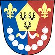
Ves Touškov
| Ves Touškov | ||||
|---|---|---|---|---|
|
||||
| Basic data | ||||
| State : |
|
|||
| Region : | Plzeňský kraj | |||
| District : | Plzeň-jih | |||
| Area : | 1185 ha | |||
| Geographic location : | 49 ° 40 ' N , 13 ° 7' E | |||
| Height: | 336 m nm | |||
| Residents : | 362 (Jan. 1, 2019) | |||
| Postal code : | 332 12 - 333 01 | |||
| structure | ||||
| Status: | local community | |||
| Districts: | 2 | |||
| administration | ||||
| Mayor : | Zdeněk Houška (status: 2007) | |||
| Address: | Ves Touškov 17 333 01 Stod |
|||
| Municipality number: | 558494 | |||
Ves Touškov (German Tuschkau Dorf ) is a village community with about 370 inhabitants in Okres Plzeň-jih in the Czech Republic .
Geographical location
The village is located in western Bohemia at 336 m above sea level. M. on Touškovský potok ( Tuschkauer Bach ), five kilometers northwest of the city of Stod ( Staab ). The cadastral area is 1185 hectares.
State road 230 runs from Stod to Stříbro on the eastern periphery . In the northwest is the Touškovský rybník.
Neighboring places are Mířovice in the west, Lochousice and Záluží in the north, Kotovice ( Gottowitz ) in the northeast, Stod ( Staab ) in the southeast, and Lisov ( Lissowa ), Červený Mlýn and Hradec ( Hradzen ) in the south.
history

The place was first mentioned in a document in 1243. In 1290 the Chotěšov monastery bought it . In the first half of the 14th century the place was made available as an Emphyteuse . In the berní rula there are 15 farms for Ves Touškov. According to the construction books, the church of St. Margarethen was already occupied by its own pastor in 1384 and 1389, at that time it was under the patronage of the abbot of the Kladrau monastery .
After the Thirty Years' War , German colonization began again. In 1788 the village consisted of 40 houses, in 1938 there were 146 with 543 inhabitants.
In order to avoid confusion with the neighboring town of Tuschkau, which had 1,358 German inhabitants in 1900, the place name Tuschkau Dorf has recently been used for the village and the place name Tuschkau Stadt for the city .
After the First World War , the region with the town of Tuschkau Dorf was added to the newly created Czechoslovakia in 1919 . Due to the Munich Agreement , the place came to the German Reich in 1938 and belonged to the district of Mies , administrative district of Eger , in the Reichsgau Sudetenland until 1945 . After the end of World War II , the German residents were expropriated and driven out .
Demographics
Until 1945 Tuschkau village was predominantly populated by German Bohemians , who were expelled.
| year | Residents | Remarks |
|---|---|---|
| 1785 | k. A. | 40 houses |
| 1837 | 438 | in 44 houses |
| 1900 | 486 | German residents |
| 1921 | 513 | including 499 German residents |
| 1930 | 532 | |
| 1939 | 544 | in 146 houses |
| year | 2006 1 | 2014 2 | 2017 3 |
|---|---|---|---|
| Residents | 306 | 344 | 363 |
Community structure
The municipality Ves Touškov the district Mirovice (belongs Mirowitz ).
Attractions
- Parish church of St. Margarethen, parish church since 1352. It was rebuilt in 1846, with the tower and the choir, the nave was enlarged
- Memorial cross for the victims of the First World War on the church
- Baroque statue of St. John of Nepomuk at the school
- Statue of the Virgin Mary Immaculate on the way to the cemetery
Web links
Individual evidence
- ↑ Český statistický úřad - The population of the Czech municipalities as of January 1, 2019 (PDF; 7.4 MiB)
- ^ A b Johann Gottfried Sommer : The Kingdom of Bohemia . Volume 6: Pilsner Kreis. Prague 1838, p. 116, paragraph 24 .
- ↑ a b Tuschkau . In: Meyers Großes Konversations-Lexikon . 6th edition. Volume 19, Bibliographisches Institut, Leipzig / Vienna 1909, p. 842 .
- ↑ Jaroslaus Schaller : Topography of the Kingdom of Bohemia. Volume 9: Pilsner Kreis. Prague 1788, pp. 106-107, paragraph 5). .
- ^ Sudetenland Genealogy Network
- ↑ a b Michael Rademacher: German administrative history from the unification of the empire in 1871 to the reunification in 1990. Mies district. (Online material for the dissertation, Osnabrück 2006).


