
Wanna
| coat of arms | Germany map | |
|---|---|---|

|
Coordinates: 53 ° 45 ' N , 8 ° 48' E |
|
| Basic data | ||
| State : | Lower Saxony | |
| County : | Cuxhaven | |
| Joint municipality : | Land Hadeln | |
| Height : | 5 m above sea level NHN | |
| Area : | 53.93 km 2 | |
| Residents: | 2228 (Dec. 31, 2019) | |
| Population density : | 41 inhabitants per km 2 | |
| Postal code : | 21776 | |
| Area code : | 04757 | |
| License plate : | CUX | |
| Community key : | 03 3 52 055 | |
| LOCODE : | DE WAA | |
| Community structure: | 5 districts | |
| Address of the municipal administration: |
Am Mühldeich 10 21776 Wanna |
|
| Website : | ||
| Mayoress : | Nicole Friedhoff ( SPD ) | |
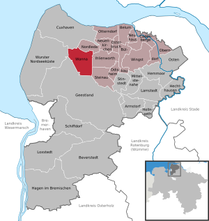
| Location of the municipality of Wanna in the district of Cuxhaven | ||
  |
||

Wanna ( Low German Wannen ) is a village municipality in the Samtgemeinde Land Hadeln , Lower Saxony , Germany .
geography
location

The municipality in the Land of Hadeln is located approx. 20 kilometers southeast of the district town of Cuxhaven . Wanna is in the Niederelbe area .
The proximity to the Elbe estuary and the North Sea entail the risk that in the event of a dike breach during a storm surge, the maximum 5 m above sea level. NHN , but often significantly lower lying municipal area will be flooded to a large extent. One possible scenario is described in the article Glameyer Stack .
The Emmelke flows through the village .
Community structure


The municipality of Wanna consists of the following districts:
- Ahlen-Falkenberg
- Easter wanna
- Osterwannaer Kampen
- Süderleda
- Westerwanna
Neighboring communities
| Wurster North Sea Coast - Wanhöden |
Cuxhaven - Lüdingworth Nordleda - Heringskoop |
North Leda |
| Geestland - clutter |
.svg)
|
Ihlienworth |
| Geestland - clutter | Geestland - Flögeln | Steinau |
history

The megalithic systems at Westerwanna are located west of Westerwanna in the moor and in the Süderheide. The place was first mentioned in 1139 as "Wanen". The St. Paul Monastery , at the gates of Bremen, owned 1½ yards in Wanna at that time. There is evidence of a chapel in Süderleda in the 13th century (around 1230). The right to propose the pastor later lay with the Neuenwalde monastery . In 1239, Duke Albert I of the still undivided Duchy of Saxony sold the parish people of Süderleda a path to Osterwanna (today: the "Neue Trift") and a drainage canal to the Emmelke . Since the 14th century there was also a church in Westerwanna, which was consecrated to St. George . Around 1369 a new church was built in Westerwanna, probably using material from the broken Süderleda chapel.
Between Michaelmas and Christmas 1526, Wanna became Protestant.
In 1590 the meadow and moorland ( common land ) in the east of the municipality was divided between the already existing farms. The moor weather system is likely to fall during this time as an extension of the southern weather of the Holländerhufen in Ihlienworth-Westerende, to the west, towards the Süderledaer Hof. After about 1650, in addition to agriculture, the economic importance of peat cutting on the northern edge of the Ahlenmoors increased. The dried peat was mostly shipped via the Emmelke and Medem to Otterndorf .
Since 1915 the cultivation of the heather and moorland south of Wanna has been intensified. This is where the Ahlen-Falkenberg settlement came into being, which has had its own chapel since 1951 .
In 1970 Wanna became a member of the Hadeln Samtgemeinde , in 1972 the Wanna municipality joined the Sietland Samtgemeinde formed two years earlier .
Gravenberg

The Wannaer Geest is rich in prehistoric and early historical sites. In addition to the large stone graves of the funnel beaker culture , the old Saxon urn grave field on the Gravenberg (20 m above sea level) has achieved national fame.
The Kronskark , also called Wanna 10 , is a megalithic complex in the Ahlen forest.
Population development
Graphic population development

|
(as of December 31st)
politics
(+ 5.53 % p )
(-4.51 % p )
(+ 3.33 % p )
(-1.47 % p )
(-2.87 % p )
Municipal council
The council of the Wanna parish consists of 12 councilors. This is the specified number for the member municipality of an integrated municipality with a population between 2001 and 3000 inhabitants. The council members are elected for a five-year term by local elections. The current term of office began on November 1, 2016 and ends on October 31, 2021.
The honorary mayor is also entitled to vote and sit on the council of the municipality.
The last local election on September 11, 2016 resulted in the following:
| Political party | Proportional votes | Number of seats |
|---|---|---|
| SPD | 50.33% | 7th |
| CDU | 33.12% | 4th |
| FBW | 12.67% | 2 |
| Individual applicant Kunkel | 3.86% | 0 |
The turnout in the 2016 local elections was 65.63%, above the Lower Saxony average of 55.5%.
Mayor
The council elected council member Nicole Friedhoff (SPD) as honorary mayor for the current electoral term. Your deputies are Jürgen Cordts (SPD) and Ernst Kopf (CDU).
coat of arms
The design of the municipal coat of arms of Wanna comes from the heraldist and coat of arms painter Albert de Badrihaye , who designed around 80 coats of arms in the district of Cuxhaven. After 1945, because of denazification , a rune was removed from the silver urn image from the original coat of arms.
|
|
Blazon : " Divided by black and green , covered with a silver urn ." |
| Justification of the coat of arms: The urn covered with ingrun (zig-zag) reminds of the numerous prehistoric finds in the Feldmark of Westerwanna. Black and green are the Hadler colors. |
Culture and sights
Architectural monuments
Local museum

The local history museum shows finds from prehistory and early history in an old farmhouse . It houses the village blacksmith, the wooden shoe workshop and the shoemaker's shop.
music
The music culture in Wanna is shaped by the church and its musically shaped church services. In 2010 the Wanna elementary school was renamed the Prof. Hermann Rauhe School ( Hermann Rauhe was director of the Hamburg University of Music), with a focus on the musical and cultural area. A hard rock band formed in 2011.
Hadler legend trail
Language and dialect
High German and North Low Saxon are spoken in Wanna .
Personalities
Honorary citizen
- Marie-Luise Hoppe , b. Paul (1936–2018), author, home nurse and choir director, she received honorary citizenship in October 2016 because of her book publications about Wanna
Sons and daughters of the church
- Hermann Rauhe (* 1930), musicologist and music teacher
People connected to the community
- Gregorius Struve († before 1737), master craftsman of Arp Schnitger, well-known organ builder in the Oldenburg and Bremen area, he built the organ in the St. Georg Church in 1733
- Willibald Hentschel (1858–1947), natural scientist and writer
Myths and legends
- The Wanna church building
- The Gravenberg
- The Wannaer See
- The Jungfernberg
- The roaring moor
- Feuds of sinners
literature
- Rudolf Schröder: Chronicle of the community of Wanna, district of Hadeln . Wanna 1976.
- Günter G. A. Marklein: The village of Wanna: A place and its people. Habitat marshland, moor and geest . dbw-Verlagsgesellschaft mbH, Freiburg / Elbe 1989, ISBN 3-925354-04-2 .
- Community of Wanna (ed.): Festschrift 850 Years of Wanna 1139–1989 . Clubs and associations data. dbw-Verlags-GmbH, Freiburg / Elbe June 1989.
- Johann Justus Plate: “Antiquities and merchandise about Wanna”: first diary Johann Justus Plate, pastor of Wanna in the country of Hadeln (1696-1760) . Ed .: Wilhelm Zimmermann (= special publications by the men from the morning star . Volume 31 ). Archive of the district of Cuxhaven, Bremerhaven 1998, ISBN 3-931771-31-8 .
- Eberhard Michael Iba (Ed.): Hake Betken siene Duven. The saga of the Elbe and Weser estuaries (= special publications by the men from Morgenstern , Heimatbund at the Elbe and Weser estuaries . Volume 16 ). 3. Edition. Men from Morgenstern Verlag, Bremerhaven 1999, ISBN 3-931771-16-4 .
- Marie-Luise Hoppe: The hardworking craftsmen from Wanna. A changing village . tape 1 . Atelier Im Bauernhaus, Fischerhude 2014, ISBN 3-88132-987-0 .
- Marie-Luise Hoppe: Life and work in Wanna. A changing village . tape 2 . Atelier Im Bauernhaus, Fischerhude 2015, ISBN 3-88132-970-6 .
- Marie-Luise Hoppe: From the good old days in Wanna. A changing village . tape 3 . Atelier Im Bauernhaus, Fischerhude 2016, ISBN 3-96045-122-9 .
Web links
Individual evidence
- ↑ State Office for Statistics Lower Saxony, LSN-Online regional database, Table 12411: Update of the population, as of December 31, 2019 ( help ).
- ^ Community directory - archive - regional structure - annual editions - Lower Saxony. (All politically independent municipalities in EXCEL format). In: Destatis website. Federal Statistical Office, accessed on April 28, 2020 .
- ↑ Local council election 2016 (election diagram). In: Website Zweckverband Kommunale Datenverarbeitung Oldenburg (KDO). September 11, 2016, accessed February 6, 2018 .
- ^ Lower Saxony Municipal Constitutional Law (NKomVG); Section 46 - Number of Deputies. In: Lower Saxony Regulations Information System (NI-VORIS). December 17, 2010, accessed February 6, 2018 .
- ↑ a b municipal council election 2016 (tabular representation). In: Website Zweckverband Kommunale Datenverarbeitung Oldenburg (KDO). September 11, 2016, accessed February 6, 2018 .
- ↑ The CDU gets the most votes nationwide. In: Website Norddeutscher Rundfunk . September 12, 2016. Retrieved February 12, 2017 .
- ^ Wanna local council. In: Ratsinfosystem der Samtgemeinde Land Hadeln. Retrieved February 6, 2018 .
- ↑ a b Wanna - local history and coat of arms. In: Website of the municipality of Land Hadeln. Archived from the original on September 7, 2017 ; accessed on April 28, 2020 .
- ^ Community Wanna (ed.): Festschrift 850 Years Wanna 1139–1989 . Clubs and associations data. dbw-Verlags-GmbH, Freiburg / Elbe June 1989, p. 3 .
- ↑ Wanna: Author Marie-Luise Hoppe has died. In: Website Cuxhavener Nachrichten . September 9, 2018, accessed October 3, 2018 .
- ↑ Marie-Luise Hoppe's obituary notice. (PDF; 104 kB) In: Website Cuxhavener Nachrichten. September 6, 2018, accessed October 3, 2018 .

Armstorf | Belum | Beverstedt | Bülkau | Cadenberge | Cuxhaven | Geestland | Hagen in Bremen | Hechthausen | Hemmoor | Hollnseth | Ihlienworth | Lamstedt | Loxstedt | Near center | Neuenkirchen | Neuhaus | North Leda | Oberndorf | Odisheim | East | Easter break | Otterndorf | Schiffdorf | Steinau | Stinstedt | Wanna | Wingst | Wurster North Sea Coast