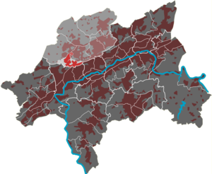
Beek (quarter)
|
Beek (24) district of Wuppertal |
|
|---|---|
| Coordinates | 51 ° 15 '58 " N , 7 ° 6' 26" E |
| height | 200– 267 m above sea level NHN |
| surface | 1.75 km² |
| Residents | 2945 (Dec. 31, 2016) |
| Population density | 1683 inhabitants / km² |
| Proportion of foreigners | 5.3% (Dec. 31, 2016) |
| Post Code | 42113 |
| prefix | 02 02 |
| Borough | Uellendahl-Katernberg |
| Transport links | |
| Highway |
|
| bus | 611 613 AST13 |
| Source: Wuppertal statistics - spatial data | |
Beek is a 1.75 km² residential area in the west of the Wuppertal district of Uellendahl-Katernberg and belongs to the area of the old town of Elberfeld .
geography
The residential area is in the northwest by the street In den Birken , in the northeast by the streets Katernberger Schulweg , Herberts Katernberg and August-Jung-Weg , in the south by the Wuppertaler Nordbahn and Katernberger Straße as well as the border to the Elberfeld-West and the Steinberger Bach limited. In a clockwise direction, the residential quarters Eckbusch , Nevigeser Strasse , Nordstadt , Brill , Nützenberg and Varresbeck surround the residential quarter.
The half-settled residential area is used for agriculture in the west and is interspersed with several small forests. It is crossed by the central thoroughfare In der Beek , which follows the eponymous brook (Middle Low German Beek, Beke, Becke or Bäke ), the Varresbeck , which leaves the residential area at Hof Beek . The highest point is the Falkenberg , which is 267 meters above sea level .
The Wuppertal-Katernberg junction of federal motorway 46 is to the west of the residential area .
The suburbs, locations and courtyards in the residential area include Am Hagen , Am Baum , Am Krötelnfeld , An der Straße , Bergerheide , Dorp , Falkenberg , Häuschen , In der Hülsbeck , In der Beek , Herberts Katernberg , Hosfelds Katernberg , König , Nüll and Steinberg .

