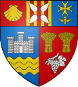
Les Bordes-sur-Arize
|
Les Bordes-sur-Arize Las Bòrdas |
||
|---|---|---|

|
|
|
| region | Occitania | |
| Department | Ariège | |
| Arrondissement | Saint-Girons | |
| Canton | Arize-Lèze | |
| Community association | Arize Lèze | |
| Coordinates | 43 ° 6 ′ N , 1 ° 22 ′ E | |
| height | 256-508 m | |
| surface | 12.68 km 2 | |
| Residents | 518 (January 1, 2017) | |
| Population density | 41 inhabitants / km 2 | |
| Post Code | 09350 | |
| INSEE code | 09061 | |
| Website | http://www.les-bordes-sur-arize.com/ | |
Les Bordes-sur-Arize ( Las Bòrdas in Occitan ) is a French commune with 518 inhabitants (as of January 1, 2017) in the Ariège department in the Occitania region (previously Midi-Pyrénées ); it belongs to the arrondissement of Saint-Girons and the canton of Arize-Lèze .
location
Les Bordes-sur-Arize is located on the Arize River in the north of the Ariège department. The closest city is Pamiers , about 20 kilometers (as the crow flies) to the east ; the city of Toulouse is just under 70 kilometers to the north. The municipality is part of the Massif du Plantaurel and lies within the Pyrénées Ariégeoises Regional Natural Park .
The community consists of the village of Les Bordes-sur-Arize, the hamlets (hameaux) Lagrémounal, Lapeyrêre, Les Bourrets, Les Mances and Rébaillou, as well as individual farms.
history
There was a Gallo-Roman castrum in the municipality. Historically, the place belongs to the Volvestre region within Languedoc. There has also been a castle since the Middle Ages. In the Middle Ages, Les Bordes-sur-Arize was part of the County of Foix . In 1353 the Cistercian monastery of Notre Dame de l "" Abondance-Dieu was founded. The majority of the residents converted to the Reformed Church in the 16th century. In 1574 the monks fled and in 1590 there were no more Catholic services. From September to October 1625 a royal army of 14,000 men advanced to fight Calvinism. A small part of the population, 35 men, offered armed resistance to the superior strength of the invading army. So that the other residents could flee to the fortified town of Le Mas-d'Asil. In a hopeless situation, the defenders set fire to the entire village. The castle was also destroyed. In 1683, of the 1,086 inhabitants, 802 are Protestants and only 284 are Catholics. Only with the re-Catholicization was a catholic church built again in 1682. The community belonged to the Mirepoix-Pamiers district from 1793 to 1801. In addition, from 1793 to 2015 it was part of the canton of Le Mas d'Azil (1793-1801) under the name of Canton Mas d'Azis . Between 1790 and 1794 the previously independent municipality of Saint Félix des Salenques was incorporated. The community changed names several times. From 1793 to 1801 it was called Labordes , then until 1872 Les Bordes . Since then it has had its current name.
Population development
| year | 1793 | 1846 | 1861 | 1866 | 1891 | 1962 | 1968 | 1975 | 1982 | 1990 | 1999 | 2006 | 2012 |
| Residents | 1,185 | 1,375 | 1,290 | 1,198 | 1,117 | 454 | 406 | 378 | 386 | 446 | 513 | 547 | 525 |
| Sources: Cassini and INSEE | |||||||||||||
In the 19th century the place had up to 1400 inhabitants at times. The increasing mechanization of agriculture in the first half of the 20th century led to a continuous decline in the number of inhabitants to the lowest level around 1980.
Attractions
- Salenques Castle with the remains of the former abbey
- Castle Château de Ligny from 1840
- Castle Chàteau de Marveille 18th century
- Reformed Church (Temple) from 1787
- Catholic village church of Saint-Jacques from 1682
- several village wells
Web links
- Location of the municipality
- Les Bordes-sur-Arize, history and places of interest - photos + info (French)
- Brief information about the community
- Les Bordes-sur-Arize on the IGN side
- Saint-Jacques church
- Photos of the village churches
