Montécu
| Montécu | ||
|---|---|---|
| State : |
|
|
| Canton : |
|
|
| District : | Saane / Sarine | |
| Municipality : | Le Mouret | |
| Postal code : | 1724 | |
| former BFS no. : | XXXX | |
| Coordinates : | 581 760 / 175821 | |
| Height : | 765 m above sea level M. | |
| Residents: | 167 (1988) | |
| map | ||
|
|
||
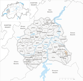
Montécu is a town and formerly an independent political municipality in the District de la Sarine (German: Saanebezirk) in the canton of Friborg in Switzerland . On January 1, 1989, Montécu was incorporated into Bonnefontaine . On January 1, 2003, Bonnefontaine merged with numerous other municipalities in the new municipality of Le Mouret .
geography
Montécu is 765 m above sea level. M. , eight kilometers south-southeast of the canton capital of Friborg (beeline). The village extends on a saddle on the western slope of the Ruisseau de Montécu , in the hill country at the northern foot of the Alps. The former municipality area was around 1.0 km². It was bounded in the north by the Ruisseau du Pontet, in the east by the Ruisseau de Montécu and reached to the southwest to the height at Sonnenwil ( 869 m above sea level ).
population
With 167 inhabitants (1988), Montécu was one of the small communities in the canton of Friborg before the merger. In 1930 the village had 96 inhabitants, in 1960 only 67 inhabitants. Due to the growth of the hamlet of Le Pafuet ( 741 m above sea level ; in the valley of the Ruisseau du Pontet), the eastern part of which belonged to Montécu, a significant increase in population was recorded.
economy
Montécu still lives from agriculture , especially from agriculture and cattle breeding . There is a campsite south-east of the village.
traffic
The village is located away from the major thoroughfares, the main access is from Praroman . Montécu is connected to the public transport network by a PostBus course that runs from Freiburg to Bonnefontaine .
history
The place was first mentioned in a document in 1285 under the name Monticum ; from 1323 the name Monticon has been handed down. The place name goes back to the late Latin adjective monticus (mountainous, mountainous).
In the course of the 15th century, Montécu came under the rule of Friborg and was assigned to the Old Landscape (Burgpanner). After the collapse of the Ancien Régime (1798), the village belonged to the La Roche district during the Helvetic period and to the Friborg district from 1803 before it was incorporated into the Saane district in 1848 with the new cantonal constitution. Ecclesiastically, Montécu belonged to Praroman since the 17th century and to Bonnefontaine since 1898.
Attractions
Web links
- Marianne Rolle: Montécu. In: Historical Lexicon of Switzerland .


