
Cottens FR
| FR is the abbreviation for the canton of Friborg in Switzerland and is used to avoid confusion with other entries of the name Cottens . |
| Cottens | |
|---|---|
 |
|
| State : |
|
| Canton : |
|
| District : | Saane |
| BFS no. : | 2186 |
| Postal code : | 1741 |
| Coordinates : | 569010 / 177788 |
| Height : | 713 m above sea level M. |
| Height range : | 604–751 m above sea level M. |
| Area : | 4.97 km² |
| Residents: | 1509 (December 31, 2018) |
| Population density : | 304 inhabitants per km² |
| Website: | www.cottens-fr.ch |
 Cottens |
|
| Location of the municipality | |
  |
|
Cottens ( Freiburger Patois ) is a municipality in the District de la Sarine (German: Saanebezirk) in the canton of Friborg in Switzerland . The former German place name Cottingen is no longer used today.
geography
Cottens is 713 m above sea level. M. , 11 km southwest of the canton capital Friborg (linear distance). The village extends in a panoramic position on the northern slope of the Ruisseau de Cottens , in the Molasse hills of the Freiburg Central Plateau .
The area of the 5.0 km² municipal area comprises a section of the gently undulating Molasse plateau between the Broye plain in the north and the Glânetal in the south. The area is crossed from west to east by the valley of the Ruisseau de Cottens . To the west, the municipal ban extends into the formerly boggy valley with the ponds of Lentigny. To the north of the valley, the municipality extends to the plateau with the Grand Bois (at 751 m above sea level, the highest point in Cottens) and to the edge of the forest of Les Boennes . South of the Ruisseau de Cottens is the plateau of Rimbochat and P ert (up to 745 m above sea level ). To the east, the plateau gradually slopes down and ends in the Bois de Chavailles with a protrusion over the course of the Glâne, which is deeply carved into the molasse layers. In 1997, 10% of the municipal area was in settlements, 17% in forests and woodlands, 72% in agriculture and around 1% was unproductive land.
Cottens includes the residential quarters on the Bimont, the hamlet of Les Rialets ( 707 m above sea level ) on the western slope of the Glâne and several individual farms. Cottens' neighboring communities are La Brillaz , Neyruz , Hauterive , Gibloux and Autigny .
population
With 1509 inhabitants (as of December 31, 2018) Cottens is one of the medium-sized communities in the canton of Friborg. 93.0% of the residents are French-speaking, 4.4% German-speaking and 0.7% speak Italian (as of 2000). The population of Cottens was 268 in 1850 and 403 in 1900. After a peak in 1940 with 552 inhabitants, the population decreased to 465 people by 1970. Since then, there has been a significant increase in population combined with a doubling of the population within 30 years.
economy
Cottens was a predominantly agricultural village until the second half of the 20th century . Even today, the have farming , the fruit production , the dairy industry and animal husbandry an important role in the employment structure of the population. Further jobs are available in local small businesses and in the service sector. Cottens has been the location of an old people's and nursing home since 1991. In the last few decades the village has developed into a residential community thanks to its attractive location. Many workers are therefore commuters who mainly work in the Freiburg region.
traffic
The community has good transport links. It is located on the main road from Freiburg to Romont . The closest connection to the A12 motorway (Bern-Vevey) is around 5 km from the town center. On September 4, 1862, the railway line from Freiburg to Lausanne was put into operation with a station in Cottens. A bus line operated by Transports publics Fribourgeois , which operates the route from Cottens to Farvagny, provides for the fine distribution of public transport .
history

The municipality of Cottens was settled very early, which could be proven by the discovery of traces from the Mesolithic . The first written mention of the place took place in 1142 under the name Cotens . Later the names Cottens (1173), Cotains (1223), Cotteins (1252), Cottin (1445) and Coctens , Chotens and Chottens appeared . The place name is derived from the Germanic personal name Cotto and means with the suffix -ens as much as for the people of Cotto .
In the Middle Ages Cottens was temporarily under the rule of Arconciel . A noble von Cottens family has been mentioned since the 12th century. The rule belonged to the Counts of Neuchâtel from the 13th century. The Abbey of Hauterive also had rich property in the municipality. In 1442 at the latest, Cottens came under the rule of Freiburg and was assigned to the old landscape (Neustadtpanner). After the collapse of the Ancien Régime (1798), the village belonged to the Friborg district during the Helvetic and the following period, before it was incorporated into the Saane district in 1848 with the new cantonal constitution.
Attractions
Since 1423 Cottens owned the Saint-Martin chapel, which was replaced by a modern church in 1956. Until 1930 the village belonged to the parish of Autigny, since then it has formed its own parish.
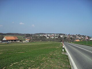
View of Cottens

Granary A
cultural asset of national importance
Entrance

bakery

New housing estate


_344.JPG)
_347.JPG)
_351.JPG)
Web links
- Official website of the municipality of Cottens (French)
- Marianne Rolle: Cottens (FR). In: Historical Lexicon of Switzerland .
- Aerial views of the village
Individual evidence
- ↑ Permanent and non-permanent resident population by year, canton, district, municipality, population type and gender (permanent resident population). In: bfs. admin.ch . Federal Statistical Office (FSO), August 31, 2019, accessed on December 22, 2019 .
Arconciel | Autigny | Avry | Belfaux | Chénens | Corminboeuf | Cottens | Ependes | Ferpicloz | Freiburg | Gibloux | Givisiez | Granges-Paccot | Grolley | Hauterive | La Brillaz | La Sonnaz | Le Mouret | Marly | Matran | Neyruz | Pierrafortscha | Ponthaux | Prez | Senèdes | Treyvaux | Villarsel-sur-Marly | Villars-sur-Glâne
Former parishes: Autafond | Avry-sur-Matran | Bonnefontaine | Chésalles | Chésopelloz | Cormagens | Corpataux | Corpataux-Magnedens | Corsalettes | Corserey | Corjolens | Cutterwil | Ecuvillens | Essert | Estavayer-le-Gibloux | Farvagny | Farvagny-le-Grand | Farvagny-le-Petit | Formangueires | Grenilles | Illens | La Corbaz | Le Glèbe | Lentigny | Lossy | Lossy Formangueires | Lovens | Magnedens | Marly-le-Grand | Marly-le-Petit | Montécu | Montévraz | Nierlet-les-Bois | Noréaz | Oberried | Onnens | Posat | Posieux | Prelude | Prez-vers-Noréaz | Rossens | Rueyres-Saint-Laurent | Sales | Villarlod | Villarsel-le-Gibloux | Vuisternens-en-Ogoz | Zénauva
Canton of Friborg | Districts of the canton of Friborg | Municipalities of the canton of Friborg