Philippsthal (Werra)
| coat of arms | Germany map | |
|---|---|---|

|
Coordinates: 50 ° 50 ' N , 10 ° 0' E |
|
| Basic data | ||
| State : | Hesse | |
| Administrative region : | kassel | |
| County : | Hersfeld-Rotenburg | |
| Height : | 230 m above sea level NHN | |
| Area : | 21.31 km 2 | |
| Residents: | 4072 (Dec. 31, 2019) | |
| Population density : | 191 inhabitants per km 2 | |
| Postal code : | 36269 | |
| Primaries : | 06620, 06624, 06674 | |
| License plate : | HEF, ROF | |
| Community key : | 06 6 32 016 | |
| Address of the municipal administration: |
Schloss 1 36269 Philippsthal (Werra) |
|
| Website : | ||
| Mayor : | Timo Heusner ( SPD ) | |
| Location of the municipality of Philippsthal (Werra) in the Hersfeld-Rotenburg district | ||
The market town of Philippsthal (Werra) is located in the Hersfeld-Rotenburg district in eastern Hesse , directly on the border with Thuringia .
geography
location
Philippsthal is on the Werra . The Ulster flows into the Werra between the village and the Röhrigshof district.
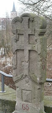
The lowest point is 212 m above sea level. NN in the Werraaue near urethra. The highest point is in the northeast of the municipality marker at around 445 m above sea level. NN height, where the boundaries of Philippsthal, Heringen and Vacha meet.
The next larger cities are Bad Hersfeld (about 25 km to the west) and Eisenach (about 29 km to the northeast).
Neighboring communities
Philippsthal borders in the north on the city of Heringen (in the district of Hersfeld-Rotenburg), in the east on the city of Vacha , in the south on the communities of Unterbreizbach (both in the Thuringian Wartburg district ) and Hohenroda and in the west on the community of Friedewald (both in the district of Hersfeld- Rotenburg).
Community structure
The community consists of the districts Gethsemane , Harnrode , Heimboldshausen , Philippsthal, Röhrigshof , Untersteurode .
history
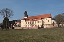
Philippsthal is in 1191 in a letter of protection from Pope Celestine III. mentioned for the first time to the Hersfeld Abbey . In that year the abbey founded a Benedictine monastery and named it after the knight family of Cruceburg who lived here. The developing town of Kreuzberg was named after these . The corridor, which mainly belongs to the monastery, and some properties in the area were administered by a Vogt and therefore referred to in the documents as Vogtei Kreuzberg . The monastery was destroyed in the Peasants' War in 1525 and abandoned by the nuns in 1568. The former monastery church from the 12th century is still preserved and in its interior a late Romanesque tombstone found in the former monastery garden for a knight from the von Cruceburg family . Landgrave Philipp von Hessen-Philippsthal (* December 14, 1655, † June 18, 1721) had a castle built in 1685 at the site of the monastery , which he named Philippsthal . This name also caught on as a place name at the end of the 18th century. The Weidenhain landscape park on the high bank of the Werra also belonged to the castle, stretching up to 300 m west of the Vachaer Werra bridge and with its famous pub in the early 19th century was the most famous attraction of the place. After mining began in the Hattorf potash works in 1905, the craftsmen and weavers' village became an industrial town.
During the war years 1943 to 1945, several million volumes from the archives of the Prussian State Library in Berlin were relocated to the Hattorf mine in order to safeguard their stocks . On June 10, 1942, there was a serious railway accident at an open level crossing on the Ulstertal Railway near the Philippsthal Süd station, in which three people died.
During the time of the inner German division , the building of the former printing house Hoßfeld gained fame because the inner German border ran right through the building. It was not until 1976 that the entire property was allocated to the Federal Republic through a border regulation between the Federal Republic of Germany and the German Democratic Republic .
In June 1953 the parish of “Philippsthal a. W. "renamed" Philippsthal (Werra) ". On January 1, 1977, the community received the official name it had until the regional reform: "Philippstal (Werra)".
The community became known nationwide in the 1990s through the murder of Melanie and Karola Weimar in 1986 and the resulting criminal trials.
The title “market community” was awarded to the community on May 30, 2001.
- Incorporations
On August 1, 1972, as part of the regional reform in Hesse, the previously independent communities of Gethsemane, Harnrode, Heimboldshausen, Philippsthal (Werra), Röhrigshof and Untersteurode were merged to form the new community of Philippsthal.
politics
Community representation
The local elections on March 6, 2016 produced the following results, compared to previous local elections:
| Parties and constituencies |
% 2016 |
Seats 2016 |
% 2011 |
Seats 2011 |
% 2006 |
Seats 2006 |
% 2001 |
Seats 2001 |
||
|---|---|---|---|---|---|---|---|---|---|---|
| SPD | Social Democratic Party of Germany | 47.6 | 11 | 50.7 | 12 | 45.5 | 10 | 52.7 | 12 | |
| FWG | Free electoral community in Philippsthal | 32.2 | 7th | 28.4 | 6th | 34.7 | 8th | 27.9 | 6th | |
| CDU | Christian Democratic Union of Germany | 20.2 | 5 | 20.9 | 5 | 19.8 | 5 | 19.5 | 5 | |
| total | 100.0 | 23 | 100.0 | 23 | 100.0 | 23 | 100.0 | 23 | ||
| Voter turnout in% | 54.7 | 52.7 | 56.2 | 63.0 | ||||||
mayor
Timo Heusner (SPD) won the mayoral election on May 26, 2019 with 55.6% in the first ballot. He was sworn in on October 23, 2019 and succeeds Ralf Orth (SPD), who no longer stood for election for health reasons. Ralf Orth (SPD) won the mayoral election on September 16, 2007 with 55.1% of the vote. He has been the successor to Hartwig Klotzbach ( FWG ), who has held the office since 2001, since January 1, 2008 .
coat of arms
|
Blazon : “A silver three-mountain in red with a silver double cross on top. In front of the Dreiberg a blue coat of arms with a right-turned, golden crowned and golden armored lion, divided nine times by silver and red ( lion of Hesse ). "
The Hersfeld double cross reminds of the local monastery and the Hersfeld abbey, which was a determining factor here in the first centuries. The Hessian lion stands for the Landgraves of Hessen-Kassel , who came into possession of the place in the 16th century. |
|
Partner communities
Partnership relationships have been cultivated with Salies-du-Salat (Région Midi Pyrénées, Département Haute-Garonne ) in France since 1974 and with Vacha and Dorndorf in Thuringia since 1990 .
Religions and denominations
The area of the market town of Philippsthal today belongs to the Evangelical Church of Kurhessen-Waldeck (Hersfeld parish) and the largely congruent Catholic diocese of Fulda . The majority of the community is Protestant.
Evangelical:
The Protestant castle church is located at Schloß 8, 36269 Philippsthal (Werra).
Catholic:
St. Maria (Philippsthal) is the Catholic branch church in the market town and belongs to the parish of St. Robert Heringen . The church building is located at Südstraße 6, 36269 Philippsthal.
Culture and sights

Museums
- Border museum in the archway house
Buildings
- Philippsthal Castle
- Orangery in the castle park
- three-aisled monastery church from the 12th century
Economy and Infrastructure
Commercial enterprise
- Hattorf potash plant, part of the Werra potash plant of the K + S Group
traffic
On the left side of the Werra, the federal road 62 leads through the community.
Local public transport is carried out by ÜWAG Bus GmbH on line 340. Passenger traffic on the Hersfeld Kreisbahn and the Gerstungen – Vacha railway was discontinued in 1993 and 1981, respectively. Only goods traffic between Gerstungen and the Hattorf potash plant still exists.
Biking and hiking trails
The following cycle paths run through the city :
- The Hessen Railway Cycle Path leads from Hanau on former railway lines for around 250 km through the Vogelsberg and the Rhön and ends in Bad Hersfeld.
- The Ulster Cycle Path is part of the Rhön Cycle Path . This has a total length of 180 km and leads from Bad Salzungen to Hammelburg . It runs from Thuringia via Hessen to Bavaria .
- The Werra Valley Cycle Path runs along the Werra and connects Thuringia, Hesse and Lower Saxony over a length of 290 km .
- The Hessian long-distance cycle route R7 ( from the Lahn to the Werra ) leads over 215 km through the Lahn valley , the Vogelsberg and the Fulda valley .
literature
- Philippsthal . In: Meyers Konversations-Lexikon . 4th edition. Volume 12, Verlag des Bibliographisches Institut, Leipzig / Vienna 1885–1892, p. 1006.
- The house of Hessen-Philippsthal . In: Meyers. 4th edition. Volume 8, p. 486.
- Johannes Burkardt: Kreuzberg (Philippsthal) . In: Friedhelm Jürgensmeier u. a .: The Benedictine monasteries and nunneries in Hesse (Germania Benedictina 7 Hessen), Eos, St. Ottilien 2004, pp. 732–740. ISBN 3-8306-7199-7 .
- Literature about Philippsthal in the Hessian Bibliography
- Elmar Clute-Simon, Reiner Emmerich: The house on the border . Ott, Bad Hersfeld 1989.
Web links
- Community website
- Philippsthal (Werra), Hersfeld-Rotenburg district. Historical local dictionary for Hessen. In: Landesgeschichtliches Informationssystem Hessen (LAGIS).
Individual evidence
- ↑ Hessian State Statistical Office: Population status on December 31, 2019 (districts and urban districts as well as municipalities, population figures based on the 2011 census) ( help ).
- ↑ a b Manfred Oertel: Vitzeroda and his church. Studies on the history of a village in the Hessian-Thuringian cultural landscape in the Werra bend . Osnabrück 2007, ISBN 978-3-939465-31-7 .
- ↑ Heinrich Schwerth: Thuringian baths according to their location, their healing powers and their surroundings. A signpost and memorial book. Third booklet: Soolbad Salzungen . Johann Georg Müller, Gotha 1855, p. 129 .
- ↑ Werner Schochow , Werner Knopp : Bücherschicksale. The history of relocation of the Prussian State Library. ISBN 978-3-11-017764-0 , pp. 209-219.
- ↑ Michael Knauf, Markus Schmidt: The history of the Ulstertal Railway 1981-1996; Verlag Rockstuhl, Bad Langensalza 2018, ISBN 978-395-966-295-6 , page 88
- ↑ Change of the name of the community Philippsthal a. W. in the district of Hersfeld, administrative district of Kassel from June 23, 1953 . In: The Hessian Minister of the Interior (ed.): State Gazette for the State of Hesse. 1953 No. 27 , p. 591 , point 739 ( online at the information system of the Hessian state parliament [PDF; 3.2 MB ]).
- ↑ a b Federal Statistical Office (ed.): Historical municipality register for the Federal Republic of Germany. Name, border and key number changes in municipalities, counties and administrative districts from May 27, 1970 to December 31, 1982 . W. Kohlhammer, Stuttgart / Mainz 1983, ISBN 3-17-003263-1 , p. 397 and 413 .
- ↑ Law on the reorganization of the districts of Hersfeld and Rotenburg (GVBl. II 330-13) of July 11, 1972 . In: The Hessian Minister of the Interior (ed.): Law and Ordinance Gazette for the State of Hesse . 1972 No. 17 , p. 217 , § 10 ( online at the information system of the Hessian state parliament [PDF; 1,2 MB ]).
- ^ Result of the municipal election on March 6, 2016. Hessian State Statistical Office, accessed in April 2016 .
- ^ Hessian State Statistical Office: Result of the municipal elections on March 27, 2011
- ^ Hessian State Statistical Office: Result of the municipal elections on March 26, 2006
- ↑ Information on the website of the State Statistical Office of Hesse , accessed on July 29, 2017
- ↑ Kali GmbH ( Memento from September 29, 2015 in the web archive archive.today )


