Podhorany (Nitra)
| Podhorany | ||
|---|---|---|
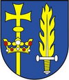
| coat of arms | map | |

|
|
|
| Basic data | ||
| State : | Slovakia | |
| Kraj : | Nitriansky kraj | |
| Okres : | Nitra | |
| Region : | Nitra | |
| Area : | 17.71 km² | |
| Residents : | 1,063 (Dec. 31, 2019) | |
| Population density : | 60 inhabitants per km² | |
| Height : | 190 m nm | |
| Postal code : | 951 46 | |
| Telephone code : | 0 37 | |
| Geographic location : | 48 ° 23 ' N , 18 ° 7' E | |
| License plate : | NO | |
| Kód obce : | 500674 | |
| structure | ||
| Community type : | local community | |
| Structure of the municipality: | 2 parts of the community | |
| Administration (as of November 2018) | ||
| Mayor : | Magdaléna Bogyová | |
| Address: | Obecný úrad Podhorany 2/51 95146 Podhorany |
|
| Website: | www.podhorany.sk | |
| Statistics information on statistics.sk | ||
Podhorany is a municipality in Slovakia .
It was created in 1960 by the union of the places Bádice , Mechenice (German Mehenitz ) and Sokolníky .
Since December 13, 2002, Bádice has been an independent municipality again.
Until 1918 the individual parts of the community belonged to the Kingdom of Hungary . Then they came to the newly formed Czechoslovakia .
