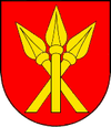
Vráble
| Vráble | ||
|---|---|---|
| coat of arms | map | |

|
|
|
| Basic data | ||
| State : | Slovakia | |
| Kraj : | Nitriansky kraj | |
| Okres : | Nitra | |
| Region : | Nitra | |
| Area : | 38.313 km² | |
| Residents : | 8,551 (Dec 31, 2019) | |
| Population density : | 223 inhabitants per km² | |
| Height : | 142 m nm | |
| Postal code : | 952 01 | |
| Telephone code : | 0 37 | |
| Geographic location : | 48 ° 15 ' N , 18 ° 19' E | |
| License plate : | NO | |
| Kód obce : | 500933 | |
| structure | ||
| Community type : | city | |
| Urban area structure: | 3 districts | |
| Administration (as of November 2018) | ||
| Mayor : | Tibor Tóth | |
| Address: | Mestský úrad Vráble Hlavná 1221 95201 Vráble |
|
| Website: | www.vrable.sk | |
| Statistics information on statistics.sk | ||
Vráble (Hungarian : Verebély ) is a town in Slovakia with 8551 inhabitants (as of December 31, 2019).
It was first mentioned as Verebel in 1265 and is divided into the following parts:
- Dyčka (incorporated in 1975)
- Horný Oháj (incorporated in 1975)
- Vráble
Until 1918 the city belonged to the Kingdom of Hungary and then came to the newly formed Czechoslovakia . She came back to Hungary for a short time from 1938 to 1945 through the First Vienna Arbitration .
Town twinning
-
 Andouillé , France
 -
 Csurgó , Hungary
 -
 Nova Varoš , Serbia
Culture
See also: List of listed objects in Vráble
See also
Web links
Commons : Vráble - collection of images, videos and audio files
- Illustration by Lukas Schnitzer from 1665: Illustration of the Vöstung Verebel in Hungary 1665 ( digitized version )

