Porúbka (Žilina)
| Porúbka | ||
|---|---|---|
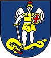
| coat of arms | map | |

|
|
|
| Basic data | ||
| State : | Slovakia | |
| Kraj : | Žilinský kraj | |
| Okres : | Žilina | |
| Region : | Severné Považie | |
| Area : | 3.452 km² | |
| Residents : | 490 (Dec. 31, 2019) | |
| Population density : | 142 inhabitants per km² | |
| Height : | 376 m nm | |
| Postal code : | 013 11 ( Lietavská Lúčka Post Office ) | |
| Telephone code : | 0 41 | |
| Geographic location : | 49 ° 9 ' N , 18 ° 43' E | |
| License plate : | ZA | |
| Kód obce : | 557960 | |
| structure | ||
| Community type : | local community | |
| Administration (as of November 2018) | ||
| Mayor : | Igor Frko | |
| Address: | Obecný úrad Porúbka Rajecká cesta 29 013 11 Lietavská Lúčka |
|
| Website: | www.obecporubka.sk | |
| Statistics information on statistics.sk | ||
Porúbka (Hungarian Túrirtovány - until 1899 Porubka ) is a municipality in northern Slovakia with 490 inhabitants (as of December 31, 2019) in Okres Žilina , a district of Žilinský kraj .
geography
The village is located in the Žilinská kotlina basin on the right bank of the Rajčanka . The center of the village lies at an altitude of 376 m nm and is nine kilometers from Žilina .
Neighboring municipalities are Lietavská Lúčka in the north, Turie in the east and southeast, Rajecké Teplice (district Poluvsie) in the south and Lietavská Svinná-Babkov in the west.
history
The place was mentioned in writing for the first time in 1362 as Poruba and at that time belonged to the dominion of the Lietava Castle ; the name indicates a foundation in a forest clearing. After that, the village was owned by the noble families Praznovszky and Egresdy , before ownership changed to the estate of the Strečno Castle until the 18th century . In 1598 there was a mill and seven houses in the village, in 1784 the village had 20 houses, 22 families and 175 residents including the Podhradek farm . In 1828 there were 23 houses and 255 inhabitants who were employed as shepherds, woodworkers and sawmills.
Until 1918, the place in Trenčín County belonged to the Kingdom of Hungary and then belonged to Czechoslovakia or now Slovakia. In 1936 the whole community was electrified.
From 1960 to 1990 Porúbka was part of the Lietavská Lúčka municipality.
population
According to the 2011 census, Porúbka had 440 inhabitants, including 383 Slovaks and one Czech . 56 inhabitants did not provide any information on ethnicity .
351 residents supported the Roman Catholic Church and four residents joined the Evangelical Church AB. 24 residents were non-denominational and 61 residents had no denomination.
Buildings
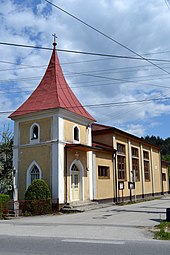
- Trinity Chapel
traffic
Porúbka has a stop on the Žilina – Rajec railway and is located directly on the 1st order road 64 between Žilina and Rajec .

