Saint-Pierre-lès-Nemours
| Saint-Pierre-lès-Nemours | ||
|---|---|---|

|
|
|
| region | Île-de-France | |
| Department | Seine-et-Marne | |
| Arrondissement | Fontainebleau | |
| Canton | Nemours | |
| Community association | Pays de Nemours | |
| Coordinates | 48 ° 16 ' N , 2 ° 41' E | |
| height | 60-115 m | |
| surface | 21.62 km 2 | |
| Residents | 5,483 (January 1, 2017) | |
| Population density | 254 inhabitants / km 2 | |
| Post Code | 77140 | |
| INSEE code | 77431 | |
| Website | www.saintpierrelesnemours.fr/ | |
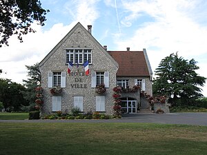
 Town hall and park of Saint-Pierre-lès-Nemours |
||
Saint-Pierre-lès-Nemours is a French commune with 5483 inhabitants (as of January 1, 2017) in the Seine-et-Marne department of the Île-de-France region . It belongs to the Arrondissement of Fontainebleau and the Canton of Nemours . The inhabitants are called Saint-Pierrois (es) .
geography
The localities Chaintréauville , Puiselet , Montaviot , Foljuif also belong to the municipality .
Saint-Pierre-lès-Nemours is 70 kilometers between Paris and Orléans on the Loing River . Saint-Pierre-lès-Nemours is surrounded by the neighboring communities of Grez-sur-Loing in the north, Montcourt-Fromonville in the northeast, Nemours and Darvault in the east, Bagneaux-sur-Loing in the southeast, Faÿ-lès-Nemours in the south, Ormesson in the Southwest, Chevrainvilliers to the west, and Larchant to the northwest.
Population development
| year | 1962 | 1968 | 1975 | 1982 | 1990 | 1999 | 2006 | 2011 |
| Residents | 3124 | 3298 | 3713 | 4777 | 5374 | 5815 | 5753 | 5575 |
Attractions
- Church of Saint-Pierre-Saint-Paul built from the 11th century (see also: List of Monuments historiques in Saint-Pierre-lès-Nemours )
- La Joie Abbey from the 13th century
Community partnerships
A partnership has existed with the German municipality of Bad Hönningen in Rhineland-Palatinate since 1980 .
Personalities
- Jean Prévost (1901–1944), writer and resistance fighter
literature
- Le Patrimoine des Communes de la Seine-et-Marne . Flohic Editions, Volume 2, Paris 2001, ISBN 2-84234-100-7 , pp. 1175-1181.

