
Lützkampen
| coat of arms | Germany map | |
|---|---|---|

|
Coordinates: 50 ° 9 ′ N , 6 ° 11 ′ E |
|
| Basic data | ||
| State : | Rhineland-Palatinate | |
| County : | Eifel district Bitburg-Prüm | |
| Association municipality : | Arzfeld | |
| Height : | 510 m above sea level NHN | |
| Area : | 10.98 km 2 | |
| Residents: | 346 (Dec. 31, 2019) | |
| Population density : | 32 inhabitants per km 2 | |
| Postal code : | 54617 | |
| Area code : | 06559 | |
| License plate : | BIT, PRÜ | |
| Community key : | 07 2 32 263 | |
| Association administration address: | Luxemburger Strasse 6 54687 Arzfeld |
|
| Website : | ||
| Local Mayor : | Manfred Mueller | |
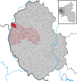
| Location of the local community Lützkampen in the Eifelkreis Bitburg-Prüm | ||
  |
||

Lützkampen is a municipality in the Eifelkreis Bitburg-Prüm in Rhineland-Palatinate . It belongs to the community of Arzfeld .
geography

location
The place is in the Islek landscape , in the west of the Eifel and near the border triangle Germany - Luxembourg - Belgium . The location has the shape of an elongated, semicircular street village that extends in an east-west direction. It has recently been expanded to include new buildings in the direction of Harspelt and in the “Bornwiese”.
The highest point in the municipality is Auf der Nell at 540 m above sea level. NHN , the lowest point on the ground is on the Our south of the Grimmelslei with 321 m .
With 51.0%, half of the municipal area is used for agriculture, 43.5% is forest area (as of 2011).
Community structure
The community is divided into the community parts Lützkampen, Stupbach and Welchenhausen. Lützkampen also includes the residential areas Auf dem Bock, Diedrichsborn, Lützkampenermühle, Zollamt Lützkampen (Auf dem Halvent), Auf der Nöll and Im Pesch; Stupbach includes the residential areas Auf Halenfeld, In der Loch and Stupbacherseif (Brodelseifen).
Neighboring communities
Neighboring communities are Burg-Reuland (Belgium) in the west and north, Kesfeld and Großkampenberg in the east, Herzfeld in the southeast and Harspelt in the south.
history
Finds of ruins of Roman settlements in the Lützkamper area indicate an early settlement of the place.
The three villages of Lützkampen, Stupbach and Welchenhausen belonged to the Luxembourg rule of Dasburg until the end of the 18th century .
In 1794 French revolutionary troops occupied the Austrian Netherlands , to which the Duchy of Luxembourg belonged, and annexed it in October 1795 . Under French administration , Lützkampen, Stupbach and Welchenhausen belonged to the Arzfeld canton , which was administratively assigned to the Forests department.
Due to the resolutions at the Congress of Vienna in 1815, the former Luxembourg area east of the Sauer and Our was assigned to the Kingdom of Prussia . Lützkampen and Stupbach became members of the Harspelt mayor , Welchenhausen of the Leidenborn mayor . Together they belonged to the newly formed district of Prüm in the Trier administrative district in 1816 and to the Rhine province from 1822 on . All three communities belonged to the Daleiden-Leidenborn office from 1936 and to the Arzfeld association from 1970 .
On January 1, 1972, the previously independent communities of Stupbach (then 60 inhabitants) and Welchenhausen (51 inhabitants) were incorporated into Lützkampen.
A first church was built in the early Middle Ages when Lützkampen was a subsidiary of Ouren. A rectory was built in 1806.
It was first hit by World War II in 1944 when American troops invaded and the population was evacuated to Belgium. In 1945 there was another evacuation by the Americans. A total of 27 civilian casualties, three missing and six deaths were recorded for the war.
In 1955 the place was connected to the district waterworks, two years later it was canalized.
The place name means something like "small field", because "lütz" is derived as "small" and "camping" is derived from the Latin word for "field".
Population development
The development of the population of Lützkampen in relation to today's municipal area; the values from 1871 to 1987 are based on censuses:
|
|
Municipal council
The municipal council in Lützkampen consists of eight council members, who were elected by a majority vote in the local elections on May 26, 2019 , and the honorary local mayor as chairman.
coat of arms
|
|
Blazon : "In a shield head divided nine times by silver and blue, a golden wedge, inside a fallen blue sword with black pommel and black crossguard." |
| Founding of the coat of arms: From the 11th to the end of the 18th century, Lützkampen belonged to the Lordship of Ouren, a feudal part of the County of Vianden in the Grand Duchy of Luxembourg, but also belonged to the Dasburg Lordship. The origin of the place name is interpreted in different ways: Lützel-Lütz-Littel-klein and Campus-Feld or Siedlung, Lütsch-Letsch-Letzkampen more than one language variant of Luxembourg-Letzeburg. This meaning would correspond to the economic, historical and cultural-historical importance, as a contrast to the neighboring Großkampen. That is why the Luxembourg national colors blue and silver are used in the municipal coat of arms. Parish patron of the parish of Lützkampen is St. Martin. His attributes are cloak and sword, which are represented by the golden wedge and the sword in the coat of arms. |
Culture and sights


Buildings
Today's church in Lützkampens was built in 1962–63. The choir was taken over from the previous church. In 1964 three new bells were installed. In 1974 a new organ was inaugurated. The cemetery was moved about one kilometer outside of the village in 1958.
See also: List of cultural monuments in Lützkampen
Museums
In August 2002 the "Museum in der wArtehalle" was opened, a small art museum in the village of Welchenhausen, which shows works by artists from Germany and neighboring countries as well as various individual presentations in the winter months, exhibitions on the cultural history of the Islek region.
Green spaces and recreation
A natural monument is a 250-year-old beech tree near a single farm on the road to Sevenig (Our) .
See also: List of natural monuments in Lützkampen
Regular events
- The fair is held on the last Sunday in July as a reminder of the laying of the foundation stone of the new church.
- Castle burning on the first weekend after Ash Wednesday (so-called Scheef Sunday)
Economy and Infrastructure
Business
Until the Second World War, Lützkampen was characterized by numerous small farms. Since 1971, when there were still 72 farms, the utilized agricultural area has decreased from 668 ha to 301 ha (2010), which were cultivated by eight farms. As a result, Lützkampen has also become a residential community .
traffic
In the center of Lützkampen, Landesstraße 15 , which ends in the village and runs in a north-south direction, meets Landesstraße 1, which runs from east to west . The two state roads lead u. a. to Üttfeld , Harspelt and to the Belgian border.
Public facilities
Lützkampen is the location of a volunteer fire brigade founded in 1950 with 15 members, a kindergarten and the St. Willibrord primary school .
literature
- Ernst Wackenroder (edit.): The art monuments of the Prüm district (= Paul Clemen [Hrsg.]: The art monuments of the Rhine province . Volume 12 / II ). Trier 1983, ISBN 3-88915-006-3 , p. 98–99 (222 p., With 12 plates and 227 ills. In the text. Reprinted by the Schwann edition, Düsseldorf 1927).
Web links
- To search for cultural assets of the local community Lützkampen in the database of cultural assets in the Trier region .
Individual evidence
- ↑ a b State Statistical Office of Rhineland-Palatinate - population status 2019, districts, municipalities, association communities ( help on this ).
- ↑ a b c State Statistical Office Rhineland-Palatinate: My village, my city. Retrieved April 21, 2020 .
- ↑ State Statistical Office Rhineland-Palatinate (ed.): Official directory of the municipalities and parts of the municipality. Status: January 2019 [ Version 2020 is available. ] . S. 96 (PDF; 3 MB).
- ↑ Official municipality directory 2006 ( Memento from December 22, 2017 in the Internet Archive ) (= State Statistical Office Rhineland-Palatinate [Hrsg.]: Statistical volumes . Volume 393 ). Bad Ems March 2006, p. 185 (PDF; 2.6 MB). Info: An up-to-date directory ( 2016 ) is available, but in the section "Territorial changes - Territorial administrative reform" it does not give any population figures.
- ^ The Regional Returning Officer Rhineland-Palatinate: Local elections 2019, city and municipal council elections.
- ↑ Coat of arms of Lützkampen
- ↑ Information on the museum's website
- ↑ Hüttenbrennen in the Eifel. Retrieved May 1, 2016 .
- ↑ Hut Sunday in the Eifel. Retrieved August 10, 2017 .
Arzfeld | Dackscheid | Dahnen | Daleiden | Dasburg | Eilscheid | Eschfeld | Euscheid | Großkampenberg | Hargarten | Harpelt | Herzfeld | Irrhausen | Itching | Kesfeld | Kickeshausen | Kinzenburg | Krautscheid | Lambertsberg | Lash oath | Lauperath | Leidenborn | Lichtenborn | Lierfeld | Lünebach | Lützkampen | Manderscheid | Mauel | Merlscheid | Niederpierscheid | Oberpierscheid | Olmscheid | Pintesfeld | Plütscheid | Price oath | Reiff | Reipeldingen | Roscheid | Sengerich | Sevenig (Our) | Strickscheid | Üttfeld | Waxweiler