
Ybbs on the Danube
|
Borough Ybbs on the Danube
|
||
|---|---|---|
| coat of arms | Austria map | |
 |
|
|
| Basic data | ||
| Country: | Austria | |
| State : | Lower Austria | |
| Political District : | Melk | |
| License plate : | ME | |
| Surface: | 23.78 km² | |
| Coordinates : | 48 ° 10 ' N , 15 ° 4' E | |
| Height : | 224 m above sea level A. | |
| Residents : | 5,627 (January 1, 2020) | |
| Population density : | 237 inhabitants per km² | |
| Postal code : | 3370 | |
| Area code : | 07412 | |
| Community code : | 3 15 49 | |
| NUTS region | AT121 | |
| UN / LOCODE | AT YBB | |
| Address of the municipal administration: |
Hauptplatz 1 3370 Ybbs on the Danube |
|
| Website: | ||
| politics | ||
| Mayor : | Alois Schroll ( SPÖ ) | |
|
Municipal Council : ( 2015 ) (29 members) |
||
| Location of Ybbs on the Danube in the Melk district | ||
  |
||
 town hall |
||
| Source: Municipal data from Statistics Austria | ||

Ybbs an der Donau [ ɪps ] is a municipality in the Mostviertel of the Austrian state of Lower Austria with 5627 inhabitants (as of January 1, 2020).
etymology
The name of the city is also known as Ips (also known as Ips Stadt or Ips an der Donau ) in historical documents . Later, the spelling Ybbs on the Danube prevailed. The original origin of the name is unclear.
geography
The city of Ybbs on the Danube lies at an altitude of 224 m above sea level. A. in the south-western part of the Melk district . The location at the transition between Strudengau and Nibelungengau, northwest of the mouth of the Ybbs directly on the Danube , has been secured with flood protection since 2011. Sections of today's Danube Valley were already formed in the middle Tertiary and, depending on the geological-tectonic ground, the section between Ardagger and Ybbs was created. The Danube River cut where rift and fault lines, i.e. softer zones, existed. From a geological point of view, the city has a share in the granite of the Bohemian Massif, which is one of the oldest mountains on the continent. In the area from Ardagger to Ybbs, this primary rock extends beyond the southern right bank of the Danube. This is bordered by a zone with Schliere rocks, marly-sandy deposits from the Tertiary, a by-product of the formation of the Alps. The border runs at a right angle to the river at about the height of the town hall. In the area of the primary rock, west and southwest of the city, on the Hengstberg and the Donauleiten, in Grießheim and Göttsbach and again on the right bank of the Danube in Sarling and Säusenstein, there are slate gneisses, granulite - fine-grained, brittle rocks or graphite-bearing gneiss lenses. Clays, sands, sandstones and conglomerates predominate in the adjoining Schlier rock zone to the south. There is also plenty of gravel deposits from the present.
Community structure
The municipality includes the following five localities (population in brackets as of January 1, 2020):
- Donaudorf (103) including hermitage and pond
- Göttsbach (545) including Griesheim, Grillenbach, Mitterburg, Reitern, Roßberg, Scharlreith, Theinstetten, Unterau and Windhof
- Sarling (492) including Aigen, Neusarling, Reist and House of Commons
- Säusenstein (205) including the underground
- Ybbs on the Danube (4282) including Au, Berging and Reitering
The community consists of the cadastral communities Donaudorf, Göttsbach, Sarling, Säusenstein and Ybbs.
Neighboring communities
| Court Office Priel | Persenbeug-Gottsdorf | Curved nut tree |
| St. Martin-Karlsbach |
.svg)
|
|
| Neumarkt an der Ybbs | Mountain country |
history
There is evidence of a Celtic settlement on a hill near the city - the Marienhöhe (earth wall, sacrificial stones). A scientific review has not yet taken place. During excavations by the Federal Monuments Office in 1962/63, foundations of a previous building, settlement pits and graves of the Hallstatt culture came to light in the southeast of the municipality near the Sarlinger church . Another evidence from pre-Roman times is a bronze sword, dated around 800 BC. Christ. The full-grip sword rarely used in combat is likely to be a sacrificial sword. It was found near the mouth of the Ybbs River in the 1950s and is now in the city museum. A first documentary mention can be found in 837 in the Salzburg chamber books from the end of the 13th century, according to which the Carolingian Ludwig the German donated an area in the Slavic region in Ybbs to the Salzburg Church: "in loco nuncupante Ipusa iuxta Ipusa flumen".
In 10./11. In the 19th century, the Bavarian Counts of Sempt-Ebersberg were wealthy here. They owned castle complexes on the Danube, both in Ybbs and Persenbeug, property and a large farm in the vicinity of Ybbs. In 1037, Count Eberhard von Ebersberg handed over a farm in Göttsbach ("Gorsbach") near Ybbs to the Geisenfeld monastery. The name "Ibseburch" from 1073 indicates that the place was fortified. Over the years, more and more houses have been grouped around the old castle and the name “Ibseburch” has given way to the name “Ips” for the city.
When the Habsburg King Rudolf I moved in in 1276, the city fell away from the Bohemian King and Duke of Austria Ottokar II Přemysl and opened the gates to Rudolf. Rudolf's grandson, Duke Frederick the Fair, was particularly fond of the city. When the nobility of Austria and some cities rose against Friedrich in 1309, Ybbs remained loyal to him. In return, he confirmed to the citizens of Ybbs in 1310 the community forest, which bordered the Freyenstein area and which Konrad von Summerau , lord of Freyenstein Castle, had appropriated. In 1314, after being elected king, Frederick the Fair granted the city the right to embankment. With these and the following privileges, a “golden age” began for Ybbs. Particularly important for the city was the document from 1317, with which Friedrich bestowed the ban on blood on the “faithful dear burgers ze Ybse and the stat daselbs”. Ybbs was unquestionably considered a city at the time.
Because of the favorable location in terms of transport policy, the armies of the Second (1147–1149) and Third Crusade (1189–1192) passed the settlement directly. An extensive movement of people and goods on the Danube also stimulated settlement activity and the economy. Last but not least, the location at the exit of the Strudengau with its formerly feared rapids was decisive for growth. In the Middle Ages, the east-west trade was mainly carried out on the Danube. Ybbs was one of the most important Danube ports and, alongside Linz and Klosterneuburg, one of the three main toll stations. An iron road coming from the Erzberg also reached the Danube at Ybbs. Since 1639, Ybbs was also a salt shop for the salt from the area around Gmunden. The Kaiserin-Elisabeth-Bahn , the Westbahn, was opened in 1858, and electrification took place in 1951. The construction of the Western Railway and the increasing motorization had negative effects for Ybbs, the main traffic passed the city and it became less important.
coat of arms
|
|
Blazon : “In a silver shield there is a red, crenellated city wall with an open gate and raised portcullis, which is surmounted by two towers; floating between the towers, hanging on a green linden branch, is the red-white-red shield. " |
|
Reasons for the coat of arms: unknown; Leadership since the 14th century; Colors: red-white-red
|
Community partnerships
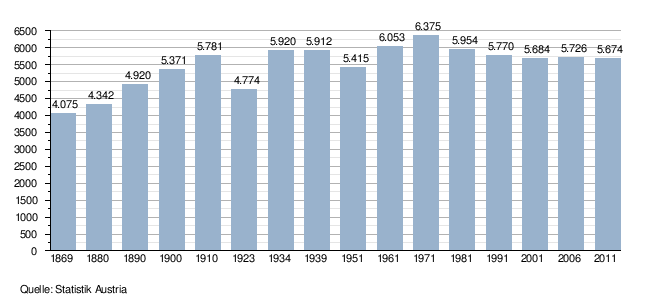
Population development
politics
The municipal council has 29 members.
- With the municipal council elections in Lower Austria in 1990, the municipal council had the following distribution: 19 SPÖ, 8 ÖVP and 2 FPÖ.
- With the municipal council elections in Lower Austria in 1995, the municipal council had the following distribution: 13 SPÖ, 6 ÖVP, 5 List Herbert Renner, 4 FPÖ and 1 Greens.
- With the municipal council elections in Lower Austria in 2000, the municipal council had the following distribution: 16 SPÖ, 7 ÖVP, 3 list Herbert Renner and 3 FPÖ.
- With the municipal council elections in Lower Austria in 2005 , the municipal council had the following distribution: 19 SPÖ, 8 ÖVP, 1 Greens and 1 List Ybbs.
- With the municipal elections in Lower Austria in 2010 , the municipal council had the following distribution: 16 SPÖ, 9 ÖVP, 3 FPÖ and 1 Greens.
- With the municipal council elections in Lower Austria 2015 , the municipal council has the following distribution: 16 SPÖ, 10 ÖVP, 2 FPÖ and 1 election platform of independent Ybbser.
mayor
- 1945: Norbert Mayer (ÖVP)
- until 2014 Anton Sirlinger (SPÖ)
- since 2014 Alois Schroll (SPÖ)
Culture and sights


- Watchtowers Ybbs : Late antique small fort (Burgus) Ad Pontem Ises on the church square
- Fortification Ybbs an der Donau : A former water-bearing moat, called Schwalleck (a structure to initiate the Danube water in the ditch) and a city tower at the southeast end of the city are still standing.
- Catholic parish church Säusenstein hl. Donatus
- Partly preserved former Cistercian Abbey Stift Säusenstein in the cadastral community of Säusenstein .
- Catholic parish church Ybbs an der Donau hl. Lorenz: Instead of the old castle building, the parish church of St. Laurenz was built in the 15th century. The three-aisled Gothic nave was built under the Viennese cathedral builder Laurenz Spenning . In 1466 he and his journeymen were commissioned to build the vault of the nave of the Ybbs church. It was not until after 1500 that the church was completed by vaulting the choir under the leadership of the princely caretaker Hans Geyer. The year 1521 can be read on the choir arch as the date of completion. If the nave is divided by a simple ribbed vault, there is already a star rib vault in the choir. In 1716 a fire destroyed the tower and interior of the church. In 1721 the interior fittings were made Baroque and the tower was renovated with a baroque onion helmet. Only the tower was damaged in the town fire of 1868. After a vote in the population, the spire was designed in the neo-Gothic style in 1874, which almost gave the church tower its former appearance.
- Old town: the appearance of the medieval city was changed several times by the two great city fires (1716 and 1868). An example of a Gothic building is the so-called Passauerkasten (an early Gothic hall building) on the Danube. In the south-western part of the old town is the castle, a renaissance building that today houses the health and nursing school of the city of Vienna. The main square merges into the church square to the north and into the ship master's square to the east. It represents the city center and slopes down towards the Schiffmeisterplatz. In its center is the city fountain from 1613 with the figure of a knight armed with a shield and sword - popularly known as "Kilian" - which is a pillory figure. The town hall on the main square is a building from the 16th century. This is shown by the barrel vaults inside the house. It carries a rectangular gate tower with a neo-Gothic roof spire. It got its current classical facade after the city fire in 1868. The Palais Gatterburg, the only surviving baroque building in the city, is located on the main square.
- Bicycle museum: with exhibits dating back to 1883.
- Former Monastery and former cavalry barracks: In the 13th century, the Holy Spirit Monastery for Cistercian women was founded outside the city walls. In 1631 the monastery building was given to the Franciscans and in 1783, like many other monasteries, it was closed by Joseph II. In 1723 a cavalry barracks was completed above the monastery, planned by Jakob Prandtauer, who himself supervised the building. From 1850 the entire area was purchased by the City of Vienna. Today everything is together the “Therapy Center of the City of Vienna in Ybbs on the Danube”.
- Early medieval St. Vitus Church in Sarling: near the cadastral parish of the same name
- Ybbs Jewish Cemetery on the Danube : On March 26, 1889, the “Cultusgemeinde Ybbs” bought a piece of land on which a cemetery wall and a ceremonial hall were built in 1894.
- Ybbs-Persenbeug power plant : 1954–1957 (since 1959 road bridge over the power plant) the first purely Austrian Danube power plant, Ybbs-Persenbeug, was built, which is now open to visitors.

Danube power plant Ybbs-Persenbeug, seen from Ybbs

Kirchengasse

Old rectory

Interior of the parish church

Passage under the church

town hall

Ybbs in winter, Ötscher in the background


economy
In the northwest of Ybbs is the Ybbs-Persenbeug power plant , the first run-of-river power plant on the Austrian Danube . The largest employer is the large-scale sawmill of Stora Enso Timber (formerly Holzindustrie Schweighofer until August 2001) with around 350 employees. Ybbs is also home to the Ybbs therapy center run by the City of Vienna ( Wiener Krankenanstaltenverbund ) - psychiatric hospital as a hospital for psychiatric illnesses and Schaufler GmbH, a waste disposal company with around 120 employees.
traffic
- Road: Ybbs is located 2 km north of the A1 motorway , which runs in a west-east direction from Salzburg via Linz and St. Pölten to Vienna . The federal highways B1, B 25, B 3 and B 36 run in the immediate vicinity and create additional connections to the distance.
- Tram: Between November 11, 1907 and September 22, 1953, the Ybbs tram operated in Ybbs, one of the shortest tram lines in the world. It had a track width of 760 mm, was 2.94 kilometers long and connected the city with the train station on the Western Railway . Today the transport company of the municipality of Ybbs on the Danube operates 7 buses and a minibus on 5 lines. Connections to the surrounding regions are offered from the Ybbs city area and the train station. The majority of the passengers are schoolchildren.
education
- Education center of the security executive (BZS) Waidhofen an der Ybbs of the security academy
- Federal Commercial Academy and Federal Commercial School Ybbs on the Danube
Personalities
- Nikolaus von Ybbs (* between 1270 and 1280–1340) Bishop of Regensburg
- Rudolf Geyling (1839–1904), Austrian painter
- Wilhelm Wirtinger (1865–1945), Austrian mathematician
- Norbert Mayer (1887–1966), Mayor of Ybbs an der Donau
- Hans Hoffmann-Ybbs (1928–2005), painter
- Alfred Klose (1928–2015), Austrian political and social scientist
- Walter Renner (* 1940 in Säusenstein), politician
- Johann Reikerstorfer (* 1945), philosopher and Catholic fundamental theologian
- Karl Fischer (* 1956), actor
- Othmar Karas (* 1957), Austrian politician (ÖVP), member of the European Parliament since 1999
- Alfred Gusenbauer (* 1960), politician (SPÖ), Austrian Chancellor from January 2007 to December 2008
- Herta Mikesch (* 1960), entrepreneur and politician (ÖVP)
- Andreas Hauer (* 1965), member of the Constitutional Court since March 2018
- Richard Schuberth (* 1968), writer
Web links
- Website of the municipality of Ybbs an der Donau
- Mayor of the city of Ybbs / people who have been in office in Ybbs since 1305
- 31549 - Ybbs on the Danube. Community data, Statistics Austria .
Individual evidence
- ↑ Statistics Austria: Population on January 1st, 2020 by locality (area status on January 1st, 2020) , ( CSV )
- ^ Result of the municipal council election 1995 in Ybbs an der Donau. Office of the Lower Austrian State Government, March 30, 2000, accessed October 17, 2019 .
- ^ Election result of the municipal council election 2000 in Ybbs an der Donau. Office of the Lower Austrian State Government, February 4, 2005, accessed on October 17, 2019 .
- ^ Election result of the municipal council election 2005 in Ybbs an der Donau. Office of the Lower Austrian State Government, March 4, 2005, accessed on October 17, 2019 .
- ^ Election result of the municipal council election 2010 in Ybbs an der Donau. Office of the Lower Austrian State Government, October 8, 2010, accessed on October 17, 2019 .
- ^ Election result of the 2015 municipal council election in Ybbs an der Donau. Office of the Lower Austrian State Government, December 1, 2015, accessed on October 17, 2019 .
- ^ Fritz Eheim: The Viennese Dombauhütte and the parish church of Ybbs . In: Our home. Journal of the Association for Regional Studies of Lower Austria and Vienna , 43, 1972, pp. 169–172

Artstetten-Pöbring | Mountain country | Bischofstetten | Blind market | Dorfstetten | Dunkelsteinerwald | Emmersdorf an der Donau | Erlauf | Golling an der Erlauf | Court Office Priel | Hürm | Kilb | Kirnberg an der Mank | Klein-Pöchlarn | Curved walnut | Body | Loosdorf | Deficiency | Marbach an der Donau | Maria Taferl | Melk | Münichreith-Laimbach | Neumarkt an der Ybbs | Nöchling | Persenbeug-Gottsdorf | Petzenkirchen | Pöchlarn | Pöggstall | Raxendorf | Ruprechtshofen | Schollach | Schönbühel-Aggsbach | St. Leonhard am Forst | St. Martin-Karlsbach | St. Oswald | Texingtal | Expanses | Ybbs on the Danube | Yspertal | Zelking-Matzleinsdorf
Cadastral communities: Donaudorf | Göttsbach | Sarling | Säusenstein | Ybbs
Locations: Donaudorf | Göttsbach | Sarling | Säusenstein | Ybbs on the Danube
City: Ybbs an der Donau Districts: Göttsbach | Griesheim | Unterau | Ybbs an der Donau Villages: Neusarling | Sarling | Säusenstein | Lower house settlement: Au Rotte: Aigen | Berging | Donaudorf | Hermitage | Grillenbach | Mitterburg | Travel | Reitering | Scharlreith | Teuch | Theinstetten | Undermine | Windhof Scattered Houses: Reitern | Rossberg
Counting district: Ybbs-Altstadt | Ybbs-West Suburb | Göttsbach-Donauleiten | Ybbs-Southeast | Säusenstein | Psychiatric hospital | Ybbs-Southwest