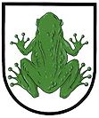
Žabeň
| Žabeň | ||||
|---|---|---|---|---|
|
||||
| Basic data | ||||
| State : |
|
|||
| Region : | Moravskoslezský kraj | |||
| District : | Frýdek-Místek | |||
| Area : | 339 ha | |||
| Geographic location : | 49 ° 43 ' N , 18 ° 18' E | |||
| Height: | 266 m nm | |||
| Residents : | 850 (Jan 1, 2019) | |||
| Postal code : | 738 01 | |||
| structure | ||||
| Status: | local community | |||
| Districts: | 1 | |||
| administration | ||||
| Mayor : | Vítězslav Klega (as of 2006) | |||
| Address: | Žabeň 62 73925 Sviadnov |
|||
| Municipality number: | 552691 | |||
| Website : | www.zaben.cz | |||
Žabeň (German Schaben ) is a municipality with 604 inhabitants in the Czech Republic . It is located in northeast Moravia five kilometers northwest of Frýdek-Místek and belongs to the Okres Frýdek-Místek .
geography
The village extends at 266 m above sea level. M. left of the Ostrawitza at its tributary Olešná. Neighboring towns are Paskov and Řepiště in the north, Lískovec in the east, Frýdek-Místek , Sviadnov and Staříč in the south and Brušperk in the west. The shaft and processing facilities of the disused Staříč coal mine are to the northwest.
history
The first documentary mention comes from 1460, in it the village was mentioned as part of the Paskov fief of the Olomouc bishopric. It is believed that Žabeň is identical to the village of Malý Sviadnov, which was documented from 1395 to the 15th century.
In 1838 the residents built a chapel near the Naisermühle, which was consecrated to St. Fabian and Sebastian. The village school was established in 1904.
Attractions
- St. Florian Chapel
- In the village there is a 22 m high oak with a trunk circumference of 3.95 m. It was declared a natural monument in 1991.

