Tamsweg district
| location | |
|---|---|
| Basic data | |
| state | Salzburg |
| NUTS III region | AT-321 |
| Administrative headquarters | Tamsweg |
| surface | 1020 km² |
| Residents | 20,251 (January 1, 2020) |
| Population density | 20 inhabitants / km² |
| License Plate | TA |
| website | BH Tamsweg |
| map | |
The Tamsweg district is a political district in the Austrian state of Salzburg .
It is congruent with the geographic region of Lungau , one of the five historical districts of Salzburg, and is located in the southeast of the state. Lungau is also the name of the AT321 region in official statistics , one of the three Salzburg NUTS 3 regions, which is also congruent with this district.
geography
The Lungau is a valley with just over 1000 square kilometers, which is surrounded by the Hohe Tauern ( Hafner Group ) in the west, the Niedere Tauern (Radstädter- and Schladminger Tauern) in the north and east and the Gurktal Alps (Nockberge) in the south.
From the north, the Lungau can be reached by road over the Radstädter Tauern Pass or through the Tauern tunnel of the Tauern motorway. From the east you can get to Lungau via the Murtal federal road, the Krakau plain or the Murtalbahn . From Carinthia in the south the district can be reached on the pass road over the Katschberg , through the Katschberg tunnel or through the Bundschuhtal. There is no direct road access to the Lungau area from the west.
With the exception of the Krems river, which flows into the Carinthian Lieser , the Lungau is drained exclusively via the Mur , the main river in Styria , which rises in the southwest of the Tamsweg district.
history
Since the 2nd century BC The area of today's Lungau belonged to Norikum , a Celtic kingdom. 15 BC BC it was occupied by the Romans and in 50 AD it became a Roman province. From the 8th to the early 14th century the Lungau was under Bavarian rule, the name Lungouue has been attested since 923 and is traced back to the Indo-European water name * Luna , which possibly denotes the Taurach . A county of Lungau is already occupied in 1103.
The rule of the Salzburg prince archbishops then lasted from 1328 to 1803 . Martin Luther's teachings were spread early in the Lungau, the first indications date from 1534. Preachers from neighboring Styria played a role in this, such as Jörg Schratl, who opposed the Pope in Stadl an der Mur as early as 1528 . In the following 100 years, the Salzburg archbishops repeatedly took measures against the faith renewers . Around 1578 z. B. the archbishop himself with troops in the Lungau, had the ringleaders captured, transferred to Hallein and executed there. In 1605 it was reported to Prince Archbishop Wolf Dietrich von Raitenau that many Lungau sectic and Lutheran pieces were speaking and singing. However, the archbishop's zeal for reform was paralyzed by his personal lifestyle and several political and economic difficulties, so that he could no longer tackle a full offensive to re-Catholicize. Only his successor Markus Sittikus carried out a general visit in 1613. a. it was found that the majority of the country pastors lived in cohabitation and had children, which was followed by a period of strict discipline. After that, through the conversion of the “sectic subjects”, the unity of faith could be restored, but it was later determined that this would have remained merely an external one. Therefore, in 1633 the Capuchin Order took over pastoral care in Lungau in order to recatholize the population permanently. This period ended in 1781 with the dissolution of the Capuchin Order in Tamsweg by the enlightened Archbishop Colloredo . After his abdication in 1803 the area came under Bavarian administration for a short time and in 1816, like all of Salzburg, became part of Upper Austria.
With the creation of a separate crown land of Salzburg in 1848, a separate state constitution was issued, which also brought about new regulations for the state administration and the introduction of municipal regulations. In 1880 the Lungau was described as the “poorest” region in the State of Salzburg. The reason for this was its geographical isolation. It was only after the connection to the railway network by the Murtalbahn in 1894 and the construction of the Tauern Autobahn from 1971 onwards, where trade and business in Lungau strengthened, with the number of employees in Lungau falling by 9.4% compared to the entire state since the opening of the autobahn until 1991, by stimulating commuter traffic to other metropolitan areas : almost every third Lungau employed person commuted in 2014.
economy
The Tamsweg district is a popular holiday destination with around 1.5 million overnight stays a year. The region offers numerous sports opportunities in summer and winter. In addition, nature, cultural features and technical objects are advertised for tourism. In this regard, the narrow-gauge railway from Mauterndorf to the Styrian community of Unzmarkt plays a role. Operationally, the railway is now divided into the Taurachbahn and the Murtalbahn .
Other important industries are milk production and forestry and timber , with around two thirds of timber production going for export , mainly to Italy .
Culture
Sacred sights
Due to its location on the Tauern crossing and the temporary prosperity based on mining and the coal and steel industry, several churches of above-average quality were built. The church of St. Rupert in Weißpriach with its Byzantine and Romanesque frescoes and the pilgrimage church of St. Leonhard ob Tamsweg are of supraregional importance . Also worth seeing are the parish and pilgrimage church in Mariapfarr , the original parish of Lungau in Mariapfarr-Althofen, which was renovated in the 18th century in rococo style, as well as the two churches in Sankt Margarethen in Lungau and the Gothic church of Sankt Andrä in Lungau.
Secular buildings
Mainly in the side valleys of the Lungau there are numerous old farms, some as single houses, some as paired farms , which are either timbered in log construction, built as stone or from a stone ground floor with a wooden attic. Many historical alpine huts are mostly built as log structures. Typical of the Lungau are the masonry and mostly elaborately decorated granaries, the so-called Troadkästen (grain boxes), which can be found in many farmhouses and have been restored in large numbers in recent years.
Not least because of its important location for traffic, the Lungau had a large number of castles in the Middle Ages, most of which are no longer preserved or only in ruins. Three of these castles were restored in 1900: Schloss Moosham , the Mauterndorf Castle in the same town and the castle Finstergrün in Ramingstein, which was rebuilt from a largely neglected ruin.
Technical monuments
For centuries, gold , silver , nickel , cobalt , talc , arsenic and other minerals were mined and smelted in the Lungau . In addition to many rather inconspicuous legacies, the blast furnace in Bundschuh in the municipality of Thomatal, the silver mine in Ramingstein, open to visitors and abandoned in 1780 , as well as the ore paths in Ramingstein and the ore path through the zinc wall , the highest accessible mine in Europe. The tunnels of the Arsenkies mining near the Rotgüldensee are well preserved, but not open to the public.
The Rotgüldensee is seen as a contemporary technical monument, a formerly natural mountain lake that was dammed up with an eco-dam and that has been expanded into a pumped storage plant.
regional customs
A well-known cultural feature of this region are the so-called Samson parades, which take place in ten locations in Lungau and in two neighboring locations in Styria. For the first time in the year after the Corpus Christi procession and then more often until September, the around six meter high Samson figure , which is present in each place, is carried through the village, whereby in half of the cases the gigantic Samson is accompanied by two dwarf figures. The highlight of a parade are the dances of honor accompanied by a “Samson Waltz”.
Administrative division
The Tamsweg district borders in the west on the Salzburg district of Sankt Johann im Pongau , in the north on the Styrian district Liezen (Expositur Gröbming), in the east on the Styrian district Murau and in the south on the Carinthian district Spittal an der Drau .
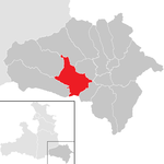
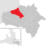
The administrative unit is divided into the following 15 municipalities with the respective population figures as of January 1, 2020.
In the NUTS classification used for the official statistics of the European Union , Lungau is one of the three groups of districts in the state of Salzburg ( NUTS level : AT -2), bears the code and includes the entire political district of Tamsweg.
AT321

|
||
|
Legend for the breakdown table
|
| local community | location | Ew | km² | Ew / km² | Judicial district | region | Type | Metadata |
|---|---|---|---|---|---|---|---|---|
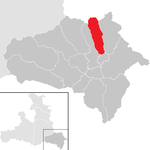
Göriach
|
|
344 | 44.1 | 7.8 | Tamsweg | local community |
Acc. To code: 50501 |
|
Lessach
|

|
535 | 72.23 | 7.4 | Tamsweg | local community |
Acc. To code: 50502 |
|
Mariapfarr
|

|
2,390 | 47.35 | 50 | Tamsweg | local community |
According to code: 50503 |
|
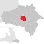
Mauterndorf
|
|
1,599 | 32.71 | 49 | Tamsweg | market community |
Acc. To code: 50504 |
|
Muhr
|

|
487 | 116.07 | 4.2 | Tamsweg | local community |
Acc. To code: 50505 |
|
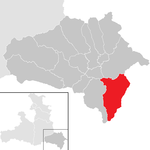
Ramingstein
|
|
1,049 | 94.21 | 11 | Tamsweg | local community |
According to code: 50506 |
|
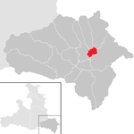
Sankt Andrä im Lungau
|
|
767 | 10.5 | 73 | Tamsweg | local community |
According to code: 50507 |
|
Sankt Margarethen im Lungau
|

|
718 | 24.44 | 29 | Tamsweg | local community |
Acc. To code: 50508 |
|
Sankt Michael im Lungau
|
|
3,512 | 68.83 | 51 | Tamsweg | market community |
Acc. To code: 50509 |
|
Tamsweg
|

|
5,741 | 117.45 | 49 | Tamsweg | market community |
According to code: 50510 |
|
Thomatal
|

|
355 | 75.68 | 4.7 | Tamsweg | local community |
Acc. To code: 50511 |
|
Tweng
|
|
259 | 86.59 | 3 | Tamsweg | local community |
Acc. To code: 50512 |
|
Unterberg
|

|
1,015 | 18.94 | 54 | Tamsweg | local community |
According to code: 50513 |
|
Weißpriach
|

|
309 | 80.29 | 3.8 | Tamsweg | local community |
According to code: 50514 |
|
Cedar house
|

|
1,171 | 130.53 | 9 | Tamsweg | local community |
According to code: 50515 |
Population development

Web links
- Lungau regional association
- NUTS-3 Lungau region in the "Tirol Atlas"
- “Lungau folk culture” , information about customs and folk culture in Lungau
Individual evidence
- ↑ Heinz-Dieter Pohl : The most famous Austrian landscape and area names , accessed on February 8, 2020.
- ^ Manfred Scheuch: Austria - Province, Empire, Republic. A historical atlas. Verlag Das Beste, Vienna 1994, ISBN 3-87070-588-4 , Salzburg - Archdiocese and Imperial Principality , p. 37, column 1.
- ^ A b Valentin Hatheyer: The Protestant movement in Lungau and the Capuchin monastery in Tamsweg . In: Annual report of the fe Gymnasium at the Collegium Borromäum , ed. vom Fe Kollegium Borromäum, 53rd year, 1902, p. 5.
- ↑ Hatheyer 1902, p. 8.
- ↑ Hatheyer 1902, p. 9f.
- ^ A b Franz Ortner: Reformation and Counter-Reformation . In: History of Salzburg . City and Country, ed. by Heinz Dopsch, Volume II / Part 1, 2nd improved edition, Salzburg 1983, p. 146.
- ^ AES: visitation protocol 1613 .
- ↑ Valentin Hatheyer: Festschrift 1433–1933 . 500 years of the pilgrimage church of St. Leonhard ob Tamsweg, Tamsweg 1933, p. 29.
- ↑ Tamsweg Capuchin Monastery. In: salzburg.gv.at , accessed on August 19, 2020.
- ↑ VCÖ : Factsheet 2003: Motorway expansion is no longer an economic engine (PDF 0.3 MB)
- ↑ 50,000 people commute to the city of Salzburg. In: Salzburger Nachrichten, August 20, 2014, accessed on August 19, 2020.
- ↑ Statistics arrivals and overnight stays 2018-19 - Lungau. In: lungau.at , November 19, 2019, accessed on August 19, 2020.
- ↑ Thomas Dax, Ingrid Machold: Regional value chain - wood in Lungau. In: proholz.at , June 2012, accessed August 19, 2020.
- ↑ Georg Mutschlechner: About mining in the Lungau. A geographical-historical and geological-mining introduction. In: Communications from the Society for Regional Studies in Salzburg. Yearbook 1967, pp. 129–168 ( PDF on ZOBODAT ).
- ↑ Statistics Austria - Population at the beginning of 2002–2020 by municipalities (area status 01/01/2020)
Coordinates: 47 ° 9 ′ 0 ″ N , 13 ° 42 ′ 0 ″ E


