Bucamps
| Bucamps | ||
|---|---|---|
|
|
||
| region | Hauts-de-France | |
| Department | Oise | |
| Arrondissement | Clermont | |
| Canton | Saint-Just-en-Chaussée | |
| Community association | Oise Picarde | |
| Coordinates | 49 ° 31 ' N , 2 ° 19' E | |
| height | 103-169 m | |
| surface | 5.82 km 2 | |
| Residents | 188 (January 1, 2017) | |
| Population density | 32 inhabitants / km 2 | |
| Post Code | 60480 | |
| INSEE code | 60113 | |
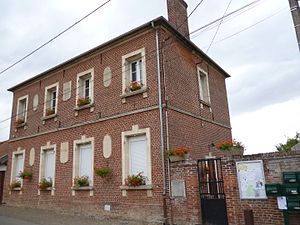
 Mairie Bucamps |
||
Bucamps is a French municipality with 188 inhabitants (at January 1, 2017) in Oise in the region of Hauts-de-France . The municipality is located in the Arrondissement of Clermont and is part of the Communauté de communes de l'Oise Picarde and the canton of Saint-Just-en-Chaussée .
geography
The center of the municipality (with the homestead La Corniole) is about ten kilometers south-east of Froissy on the plateau of the Picard plateau.
Toponymy and History
The municipality called 1075 Buschans took on the previously independent municipality Fresneaux in 1826.
Residents
| 1962 | 1968 | 1975 | 1982 | 1990 | 1999 | 2006 | 2011 |
|---|---|---|---|---|---|---|---|
| 121 | 112 | 76 | 78 | 117 | 128 | 148 | 168 |
Attractions
- Saint-Pierre church from the 18th and 19th centuries
Individual evidence
Web links
Commons : Bucamps - collection of images, videos and audio files

