Breuil-le-Sec
| Breuil-le-Sec | ||
|---|---|---|

|
|
|
| region | Hauts-de-France | |
| Department | Oise | |
| Arrondissement | Clermont | |
| Canton | Clermont | |
| Community association | Clermontois | |
| Coordinates | 49 ° 22 ′ N , 2 ° 27 ′ E | |
| height | 46–152 m | |
| surface | 8.89 km 2 | |
| Residents | 2,648 (January 1, 2017) | |
| Population density | 298 inhabitants / km 2 | |
| Post Code | 60840 | |
| INSEE code | 60106 | |
| Website | http://mairiebreuillesec.fr/ | |
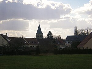
 View of Breuil-le-Sec |
||
Breuil-le-Sec is a French commune with 2,648 inhabitants (at January 1, 2017) in Oise in the region of Hauts-de-France . The municipality is located in the arrondissement of Clermont and is part of the Communauté de communes du Clermontois and the canton of Clermont .
geography
The commune, 27 kilometers from Beauvais , joins Clermont to the east , from which it is separated by the Brèche river , and is south-west of Breuil-le-Vert , south of Bailleval , east of Nointel , north of Erquery us Saint-Aubin-sous-Erquery and bounded to the north-west by Fitz-James . The national route 31, which is now an expressway, and the D61 département road following the Brèche valley to the south and the section from Rochy-Condé to Soissons, which is only used for freight transport on the section to Avrigny, run through the municipality . The former train station is now used for residential purposes. The municipality includes the districts of Autreville, Crapin, a hospital center on the outskirts of Fitz-James, an industrial area north of the former railway line, the Ferme des Sables farmstead in the north and the former mill Moulin de Bailly le Bel in the Brèche valley. The south-east of the municipality is a hilly forest area.
Toponymy and History
The place was named Bruolium siccum in 1240. The place name is of Celtic origin and means wet land.
In 51 BC Chr. Took Gaius Julius Caesar here the crossing of the vermoorte Brèche. Since 1659 the place belonged to the Margraviate Nointel, while Autreville paid homage to the rule Nointel. There was a permanent house in Bailly-le-Bel and Crapin had a priory. The no longer existing Ferme de Cercamp originally belonged to the Cercamp monastery . Viticulture has completely disappeared from the community. In 1870 Breuil was occupied by Prussian troops. In World War I French air force troops stationed here, including the fighter Georges Guynemer . During the Second World War , Breuil was damaged in two air raids.
| 1962 | 1968 | 1975 | 1982 | 1990 | 1999 | 2006 | 2012 |
|---|---|---|---|---|---|---|---|
| 2.168 | 2,200 | 2,321 | 2,421 | 2,416 | 2,055 | 2,303 | 2,463 |
economy
In Breuil-le-Sec, the company BASF has a plant that mainly produces vehicle paints (571 employees in 2013).
administration
Denis Dupuis ( PCF ) has been mayor ( maire ) since 2014 .
Partnerships
- Oppau (Germany), initiated by BASF since 1998
- Vila Franca das Naves (Portugal)
Attractions
See also: List of Monuments historiques in Breuil-le-Sec
- Château des Étournelles , 18th century castle with a vegetable garden, registered as a monument historique since 2004
- Excavated Roman fascine bridges on the municipal border to Breuil-le-Vert, Monument historique since 1936
- Saint-Martin church, the nave of which goes back to the Romanesque , burnt down in 1798 and rebuilt after 1850, modified.
- Saint-Arnoult chapel near Crapin
- War memorial, memorial stone for Guynemer, three calvaries
Personalities
- Georges Guynemer (1894–1917) was stationed with his squadron in Breuil-le-Sec.
Individual evidence
- ↑ http://www.basf.fr/ecp2/Societes_du_groupe/BASF_Coatings_Home
- ↑ Château des Etournelles in the Base Mérimée of the French Ministry of Culture (French)
- ↑ PA00114555 Ponts de Fascines in the Base Mérimée of the French Ministry of Culture (French)
- ↑ http://clochers.org/Fichiers_HTML/Accueil/Accueil_clochers/60/accueil_60106.htm


