Bacouël
| Bacouël | ||
|---|---|---|
|
|
||
| region | Hauts-de-France | |
| Department | Oise | |
| Arrondissement | Clermont | |
| Canton | Saint-Just-en-Chaussée | |
| Community association | Oise Picarde | |
| Coordinates | 49 ° 37 ' N , 2 ° 23' E | |
| height | 81-149 m | |
| surface | 5.48 km 2 | |
| Residents | 492 (January 1, 2017) | |
| Population density | 90 inhabitants / km 2 | |
| Post Code | 60120 | |
| INSEE code | 60039 | |
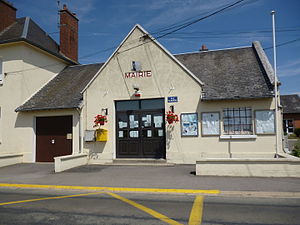
 Mairie Bacouël |
||
Bacouël is a French municipality with 492 inhabitants (at January 1, 2017) in Oise in the region of Hauts-de-France . It belongs to the Arrondissement of Clermont and Saint-Just-en-Chaussée . The residents call themselves Bacouëlois . Bacouël is a member of the Communauté de communes de l'Oise Picarde .
geography
Bacouël is about 30 kilometers south of Amiens . The neighboring municipalities are Tartigny in the north, Aulnay-l'Aître in the east, Soulanges in the south, Songy in the southwest and Saint-Martin-aux-Champs in the west. In Bacouël, the branch line to Breteuil branches off from the Paris – Lille line .
Population development
| 1962 | 1968 | 1975 | 1982 | 1990 | 1999 | 2005 | 2012 |
|---|---|---|---|---|---|---|---|
| 427 | 456 | 351 | 323 | 359 | 387 | 445 | 462 |
Attractions
- Saint-Éloi church from the 17th century (see also: List of Monuments historiques in Bacouël )
Web links
Commons : Bacouël - collection of images, videos and audio files


