Chapadão do Sul
| Chapadão do Sul | ||
|---|---|---|
|
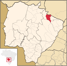
Coordinates: 18 ° 48 ′ S , 52 ° 37 ′ W Chapadão do Sul on the map of Mato Grosso do Sul
|
||
| Basic data | ||
| Country | Brazil | |
| State | Mato Grosso do Sul | |
| City foundation | October 23, 1987 | |
| Residents | 20,261 (2008) | |
| City insignia | ||
| Detailed data | ||
| surface | 3850 km 2 | |
| Population density | 5 people / km 2 | |
| height | 905 m | |
| City structure | 1 (Chapadão do Sul (Headquarters)) | |
| Waters | Rio Sucuriú , Rio Indaiá , Rio Aporé , Rio Paraíso | |
| Post Code | 79560-000 | |
| Time zone | UTC −4 | |
| City Presidency | Luiz Felipe Barreto de Magalhães (PT do B) (2013-2016) | |
| City patron | São Pedro Apóstolo | |
| Website | ||
Chapadão do Sul , officially Município de Chapadão do Sul , is a Brazilian city in the state of Mato Grosso do Sul in the Mesoregion East and Microregion Cassilandia . It is called the "state capital of quality of life".
geography
location
The city is 330 km from the state capital ( Campo Grande ) and 804 km from the federal capital ( Brasília ).
climate
The city is influenced by the tropical high altitude climate ( CWA ). The rainy season is in summer, winter is dry. The annual temperatures are between 13 and 28 ° C with an average rainfall of 1850 mm per year.
Waters
The city is located in the valley of the Río Paraná in the basin of the Río de la Plata . The Rio Sucuriú , Rio Indaiá , Rio Aporé and Rio Paraíso flow through the urban area.
vegetation
The area is part of the Cerrados (savannah of central Brazil).


