Amambai
| Município de Amambai "Campos de Vacaria"
Amambai
|
||
|---|---|---|
|
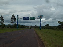
City entrance
|
||
|
|
||
| Coordinates | 23 ° 6 ′ S , 55 ° 14 ′ W | |
 Location of the Amambai municipality in Mato Grosso do Sul Location of the Amambai municipality in Mato Grosso do Sul
|
||
| Symbols | ||
|
||
| founding | September 28, 1948, January 1, 1949 emancipation |
|
| Basic data | ||
| Country | Brazil | |
| State | Mato Grosso do Sul | |
| ISO 3166-2 | BR-MS | |
| Região intermediária | Dourados (since 2017) | |
| Região imediata | Amambai (since 2017) | |
| height | 480 m | |
| climate | tropical Aw and subtropical Cfa | |
| surface | 4,202.3 km² | |
| Residents | 34,730 (2010) | |
| density | 8.3 Ew. / km² | |
| estimate | 39,396 (July 1, 2019) | |
| Parish code | IBGE : 5000609 | |
| Time zone | UTC −4 | |
| Website | amambai.ms (Brazilian Portuguese) | |
| politics | ||
| City Prefect | Edinaldo Luiz de Melo Bandeira (2017-2020) | |
| Political party | PSDB | |
| Culture | ||
| Patron saint | Mary, Help of Christians | |
| City festival | September 28 (foundation) | |
| economy | ||
| GDP | 877,582 thousand R $ 23,076 R $ per person (2016) |
|
| HDI | 0.673 (medium) (2010) | |
Amambai ( Amambaí , officially Portuguese Município de Amambai ) is a small town with a large municipality in the Brazilian state of Mato Grosso do Sul in the Greater Region Centro-Oeste . As of July 1, 2019, the population was estimated at 39,396 inhabitants, the Amambaiens ( Amambaienses ) are called and live on an area of around 4202 km² (density: 8 people / km²). The distance to the capital Campo Grande is 359 km. Amambai is near the border with Paraguay .
The gross domestic product (GDP) amounted to 2,016 thousand 877,582.23. Real . The GDP per capita was calculated at 23,076.05 real in 2016. In 2010, an HDI value of 0.673 was calculated for Amambai .
Web links
Commons : Amambai - collection of images, videos and audio files
- City Prefecture website , Prefeitura Municipal (Brazilian Portuguese)
- City Council website , Câmara Municipal (Brazilian Portuguese)
Individual evidence
- ↑ a b c Amambai - Panorama. Retrieved November 20, 2019 (Brazilian Portuguese).


