Cléguer
|
Cléguer Kleger |
||
|---|---|---|
|
|
||
| region | Brittany | |
| Department | Morbihan | |
| Arrondissement | Lorient | |
| Canton | Guidel | |
| Community association | Lorient agglomeration | |
| Coordinates | 47 ° 51 ′ N , 3 ° 23 ′ W | |
| height | 2-107 m | |
| surface | 32.15 km 2 | |
| Residents | 3,323 (January 1, 2017) | |
| Population density | 103 inhabitants / km 2 | |
| Post Code | 56620 | |
| INSEE code | 56040 | |
| Website | http://www.cleguer.fr/ | |
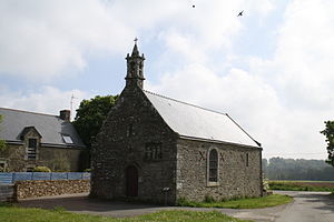
 Saint-Etienne chapel |
||
Cléguer ( Breton : Kleger ) is a French municipality with 3323 inhabitants (at January 1, 2017) in the department of Morbihan in the region of Brittany . It belongs to the arrondissement of Lorient , the canton of Guidel and is a member of the Lorient Agglomération community association . The inhabitants are called Cléguérois .
geography
Cléguer is bounded to the east by the Scorff River . Cléguer is surrounded by the neighboring communities of Plouay in the north, Calan in the east, Inzinzac-Lochrist in the southeast, Caudan in the south, Pont-Scorff in the southwest and Arzano in the west and northwest.
Population development
| year | 1962 | 1968 | 1975 | 1982 | 1990 | 1999 | 2006 | 2011 |
| Residents | 1.956 | 1,798 | 1,922 | 2,946 | 3,009 | 3,061 | 3,272 | 3,298 |
Attractions
- Saint-Gerand church
- Saint-Guénaël Chapel, a historic monument since 1973
- Saint-Etienne chapel
literature
- Le Patrimoine des Communes du Morbihan. Flohic Editions, Volume 2, Paris 1996, ISBN 2-84234-009-4 , pp. 758-763.
Web links
Commons : Cléguer - collection of images, videos and audio files

