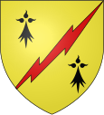
Landévant
|
Landévant Landevan |
||
|---|---|---|

|
|
|
| region | Brittany | |
| Department | Morbihan | |
| Arrondissement | Lorient | |
| Canton | Pluvigner | |
| Community association | Auray Quiberon Terre Atlantique | |
| Coordinates | 47 ° 46 ′ N , 3 ° 7 ′ W | |
| height | 0-80 m | |
| surface | 22.34 km 2 | |
| Residents | 3,810 (January 1, 2017) | |
| Population density | 171 inhabitants / km 2 | |
| Post Code | 56690 | |
| INSEE code | 56097 | |
| Website | http://www.landevant.fr/ | |
Landévant ( Breton: Landevan ) is a French municipality with 3810 inhabitants (as of January 1 2017) in the department of Morbihan in the region of Brittany . It belongs to the Arrondissement of Lorient and is part of the canton of Pluvigner . The inhabitants are called Landévantais .
geography
Landévant is located on the Étel River . Landévant is surrounded by the neighboring communities Languidic in the north and north-west, Pluvigner in the north and east, Landaul in the south and south-east and Nostang in the west and south-west.
The route nationale 165 (also E 60) and the Savenay – Landerneau railway run through the municipality .
Population development
| year | 1793 | 1846 | 1901 | 1931 | 1946 | 1962 | 1968 | 1975 | 1982 | 1990 | 1999 | 2006 | 2011 |
| Residents | 1,433 | 1,608 | 1,615 | 1,700 | 1,823 | 1,601 | 1,594 | 1,516 | 1,794 | 2,083 | 2.123 | 2.714 | 3,322 |
Swell:
Attractions
- Saint-Martin Church, built in 1834 on the site of the previous 15th century church
- Chapel de Locmaria-er-Hoët, monument historique since 1925
- Chapels of Sainte-Brigitte, Saint-Laurent and Saint-Nicolas
literature
- Le Patrimoine des Communes du Morbihan. Flohic Editions, Volume 2, Paris 1996, ISBN 2-84234-009-4 , pp. 709-713.
Web links
Commons : Landévant - collection of images, videos and audio files

