
Fiss
|
Fiss
|
||
|---|---|---|
| coat of arms | Austria map | |
 |
|
|
| Basic data | ||
| Country: | Austria | |
| State : | Tyrol | |
| Political District : | Landeck | |
| License plate : | LA | |
| Surface: | 37.68 km² | |
| Coordinates : | 47 ° 3 ' N , 10 ° 37' E | |
| Height : | 1438 m above sea level A. | |
| Residents : | 1,041 (January 1, 2020) | |
| Postal code : | 6533 | |
| Area code : | 05476 | |
| Community code : | 7 06 03 | |
| NUTS region | AT334 | |
| Address of the municipal administration: |
Via-Claudia-Augusta 35 6533 Fiss |
|
| Website: | ||
| politics | ||
| Mayor : | Markus Pale (Fiss municipal council list) | |
|
Municipal Council : (2016) (11 members) |
||
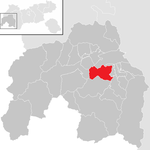
| Location of Fiss in the Landeck district | ||
  |
||
 Fiss in winter |
||
| Source: Municipal data from Statistics Austria | ||

Fiss is a municipality with 1041 inhabitants (as of January 1, 2020) in the Landeck district in the state of Tyrol ( Austria ) in the upper Tyrolean Inn Valley , also known as the Tyrolean Oberland .
According to the municipality, 945 main residences are registered, of which 488 are male and 457 are female (as of November 22, 2017).
geography
Fiss is located on the sun terrace about 500 m above the valley floor of the Upper Inn Valley , on a flat, south-facing slope. It counts to the upper court .
The municipal area of 3769 hectares comprises 6.7 hectares of settlements and 1084 hectares of forest areas, of which 934 hectares are protective forest and 150 hectares are commercial forest.
The Schönjoch ( 2,491 m above sea level ), the northwesternmost peak of the Samnaun group, rises above the village . Opposite the valley is the lower Glockturmkamm with the Pfroslkopf ( 3148 m above sea level ), and out of the valley the entrance to the Kaunertal valley and the Kaunergrat with the Aifnerspitze ( 2779 m above sea level ), both Ötztal Alps .
Geologically, the municipality of Fiss is very diverse and is located in the northeastern border region of the Engadine window in which especially the longitudinal Inn the Pennine ceiling has exposed the to the north of the mountain peaks of the tectonic ceiling of mica schist and sedimentary gneisses of the Eastern Alpine Altkristallins be covered .
Fiss is climatically in the zone of the continental inner Alps with low precipitation and fog frequency. With an annual average of over 2000 hours of sunshine , it is at the top of Central Europe.
Community structure
The community has only one cadastral community , locality and one counting district Fiss .
Districts are Fiss , Fisser Höfe , Kreuz , Plazör , Schöngamp , Telfeshof .
Neighboring communities
| Tobadill | Landeck ∗ | Flow |
| Kappl |
.svg)
|
Ladis |
| Serfaus | Ried in the Upper Inn Valley |
- ∗Landeck only borders the Gatschkopf at one point
history
The name Fiss itself is difficult to interpret, meanwhile the pre-Roman origin is considered certain. Therefore, original attempts at interpretation from Latin and Romansh are now considered outdated, according to the derivation from the Latin fossa "ditch" or fodia . The first written mention in a document of the Marienberg Abbey in 1288 names the place Fusse . A more recent hypothesis passes the name of the Eastern Alps-Indo-European * fussi (percussion, clear-cutting) from which extends over the alphabet Roman * FOSSI in MHG to feet and NHG in the local Bavarian developed -tirolischen embossing the present Fiss.
The first known settlement took place in the Bronze Age in the second millennium BC. By the Raetians . After the conquest by the Roman Empire in the 1st century BC BC Fiss was added to the province of Raetia and the population Romanized. In Roman times, went to the over the Reschenpass leading Via Claudia Augusta one of the most important Alpine passes with a side path across the plateau of Fiss. The construction of the first stone houses can be traced back to the Romans. The settlement took place as a typical Rhaeto-Romanic cluster village . From the sixth century, Bavarians , some of the Alemanni, and from around 1350 some colonists from the Valais moved in. As a result, the Rhaeto-Romanic that had prevailed until then was replaced by the southern Bavarian - Tyrolean dialect of Upper German with an Alemannic touch, which has been spoken to the present day .
The oldest preserved stone houses in the town center date from the 16th and 17th centuries.
In 1427 around 250 people were already living in Fiss, and in 1841 a high of 538 was recorded. The late 19th and early 20th centuries were characterized by emigration (to America, among others), so that the population fell to around 300. In 1928 Fiss was given an access road and in 1939/40 a material ropeway, previously there was only one cart path for carts of oxen.
Tourism began in Fiss after the Second World War. The character of the town center through narrow and winding streets with West Tyrolean farms was transformed by hotels and pensions as a result of the onset of tourism in the 1960s. A fire in the town center in 1972 also contributed to this.
politics
Serfaus was originally part of the Ried judicial district in Tyrol and became part of the Landeck judicial district after the Ried judicial district was dissolved in 1978 .
Community representation
- Fiss municipal council list : 8
- For Fiss : 3
Distribution of seats since the 2016 municipal council election:
- 67.59% - 8 mandates Fiss municipal council list
- 32.41% - 3 mandates for Fiss
Mayor is Markus Pale from the Fiss municipal council list.
coat of arms

|
|

|
| Serfaus –Fiss– Ladis , municipal coat of arms | ||
|
|
||
| Serfaus – Fiss – Ladis , tourist region | ||
- Shield quartered in black and gold , a sun in the upper right corner , two golden stalks of corn in the lower left corner .
The sun is the symbol for the sunny plateau on which the municipality of Fiss is located, the ears of wheat as a symbol for the high-alpine type of barley, imperial barley , which originated in Fiss.
Regional policy
The community is part of the Tyrolean Sun Terrace Planning Association and the Serfaus – Fiss – Ladis tourist region . The seat community of the planning association is Fiss, chairman of the mayor there. The tourist office is based in Serfaus ( Serfaus-Fiss-Ladis Information ; it also holds 80% of Serfaus-Fiss-Ladis Marketing GmbH).
Capital of the municipality
|
Fiss ( village ) district |
|
|---|---|
| Basic data | |
| Pole. District , state | Landeck , Tyrol |
| Pole. local community | Fiss ( KG Fiss ) |
| Locality | Fiss |
| Coordinates | 47 ° 3 ′ 21 " N , 10 ° 37 ′ 12" E |
| height | 1438 m above sea level A. |
| Building status | 240 (2001) |
| Statistical identification | |
| Counting district / district | Fiss (70603 000) |
 Fiss town center |
|
| Source: STAT : index of places ; BEV : GEONAM ; TIRIS | |
The main town of the municipality is the village of Fiss (nominal municipality capital is the entire municipality of the name). Fiss lies in the valley above Ried . The valley shoulder of the sun terrace breaks off suddenly south of the Fraunstobel of the Beutelsbach . The place is directly above the Serfauser Landesstraße L 19.
The settlement covers a little more than one kilometer at altitudes between about 1400- 1500 m above sea level. A. (the village church is 1438 m above sea level ), and thus significantly higher than the neighboring town of Ladis to the north , but about the same height as Serfaus . Almost the entire population of the municipality lives in the village.
- Neighboring places
|
Samnaun (Gem. Fiss and Serfaus ) ∗ |
Overwater (Gem. Ladis ) | |
|
|
Fisser Höfe | |
|
Serfaus (municipality of Serfaus ) |
Feld (district of Serfaus ) | Telfeshof |
- ∗ The scattered houses of the ski area
Economy and Infrastructure
traffic
The Serfauser Landesstraße L 19 comes up serpentine from Ried in the Oberinntal via Telfeshof and then leads the Beutelsbach out to Serfaus . Ladiser Straße L 286 branches off at the Fisser Höfe .
tourism
Fiss is part of the Serfaus-Fiss-Ladis ski region and offers numerous cross-country trails and ski slopes in winter. The region also has an extensive network of hiking trails and mountain huts.
The Fiss Summer Fun Park has existed since summer 2005 . The main attractions are the Fisser Flitzer summer toboggan run , the Fisser Flieger attractions and the Skyswing giant swing and, since summer 2008, the summer snow world .
Culture and sights

- Parish church of St. John the Baptist with cemetery with chapel for the dead and war memorial chapel
- four village wells
- Gande natural monument
- The Blochziehen in Fiss is an old carnival tradition. The custom is listed on the Austria list for intangible cultural heritage (national cultural property) of UNESCO.
Web links
- 70603 - Fiss. Community data, Statistics Austria .
- Community website
- Entry on Fiss in the Austria Forum (in the AEIOU Austria Lexicon )
- Fiss , in the history database ofthe association "fontes historiae - sources of history"
Individual evidence
- ↑ a b c Information as of November 22, 2017 from the municipality's own homepage [1] , accessed on February 28, 2019
- ↑ a b municipal coat of arms, fiss.tirol.gv.at
- ^ History-Tyrol: Fiss .
- ↑ History fiss.tirol.gv.at,
- ↑ Election results: Mayor and municipal council elections 2016 , fiss.tirol.gv.at, accessed on February 28, 2016
-
↑ Imprint , serfaus-fiss-ladis.at;
Serfaus-Fiss-Ladis Marketing GmbH in Serfaus . Commercial register data Creditreform / firmenabc.at - ↑ Gande natural monument near Fiss , State of Tyrol
Flags | Fendels | Fiss | Flow | Flirsch | Galtür | Grin | Ischgl | Kappl | Kaunerberg | Kaunertal | Kauns | Ladis | Landeck | Nauders | Pettneu am Arlberg | Pfunds | Pians | Prutz | Ried im Oberinntal | St. Anton am Arlberg | Schönwies | Lake | Serfaus | Spiss | Punching at Landeck | Strict | Tobadill | Tosses | Zams
Cadastral municipality and locality: Fiss
Parts of the municipality (municipality structure) : Fiss | Fisser Höfe | Cross | Plazor | Schöngamp | Telfeshof
Village: Fiss | Hamlet: Telfes Höfe | Settlement: Fisser Höfe | Scattered houses: Samnaun | Other locations: Möseralm • Schönjöchl
Counting district: Fiss