Bremgarten airfield
| Bremgarten airfield | |
|---|---|

|
|
| Characteristics | |
| ICAO code | EDTG |
| Coordinates | |
| Height above MSL | 212 m (696 ft ) |
| Transport links | |
| Distance from the city center | 4 km south of Hartheim am Rhein |
| Street | B 3 |
| Basic data | |
| opening | 1954 (asphalt track) |
| operator | Business park Breisgau GmbH |
| Flight movements |
45,000 (2011) |
| Runways | |
| 05/23 | 1650 m × 45 m asphalt |
| 05/23 | 600 m × 30 m grass |
The airfield Bremgarten is a special airfield and former military airfield on the territory of the municipalities of Hartheim -Bremgarten and Eschbach in Württemberg Baden- region Breisgau . It is used by the Sportfluggruppe Immelmann and some companies that are active in the aviation industry. On the site of the former military base, the Breisgau intermunicipal industrial park, whose operating company also maintains the airport. In 2011 the airfield recorded around 45,000 aircraft movements.
history
BA.136 Bremgarten
In 1950, NATO decided to build a base for the French Armée de l'air southwest of Freiburg i. Br. In the immediate vicinity of the Bremgarten community. Work began in 1952. At that time, the Söllingen and Lahr military airfields were being built further north in the Baden Rhine plain . The name of the local airfield was given by the then independent municipality of Bremgarten, because the construction management was based there. Most of the buildings were built on the parish of the municipality of Eschbach, which became a garrison municipality. The infrastructure was completed in early 1954.

On March 31, the base aérienne Tactique 136 (BAT.136) moved from Friedrichshafen to the new location near the Rhine border with France. It initially served as the base of the 4e demi-brigade de chasse, a fighter pilot association that was equipped with the Dassault Ouragan . Later the Republic F-84 was flown .
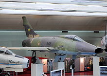
On July 1, 1961, after the 4th Half Brigade had left the Breisgau in the previous month , the airfield was renamed Base aérienne d'Opération 136 (BAO.136). Bremgarten became home to the 11e Escadre de chasse, another hunting association equipped with the F-100D / F Super Saber .
As early as 1963, the place was given the more general name Base aérienne 136, and on September 1, 1964, the base was also home to the Sikorsky H-34 A of the L'Escadron d'Hélicoptères 1/67, previously known as L'Escadron d'Hélicoptères Lourds 3/23 in neighboring Lahr. The season was disbanded on March 1, 1966.
After France announced its withdrawal from the military structures of NATO, the Armée de l'air withdrew completely from Germany. The 11e EC laid end September 1967 to Toul-Rosières , one, previously from the Air Base USAFE had been used and was henceforth also called BA.136.
Until it was handed over to the Bundeswehr on May 1, 1968 , the FFA designated the site as Base aérienne et Moyens de Support et de Soutien 178 (BMSS.178).
Bremgarten Air Base
Shortly after the transfer of the airport to the Air Force an advance team of the hit on May 20, 1968 Reconnaissance Wing 51 (AG 51) that the flying association which until the closing of the air base should be at home here. The relocation was completed the following year.
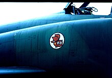
The Immelmänner, the nickname based on the unit's official nickname, first flew the RF-104G Starfighter . In early 1971 the first RF-4E Phantom II arrived, the type of aircraft that from then on dominated the scene in Bremgarten for two decades. The (old) AG 51 was dissolved on March 31, 1993 after the fall of the Berlin Wall . The Franco-German Brigade used large parts of the area until the end of 1995, and since then the shooting range and a training area in the south-western area have been used for military purposes.
Civil conversion
On October 1, 1994, twelve local authorities founded the Zweckverband Gewerbepark Breisgau. In addition to the communities of Hartheim and Eschbach and the towns of Heitersheim and Neuenburg am Rhein , which are also affected by smaller municipal areas , the city of Freiburg, the district of Breisgau-Hochschwarzwald and other district communities are involved. Business park Breisgau GmbH, founded by the Zweckverband and in which regional credit institutions are also involved , has been running the operational business since January 1st, 1998 . The special landing site has existed since June 6, 1997. The ICAO code of the airfield was changed from EDSG to EDTG after the air base was closed and the runway used was shortened by over 1000 meters.
Protected areas
As early as 1992, studies were carried out on vegetation, butterflies , grasshoppers and bird life on behalf of the Freiburg Regional Office for Nature Conservation and Landscape Management in order to determine the importance of the meadow areas in the area of the runway.
The meadows examined contained over 270 plant species, 18 of which were on the Red List. These included winged gorse , donkey thistle and medicinal thyme . Of the 21 species of grasshopper found, the following seven species were on the Red List: Green Strandschrecke , European praying mantis , Blue-winged sandhopper , Wine-cockerel , Blue-winged barren insect , Western bitter insect and meadow grasshopper . In 1993, some specimens of the brown-spotted snake were caught in the vicinity of the airfield. This search was triggered by sightings of the species believed to be extinct in Germany at the Müllheim military training area and the Freiburg airfield .
Five of the 44 butterfly species discovered belonged to Baden-Württemberg's protection program for butterfly protection areas . These were blue eyes , white forest porter , small mother-of-pearl butterfly , short-tailed blue- eyed and mallow-thick-headed butterfly .
90 species of birds were spotted, 41 of which were on the Baden-Württemberg Red List. Among them was the curlew , for whom the airfield was the only breeding ground in the Markgräflerland. In addition, were Quail , Skylark , Nightingale , Stonechat , Melodious Warbler , Rook , Corn Bunting and whinchat registered. For the latter, which is endangered in Baden-Württemberg, the airfield was the only known breeding site in the southern Upper Rhine Plain on the right bank of the Rhine.
In the spring of 1994 it became known that runways and taxiways had been leased to Daimler-Benz and were already being used for test drives by commercial vehicles and were to continue to be used. As a result, on March 4, 1994, the nature conservation associations submitted an application for designation as a nature reserve for the entire western sub-area and the gravel pit.
At the beginning of 1999, several areas in the area of the airport were declared nature and landscape protection areas. In addition to the districts of Bremgarten-Hartheim and Eschbach, the two cities of Heitersheim and Neuchâtel were also affected. This total of 276 hectares is divided into around 109 hectares for the nature reserve and 158 hectares for the nature reserve.
Nature reserve
The nature reserve consists of two sub-areas: One comprises essential parts of the meadow areas northwest of the parallel taxiway including the runway, the parallel taxiway and the connecting paths leading to the runway (northeast, north and east) up to district road 4998 (in the southwest) , the edges of the two forests used by the military and the "Ringstrasse" (north-west).
The second sub-area is formed by the former gravel pit, which is located in the south of the Breisgau industrial park. Its borders are around 40 m away from Max ‑ Immelmann ‑ Allee, along the upper eastern edge of the gravel pit and at the foot of the K 4998 (south).
The nature reserve serves the preservation and development of the last larger contiguous meadow area in the Upper Rhine Plain south of the Kaiserstuhl with occurrences of poor grass , smooth oat meadows , pioneer lawns and largely open gravel areas as a habitat for numerous rare, sometimes highly endangered or strictly protected animal and plant species. In addition, the habitat created by natural succession in the abandoned gravel pit and in which numerous rare and endangered animal and plant species occur is to be preserved. Meadow breeder and insect communities should also be protected through extensive use of grassland.
Landscape protection area
The landscape protection area connects directly to the nature reserve in the north, east and south-east and is bounded by the »Ringstrasse« in the north-east of the airfield as well as by the former access road along the airfield on the edge of the business park and the K 4998 pedestrian and cycle path in the south-west . It consists of the meadow areas east of the parallel taxiway along the airfield and other agricultural areas in the north and northwest of the airfield as well as the northern wood.
It is closely related to the animal species resident in the nature reserve and is intended to preserve agriculturally used areas that they use for foraging. The grove, which some of them serve as part of their habitat, should also be preserved. In general, the nature reserve serves to secure the nature reserve and should enable its implementation.
In the landscape conservation area itself, some meadow bird species use the agriculturally used areas as breeding grounds. The grove is also to be preserved for animal and plant species that live in the forest and edge of the forest.
Proper agricultural and forestry land use and proper hunting are permitted in the landscape protection area under certain conditions.
literature
- Hans Redemann, Peter Doll: The flying formations of the air force, 1956–1982 . Motorbuch Verlag, Stuttgart 1983, ISBN 3-87943-918-4 .
- Christian Nachbauer, Dominique Vivier (ed.): La force aerienne tactique: 1965–1994: du 1st Commandement aérien tactique au Commandement de la force aérienne de combat . Association Point fixe, Dingsheim, Bas-Rhin 1998, ISBN 2-9506692-4-7 .
- Reflets. The magazine of the base aérienne 136th (1965–1998).
- Gérard Bize: La base aérienne 136 Toul-Rosières, du Zénit au Nadir.
Web links
- Bremgarten Airport EDTG
- Traditional Association of Reconnaissance Squadron 51 "Immelmann" Bremgarten e. V.
Individual evidence
- ↑ a b Ingeborg Grziwa: More and more traders are taking off. In: Badische Zeitung . April 18, 2012, accessed May 22, 2013.
- ^ Citizens' information on the business location of the Breisgau industrial park. A + K Verlag, Gottenheim 2010, p. 34 ( gemeinde-eschbach.de [PDF; 10.8 MB]).
- ^ Citizens' information on the business location of the Breisgau industrial park. A + K Verlag, Gottenheim 2010, pp. 26, 34 ( gemeinde-eschbach.de [PDF; 10.8 MB]).
- ^ Citizens' information on the business location of the Breisgau industrial park. A + K Verlag, Gottenheim 2010, p. 28 ( gemeinde-eschbach.de [PDF; 10.8 MB]).
- ↑ a b c d e Franz Schneider: Valuable meadows in the former “Bremgarten” airfield must become a nature reserve. In: Nature conservation on the southern Upper Rhine. Volume 1 (1995), Issue 1, ISSN 0949-5355 , pp. 59-69 ( fosor.de [PDF; 943 kB]).
- ↑ a b c 3.250 Bremgarten Airport. In: lubw.baden-wuerttemberg.de, January 7, 1999, accessed on August 14, 2013.


