
Pforzen
| coat of arms | Germany map | |
|---|---|---|

|
Coordinates: 47 ° 56 ' N , 10 ° 37' E |
|
| Basic data | ||
| State : | Bavaria | |
| Administrative region : | Swabia | |
| County : | Ostallgäu | |
| Management Community : | Pforzen | |
| Height : | 656 m above sea level NHN | |
| Area : | 23.7 km 2 | |
| Residents: | 2321 (Dec. 31, 2019) | |
| Population density : | 98 inhabitants per km 2 | |
| Postal code : | 87666 | |
| Area code : | 08346 | |
| License plate : | OAL, FÜS, MOD | |
| Community key : | 09 7 77 158 | |
| LOCODE : | DE PZY | |
| Community structure: | 5 parts of the community | |
| Address of the municipal administration: |
Bahnhofstrasse 7 87666 Pforzen |
|
| Website : | ||
| Mayor : | Herbert Hofer ( CSU / Free Voting Association ) | |
| Location of the municipality of Pforzen in the Ostallgäu district | ||
  |
||

Pforzen is a municipality in the Swabian district of Ostallgäu and the seat of the Pforzen administrative community .
The name of the community goes back to the name Forzheim (presumably 'Heim an der Furt'), the spelling of which has changed several times over the years. It has been documented in its current form since 1481.
geography
Geographical location
Pforzen lies on the edge of the Allgäu on both sides of the river on the middle Wertach .
Neighboring communities
The municipality borders in turn in the north and northeast on the town of Bad Wörishofen in the neighboring district of Unterallgäu , in the northeast on the municipality of Rieden , in the east on the municipality of Germaringen , in the southeast on the independent city of Kaufbeuren , in the southwest on the market town of Irsee and in the west and northwest to the municipality of Baisweil .
Community structure
Pforzen includes the two districts Ingenried on the plateau to the left above the Wertach and Pforzen with the community's share of the valley level, which extends mainly to the right of the river to the east.
The municipality has 5 officially named parts of the municipality (the type of settlement and the district affiliation are given in brackets ):
- Hammerschmiede ( village , to Pforzen)
- Ingenried ( Pfarrdorf , to Ingenried)
- Irpisdorf (village, to Ingenried)
- Leinau (village, to Pforzen)
- Pforzen (parish village, to Pforzen)
history


Until the church is planted
In 1992 burials from the Bronze Age Barrows (around 1500 BC) were found. The excavations are of high scientific value and in this form unique in the Allgäu. At Pforzen, a silver belt buckle was found in an Alemannic grave from the late 6th century , the inscription of which represents one of the oldest alliance rhymes in a West Germanic language .
Pforzen belonged to the Irsee Imperial Abbey . Since the Reichsdeputationshauptschluss of 1803 the place belongs to Bavaria. In the course of the administrative reforms in the Kingdom of Bavaria , today's municipality was created with the municipal edict of 1818 .

19th century
On September 1, 1847, the Kaufbeuren - Augsburg section of the Royal Bavarian Ludwig-Süd-Nord-Bahn was opened and Pforzen received a rail connection. The associated Pforzen station on the Munich – Lindau railway line is in today's Zellerberg , but has been closed.
21st century
During excavations between 2001 and 2018, fossils of the extinct primate genus Danuvius were found in the clay pit "Hammerschmiede" and the research results were published in 2019 by paleontologist Madelaine Böhme , University of Tübingen. The fossil got the nickname "Udo" because it was found around the 70th birthday of Udo Lindenberg in 2016, when his songs were on the radio (a parallel to " Lucy ").
Incorporations
On July 1, 1971, the previously independent community of Ingenried was incorporated.
Population development
| year | 1840 | 1871 | 1900 | 1939 | 1950 | 1961 | 1970 | 1987 | 1991 | 1995 | 2000 | 2005 | 2010 | 2015 |
| Residents | 749 | 817 | 1090 | 1143 | 1816 | 1484 | 1499 | 1714 | 1695 | 1868 | 1991 | 2113 | 2124 | 2216 |
Pforzen grew by 451 inhabitants or by approx. 27% from 1988 to 2008. Between 1988 and 2018 the municipality grew from 1675 to 2321 by 646 inhabitants or by 38.6%.
politics
City council and mayor
The election on March 15, 2020 with a voter turnout of 64.80% resulted in the following distribution of seats:
| list | Share of votes | Seats |
| CSU and Free Voting Community Pforzen | 56.36% | 8 seats |
| SPD and Free Voter Association Pforzen | 13.81% | 2 seats |
| Independent list of Pforzen | 29.83% | 4 seats |
Herbert Hofer (CSU / Free Voting Association) has been mayor since May 1, 2014. He was re-elected on March 15, 2020 with 79.25% of the vote.
coat of arms
Description : Divided by silver and blue; above a red double jumper with a red arrow underneath it at the foot, below a striding golden deer.
The content of the coat of arms and its meaning: The double knight is taken from the coat of arms of the Lords of Pforzen, who were mentioned as early as the 12th century and whose ownership came to the Irsee Monastery after their extinction in the 14th century. On Ingenried, which is incorporated into Pforzen, and its Sebastian Chapel, the arrow is said to be an attribute of St. Point out Sebastian. In the lower part of the municipal coat of arms, another noble family, the Leinauer, known since the 12th century, was taken into account. They had their headquarters in Leinau in the municipality and featured a striding stag in their coat of arms.
Architectural monuments
Economy and Infrastructure
economy
In 2010 there were 4 employees in agriculture and forestry, 156 in manufacturing and 51 in trade and transport at the place of work. In other economic areas, 59 people were employed at the place of work subject to social security contributions. There were a total of 781 employees at the place of residence subject to social security contributions. In the manufacturing industry (as well as mining and quarrying of stones and earth) there were none, in the construction industry there were 6 companies. In addition, there were 40 farms with an agricultural area of at least 2 hectares, which farmed a total of 1299 hectares. Of this, 427 hectares were arable land and 873 hectares were permanent green space.
education
The following educational institutions existed in 2011:
- A kindergarten with 100 kindergarten places, in which 87 children are looked after by 12 teachers
- An elementary school in which 12 teachers in 8 classes taught 160 students (school year 2010/11)

Hammer forge

Ingenried near Pforzen

Ingenrieder Weiher
Leinau

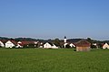
Pforzen from the west


Personalities
- Karl Linder (1849–1905), brewery owner in Leinau and member of the Reichstag
- Adolf Eberle (1886–1976), Professor Dr. phil., Dr. theol., Monsignore, Episcopal-Spiritual Council, 1931–1947 Rector of the Philosophical-Theological University in Dillingen
Web links
- Pforzen website
- Entry on the coat of arms of Pforzen in the database of the House of Bavarian History
- Pforzen: Official statistics of the LfStat (PDF; 1.05 MB)
- Archaeological Tour Wertachtal (PDF) Time travel by bike
Individual evidence
- ↑ "Data 2" sheet, Statistical Report A1200C 202041 Population of the municipalities, districts and administrative districts 1st quarter 2020 (population based on the 2011 census) ( help ).
- ^ Chronicle of the community of Pforzen . Website of the municipality of Pforzen. Retrieved December 28, 2010.
- ↑ Pforzen community in the local database of the Bavarian State Library Online . Bayerische Staatsbibliothek, accessed on August 17, 2019.
- ^ Wilhelm Volkert (ed.): Handbook of Bavarian offices, communities and courts 1799–1980 . CH Beck, Munich 1983, ISBN 3-406-09669-7 , p. 492 .

Aitrang | Baisweil | Bidingen | Biessenhofen | Buchloe | Eggenthal | Eisenberg | Friesenried | Feet | Germaringen | Görisried | Günzach | Halbch | Hopferau | Irsee | Jengen | Kaltental | Kraftisried | Lamerdingen | Lechbruck am See | Lengenwang | Marktoberdorf | Mauerstetten | Nesselwang | Obergünzburg | Oberostendorf | Osterzell | Pforzen | Pfronten | Rettenbach am Auerberg | Vineyards | Vineyards on the Forggensee | Ronsberg | Roßhaupten | Backwood | Ruderatshofen | Schwangau | Seeg | Stötten am Auerberg | Stöttwang | Unterthingau | Untrasried | Waal | Forest | Westendorf