Pernegg on the Mur
|
Pernegg on the Mur
|
||
|---|---|---|
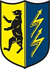
| coat of arms | Austria map | |
|
|
||
| Basic data | ||
| Country: | Austria | |
| State : | Styria | |
| Political District : | Bruck-Mürzzuschlag | |
| License plate : | BM | |
| Surface: | 86.01 km² | |
| Coordinates : | 47 ° 22 ' N , 15 ° 21' E | |
| Height : | 458 m above sea level A. | |
| Residents : | 2,364 (Jan 1, 2020) | |
| Postal code : | 8132 | |
| Area code : | 03867 | |
| Community code : | 6 21 25 | |
| NUTS region | AT223 | |
| UN / LOCODE | AT PGM | |
| Address of the municipal administration: |
Kirchdorf 16 8132 Pernegg an der Mur |
|
| Website: | ||
| politics | ||
| Mayoress : | Eva Schmidinger ( ÖVP ) | |
|
Municipal Council : (2020) (15 members) |
||
| Location of Pernegg an der Mur in the Bruck-Mürzzuschlag district | ||
 View of Pernegg from the Kirchdorf district opposite |
||
| Source: Municipal data from Statistics Austria | ||
Pernegg an der Mur is a municipality with 2364 inhabitants (as of January 1, 2020) in the judicial district of Bruck an der Mur and in the political district of Bruck-Mürzzuschlag in Styria .
The name Pernegg , formerly Bereneck, refers to the castle of the same name, which was built around 1100 by the knight Bero .
geography
Pernegg is located in the Middle Mur Valley south of the town of Bruck an der Mur .
The community is divided into seven cadastral communities (area as of 2015 :):
- Gabraun (2,028.56 ha)
- Kirchdorf (237.17 ha)
- Mixnitz (1,466.00 ha)
- Pernegg (423.68 ha)
- Roßgraben (939.50 ha)
- Traföß (1,303.46 ha)
- Zlatten (2,199.69 ha)
The municipal area comprises the following eight localities (population in brackets as of January 1, 2020):
- Gabraun (85)
- Kirchdorf (515)
- Toll station (221)
- Mixnitz (323)
- Pernegg (723)
- Roßgraben (46)
- Trafoss (79)
- Zlatten (372)
In the area of the cadastral community of Mixnitz there are two popular climbing mountains, the Rote Wand ( 1505 m ) and the Röthelstein ( 1263 m ). The highest peak in the Grazer Bergland , the Hochlantsch ( 1720 m ), is already outside the municipal area.
economy
With the construction of a run-of-river power plant by Steirische-Elektrizitätswerke-Aktiengesellschaft STEWEAG from 1925, the Pernegg power plant , Pernegg became a location for the energy industry. An oil-fired steam power plant on the left bank of the Mur, completed in 1958, ended normal operation in the 1990s and was dismantled in 2006.
Pernegg is mainly a commuter community .
politics
Pernegg an der Mur was ruled by the Social Democratic Group from 1945 to 2015. In the 2015 municipal council elections, the ÖVP achieved a relative majority under its top candidate Eva Schmidinger with 6 seats. ÖVP and ALP have formed a coalition since then. The SPÖ lost three (from eleven to eight) mandates in the 2010 municipal council elections (top candidate Irmgard Hagenauer), and another three mandates in the 2015 elections (top candidate again Irmgard Hagenauer) and now holds 5 mandates.
The following table shows the composition of the municipal council in 2010 and 2015.
| Political party | Mandates 2015 | Mandates 2010 |
|---|---|---|
| SPÖ | 5 | 8th |
| ÖVP | 6th | 3 |
| FPÖ | 1 | 0 |
| Alternative Pernegg worth living in | 3 | 4th |
| List Josef Rieger | 0 | 0 |
| BZÖ | not started | 0 |
| voter turnout | 82.98% | 85.92% |
Tourism association
Together with Fladnitz an der Teichalm, Gasen, Passail, Breitenau am Hochlantsch and St. Kathrein am Offenegg, the municipality forms the " Naturpark Almenland Teichalm-Sommeralm " tourism association . Its seat is in Fladnitz an der Teichalm.
traffic
train
Pernegg lies on the Austrian Southern Railway , to which it was connected in 1844. The train stations Pernegg (modernized in 2009) and Mixnitz-Bärenschützklamm are located in the municipality , from where the express train S1 runs every hour in the direction of Mürzzuschlag via Bruck an der Mur and Spielfeld-Straß via Graz . There is a half-hourly service at rush hour.
The electrified, narrow-gauge Breitenauerbahn runs from Mixnitz station to St. Erhard. As planned, it is only used by freight trains, but special tourist trains are also run on this interesting route several times a year.
Street
The most important road connection is the Bruck expressway S 35 , which follows the Mur valley, from Bruck an der Mur to Graz . The four-lane full expansion has been open to traffic since May 2010. Since the route has been running through the Kirchdorf Tunnel since then , the noise pollution along the old B 335 passage has been reduced by almost 90%, which has enormously increased the quality of life for the residents. The place is well connected to the high-ranking road network through the semi-junction Pernegg (only possible exit from the direction of Bruck) and the full junction Mixnitz.
Town twinning
-
 Winhöring , Altötting district, Upper Bavaria , since 2003
Culture and sights
- Pernegg Castle , first mentioned in a document in 1143, is located above the left bank of the Mur, today only exists as a ruin. In the course of the construction of the castle, the castle was used as a quarry.
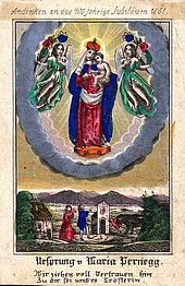
- Pernegger Marienkirche , the pilgrimage church also called Frauenkirche , was built between 1448 and 1461 at the foot of the castle - in place of a previous building built from 1439. From 1774 to 1775 the interior was redesigned in the Baroque style, with wall paintings by Joseph Adam Ritter von Mölk .
- Pernegg Castle , built between 1578 and 1582. Square building in Renaissance style with a three-storey arcade courtyard, whereby the palace architecture evokes echoes of the courtyard of the Graz country house . Pernegg Castle is located above the Frauenkirche.
- Drachenhöhle near Mixnitz , known as a Paleolithic site, is associated with the people of the Aurignacia . The eponymous legend of the Mixnitz dragon slayer probably goes back to the bones of cave bears found in the cave earlier . In the early 1920s, the cave also gained economic importance for the community through phosphate mining .
- Bärenschützklamm , a water-bearing rock gorge , has been accessible since 1901 using wooden ladders.
- Pernegg run-of-river power station , listed technical facilities from the 1920s.
- Maximiliankirche, located in the district of Kirchdorf and first mentioned in a document in 1130; the mainly late Gothic complex includes a Romanesque nave and a mighty Gothic defense tower ; the interior is late baroque , except for a neo-Gothic side altar from 1920 and interior design () by Richard Kriesche from 1992.
Personalities
Sons and daughters of the church
- Rudolf Stöger-Steiner von Steinstätten (1861–1921), officer, minister
- Karl Ahorner (1889–1949), politician of the NSDAP
- Franz Pühringer (1906–1977), journalist, poet, playwright
- Manfred Rumpl (* 1960), writer
- Ingrid Kaiserfeld (* 1961), opera singer
Personalities associated with Pernegg an der Mur
- Hermann Geißler (1920–2001), politician of the ÖVP , member of the National Council 1957–1970
- Franz Xaver Lössl (1801–1885), architect
- Sepp Maier (* 1939), local poet
- Viktor Pratl (1896–1960), SDAP politician , member of the Burgenland Landtag 1922–1923
Web links
- 62125 - Pernegg on the Mur. Community data, Statistics Austria .
- Entry on Pernegg an der Mur in the Austria Forum (in the AEIOU Austria Lexicon )
- Werner Moritz: Municipality of Pernegg an der Mur. In: pernegg.at. November 14, 2018, accessed November 11, 2018 .
Individual evidence
- ↑ cadastral communities Styria. 2015 (Excel file, 128 kB); Retrieved July 29, 2015
- ↑ Statistics Austria: Population on January 1st, 2020 by locality (area status on January 1st, 2020) , ( CSV )
- ↑ https://egov.stmk.gv.at/wahlen/GR2015/GR2015_62100.html
- ^ Grazer Zeitung , Official Gazette for Styria. December 30, 2014, 210th year, 52nd piece. No. 313. ZDB -ID 1291268-2 p. 628.
- ^ S35 Brucker Schnellstraße ( memento from October 30, 2007 in the Internet Archive ) of ASFINAG on the north section of the expansion of the S35
- ^ Website on the founding legend of the pilgrimage
- ↑ Building description of Pernegg Castle , burgseite.com
- ↑ Frauenkirche ( Memento from May 2, 2015 in the Internet Archive )
- ↑ On the history of the pilgrimage church
- ^ The fortified church in Kirchdorf. Retrieved March 9, 2020 .
- ↑ The Maximilian Church in Kirchdorf. In: pernegg.at. Retrieved March 9, 2020 (archive.org (September 21, 2008)).


