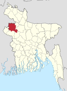
Naogaon (District)
Naogaon ( Bengali : নওগাঁ জেলা) is a district in Rajshahi . In the capital of the district forms the homonymous city Naogaon . The total area of the district is 3435.65 km². The district is composed of 11 Upazilas . Naogaon was founded as a district on 1984. In the district are the archaeological site Paharpur that since 1985 the UNESCO - World Heritage belongs.
Naogaon is bounded to the northwest by India , to the east by Jaipurhat and Bogra , to the south by Natore and Rajshahi and to the west by Nawabganj . The district has 2,600,157 inhabitants (2011 census). Muslims made up 86.55% of the population, Hindus 11.07%, Christians 0.71% and others 1.66%. Nagaon district had a literacy rate of 48.22% for the population aged 7 and over in 2011, after 44.39% in 2001 and 28.40% in 1991. Nagaon recorded a growth rate of 8 in the period from 2001 to 2011, 73% after 11.33% in the decade 1991 to 2001.
The climate is tropical and warm all year round. The annual average temperature of this district varies from a maximum of 37.8 degrees Celsius to a minimum of 11.2 degrees. The annual rainfall is 1862 mm (2011) and the humidity is high all year round.
The economy of the district is dominated by agriculture . The district is one of the country's granaries and around 80% of the area is used for agriculture. According to the 2011 census, 73.4% of the workforce works in agriculture, 21.8% in the service sector (mostly in informal settings) and 4.8% in industry .
Individual evidence
- ↑ a b c District Statistics 2011 Naogaon. Retrieved August 3, 2019 .
- ^ Naogaon (District (Zila), Bangladesh) - Population Statistics, Charts, Map and Location. Retrieved August 4, 2019 .
