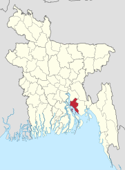
Lakshmipur (District)
| Lakshmipur District | |
|---|---|
 |
|
| Basic data | |
| Country | Bangladesh |
| division | Chittagong |
| Seat | Lakshmipur |
| surface | 1,440.4 km² |
| Residents | 1,729,188 (2011) |
| density | 1200 inhabitants per km² |
| ISO 3166-2 | BD-31 |
| Website | www.lakshmipur.gov.bd |
Coordinates: 22 ° 57 ' N , 90 ° 50' E
Lakshmipur ( Bengali : লক্ষ্মীপুর জেলা , Lakṣmīpur jelā ) is an administrative district in southeastern Bangladesh , which lies within the Chittagong Division , the superordinate administrative unit.
geography
The 1440.39 km² area is bordered by the Chandpur district to the north, Noakhali to the east, the Bhola and Noakhali districts to the south and the Barishal and Bhola districts and the Meghna river to the west .
The largest rivers are Meghna , Dakatia , Katakhali , Rahmatkhali and Bhulua .
Nature and wildlife
The vegetation corresponds to that of the entire lower reaches of the Ganges and the Ganges delta with numerous evergreen trees. There are also fruit trees, palms and banana trees.
Wildlife includes jackals, foxes, the Bengal mongoose , civets , squirrels and bats. There are also numerous species of birds, fish, reptiles, numerous species of snakes and amphibians.
climate
The climate is subtropical and the temperatures fluctuate between 14.4 ° C and 34.3 ° Celsius. The average annual rainfall is 3302 mm. The average humidity is usually more than 70%. There is little rain in the months from November to March. June, July and August are the months with the most rain.
Due to its location, the area is repeatedly hit by cyclones, floods and tidal waves.
history
Until the 8th century, the region belonged to the Kingdom of Pundra (Pundravardhana). At the beginning of the 13th century, the area of today's Lakshmipur also belonged to the kingdom of Bhulua . In 1279 the Sultanate of Delhi attacked the area and in 1353 the area was conquered by the Sultanate of Bengal . The majority of the population converted from the previously dominant Buddhism to (Sufi) Islam during the time of the Sultanate. This sultanate and the subsequent Mughal Empire fought with the Arakan Empire for supremacy for centuries. Despite the support of Portuguese mercenaries, the Arakanese never managed to hold the area longer. From 1666 to 1760 it was firmly in the hands of the Mughal Empire. During the Mughal Empire and the colonial period, Lakshmipur was a military outpost. It then belonged to British India as part of the Chittagong Division and the Kumilla District. In the first decades of the 20th century, the residents of the district took an active part in various anti-colonial movements ( indigo riots , sannyasi rebellion , swadeshi movement ). Sun visited Mohandas Gandhi the area as part of the Swadeshi movement. From 1947 to 1971 the district was part of East Pakistan in the Republic of Pakistan. From 1947 to 1971, the Noakhali District was part of East Pakistan in the Republic of Pakistan. During the War of Independence in East Pakistan (now Bangladesh), the area was liberated by Bengali troops on December 7, 1971. Several battles took place in the Lakshmipur area in the 1971 struggle for independence from Pakistan . On February 5, 1984, today's district was created by splitting off the Upazilas Lakshmipur, Raipur, Ramganj and Ramgati from the previous Noakhali district.
population
Population development
As everywhere in Bangladesh, the population in the district has been growing rapidly for decades. The following table illustrates this:

Significant places
The most populous place within the district is the district capital Lakshmipur . Other towns (towns) are Raipur , Ramganj and Ramgati . Another place with more than 10,000 inhabitants without city rights is Kamalnagar . The urban population makes up only 15.21 percent of the total population. The population:

administration
Lakshmipur was created administratively subordinate to Noakhali in 1860. In 1979 Lakshmipur was converted into a sub-district, and since 1984 it has been an independent administrative district, which is administratively divided into the five so-called Upazilas : Lakshmipur Sadar, Raipur, Ramganj, Ramgati and Kamalnagar. Within this administrative subdivision there are four self-governing cities ( municipalities ), 58 Union Parishads (village councils) and 547 villages.
economy
From the 16th to 19th centuries, so much salt was extracted in the area that it was exported. In total there are (2011) 1,270,798 people older than 10 years. Of these, 409,146 people are in school, 19,581 people looking for work and 455,777 people work in a household. 386,294 people are in paid employment. 208,073 (= 53.9 percent) of these people work in agriculture and fishing, 36,132 in industry and 142,089 in services.
The main agricultural products are rice, legumes, soybeans, peanuts, mustard seeds, chilli, potatoes and various vegetables. The most common types of fruit and berries are mangoes, watermelons, jackfruit , papayas, coconuts, betel nuts, bananas and limes. The main export products are peanuts, betel nuts, fish, chilli and watermelons.
health
There is a single hospital and a health center in each subdistrict. There are also smaller health centers and family planning centers at the local level.
traffic
There are few railway lines in the whole district. That is why regional traffic is mostly handled by auto rickshaws and minibuses, and supra-regional traffic by buses. Because of the location by the sea and numerous rivers, water transport is also important in parts of the district.