
European Arctic Ocean


The European North Sea (also Norwegian Sea , Norwegian Sea , ancient Scandinavian Sea ) is a marginal sea of the Atlantic Ocean . It forms the most important link between the open North Atlantic and the Arctic Ocean . The sea lies between Norway , Iceland and the Spitzbergen archipelago (Svalbard) and covers an area of around 1.1 million km². Unlike the North Sea in the south and the Barents Sea in the northeast, the European Arctic Ocean is not a shelf sea , but reaches depths of up to 4000 meters. The seabed is very uneven and rich in natural gas and oil, and the coastal zones serve as spawning areas for numerous fish in the North Atlantic.
The North Atlantic Current ensures uniform temperatures all year round, which are about 10 degrees above the intersection of the latitude. Together with the neighboring Greenland Sea, the North Sea forms the origin of the North Atlantic deep water : warm, salty water cools down here and sinks into the depths. It is therefore a crucial place for the creation and maintenance of the thermohaline circulation .
geography
location and size
The North Sea occupies the southeastern deep-sea basin in the marine area between Greenland and Scandinavia , the northwestern part is the Greenland Sea . In the northwest, a line from Gerpir , the most easterly point of Iceland , limits the sea across the Faroe Islands to 61 degrees north, 0.53 degrees west, opposite the open North Atlantic. There the border follows the 61st degree of latitude to the Norwegian coast . This line forms the boundary to the North Sea . In the southeast, the Norwegian coast borders the North Sea between 61 degrees latitude and the North Cape . Traditionally, the border to the Barents Sea is defined by a line from the North Cape to Bear Island and from there to Sørkapp , the southernmost point of Spitsbergen . The slope that separates the deep-sea basin from the shelf of the Barents Sea, however, runs along approximately 16 degrees east to the north until it meets Spitsbergen. So it is located in its southern part many kilometers southeast of the traditional border. In the north, it runs from Spitzbergen via Jan Mayen to Gerpir, following the deep-sea threshold that separates the Norwegian and Greenlandic deep-sea basins. The North Sea has about 1.1 million km² and a volume of about 2 million km³, which means that it is almost 2000 meters deep on average.
Submarine thresholds and continental slopes separate the deep-sea basins of the North Sea from the adjacent marine areas. To the south the North Sea lies on the European continental shelf , to the east the Barents Sea lies on the Eurasian continental shelf. To the west, the southern parts of the Scotland-Greenland Ridge delimit the North Atlantic. The ridge is only 500 meters deep, only in a few places it reaches up to 850 meters. Finally, to the north are the Jan-Mayen-Schwelle and the Mohns-Schwelle , which lie at a depth of around 2000 meters. Various trenches have saddle depths of up to 2600 meters.

Northern border: Svalbard

Eastern border: North Cape

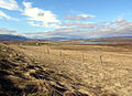
Southern border: Geirangerfjord
Western border: East Iceland
_10.jpg)


Origin and shape

The Northern European Sea was formed about 250 million years ago when the Eurasian Plate with Norway and the North American Plate with Greenland began to move apart. The existing narrow shelf sea between Norway and Greenland began to widen and deepen.
The continental slope begins roughly where the border between Norway and Greenland lay 250 million years ago. In the north it runs east of Spitsbergen , in the south-west it continues between Great Britain and the Faroe Islands. It was partly formed by large landslides , of which the Storegga slide 8000 years ago led to a huge tsunami on the coasts of the North Sea. The continental slope is home to rich fishing grounds and numerous coral reefs .
The coasts of the North Sea are shaped by the ice ages of the past three million years. Large, several kilometers high glaciers pushed into the sea, especially in Norway, and formed valleys and fjords . The material they carried into the sea enlarged the continental shelf off the coast and further expanded the area between land and continental slope. This is particularly evident off the Norwegian coast between Lofoten and the Halt Bank.
The Norwegian continental shelf is between 40 and 200 kilometers wide and, unlike in the North or Barents Sea, for example, is shaped by the former glaciers. The irregular banks and elevations of less than 100 meters are separated by numerous canals up to 200 meters deep. Between them there are often ditches and valleys that can reach up to 400 meters. At the end of the ice ages, the elevations between the trenches were often briefly above the water surface or immediately below it, so that their composition is similar to that of the coast: a mixture of gravel, sand and mud. Finer material like clay, on the other hand, has sunk into the faults between the banks and forms the material in many trenches. Others, however, are traversed by powerful currents, so that no sediments can deposit; The soil here is like the one left by the Ice Ages, and it is in these ditches in particular that many fish have their spawning grounds.
In the depths of the North Sea there are two deep-sea basins, which are separated by a deep sill between the Vøring plateau and Jan Mayen . The southern basin is the larger of the two and reaches depths of 3500 to almost 4000 meters over a large area. The northern basin is smaller, generally reaching a depth of 3200 to 3300 meters, but has numerous individual spots where it goes down to 3500 meters. The threshold between the two basins is 3000 meters deep at the deepest point.
Hydrology


In the North Sea, four bodies of water meet, some of which come from the North Atlantic and some from the Arctic. They mix in the North Sea and so form new currents of fundamental importance to the climate of the Arctic as well as the global conveyor belt are. The warm, salty North Atlantic Current comes from the Atlantic, the warm , but sweeter Norwegian Current from the North Sea . The Arctic East Iceland Current flows from the southwest into the Arctic Ocean , the water of which is mainly found in the middle water layers. Finally, via the deep sea from the Greenland Sea, arctic deep water comes, which is transformed here into Norwegian deep water .
Surface currents
The hydrology of the upper water layers is largely determined by water from the North Atlantic, which flows into the Arctic Ocean at around 10 Sverdrup . In its extension it reaches the maximum depth of 700 meters in the Lofoten area, in the greater part of its extension it occupies the upper 400 to 500 meters. Above all, it comes through the Faroe-Shetland Canal into the North Sea and has a comparatively high salinity of 35.3 per thousand. The water originally came from the North Atlantic Current, but it mainly flowed over the Bay of Biscay along the European continental slope, where evaporation in southern latitudes has led to higher salinity. In smaller quantities, however, water also reaches the North Sea directly from the North Atlantic Current through the Greenland-Scotland Rift between the Faroe Islands and Iceland . The water there has an average salinity between 35 and 35.2. The amount of water is subject to strong seasonal fluctuations and can be twice as high in winter as in summer. The water of the North Atlantic Current carries considerable amounts of heat with it and thus ensures that the climate in northwestern Europe is far warmer and friendlier than at the same altitudes in other areas of the world. While it still has a temperature of around 9.5 ° C in the Shetland-Faroe Strait, it cools down to around 5 ° C by Svalbard and releases this energy to the environment. Estimates assume that the energy content of the Atlantic water in the North Sea is around 250 terawatts .
Water from the North Sea and thus via a detour also the water from the Baltic Sea and thus a large part of the northern European drainage area flows north along the Norwegian coast and into the North Sea. Compared to the Atlantic water, this is only a relatively small amount. The water is subject to strong seasonal and annual fluctuations in temperature and salinity. Long-term measurements at a depth of 50 meters near the coast showed maximum temperatures of 11.2 ° C water temperature at the 63rd parallel in September and minimums of 3.9 ° C at the North Cape in March. The salinity was between 34.3 and 34.6. In general, the salt content is lowest in spring when the water from the snowmelt has reached the sea. The Norwegian rivers flow directly into the North Sea on the northwest side of the Scandinavian Mountains . In the north, the watershed to the Baltic Sea roughly follows the Norwegian-Finnish and Norwegian-Swedish borders; in Norway itself, it runs along the main mountain ridge. Major rivers that flow into the sea are Namsen , Ranelva and Vefsna . These are all comparatively short, but due to the uphill rain on the Scandinavian mountains, they are among the most water-rich in Scandinavia. Nevertheless, in the coastal areas as well, the temperature decreases and the salinity increases in the course of the flow from south to north.
In some cases, the warm surface water from the Atlantic flows on and flows away with the West Spitsbergen Current , via which three to five Sverdrup via the Greenland Sea reach the Arctic Ocean and have a major impact on the climate there. Additional surface water, such as a sverdrup, flows along the Norwegian coast towards the Barents Sea . In some cases, the water in the North Sea cools down to such an extent that it sinks into deep water layers and displaces water that is already there, which flows back into the North Atlantic.
The arctic water from the East Iceland Current is particularly in the south-western part, near Greenland, on the surface of the North Sea. This is also subject to comparatively strong fluctuations in its properties. The long-term mean the temperature is below 3 ° C and the salinity between 34.7 and 34.9 per mille. The proportion that this water takes up in the total surface water depends on the strength of the East Icelandic Current , which in turn is strongly influenced by the North Atlantic Oscillation , the pressure difference between the Icelandic low and the Azores high . The more pronounced the pressure difference, the stronger the Icelandic current and the more arctic surface water there is in the North Sea.
Deep sea currents
The European Arctic Ocean is connected to the Greenland Sea and further to the Arctic Ocean by the Fram Strait , which reaches a depth of 2,600 meters. The deep water of the North Sea, the Norwegian Sea deep water ( NSDW - Norwegian Sea deep water ) at depths greater than 2000 meters is an almost homogeneous type of water with a salinity of 34.91, which has little exchange with the neighboring seas. The temperature is below 0 ° C and drops down to −1 ° C to the sea floor. Water flows in there mainly from the Greenland Sea through a channel a little more than 2000 meters deep north of Jan Mayen. Due to changes in temperature and thus density in the water layers, the direction of flow in the canal has sometimes been reversed in recent years. Compared to the surrounding seas and their deep water areas, the European Arctic Ocean has the highest proportion of nutrients in the depths, but the lowest amount of oxygen and human-generated traces, so that the North Sea deep water is the oldest in the area.
The deep water exchange with the Atlantic is limited by the comparatively flat Greenland-Scotland Ridge between Scotland and Greenland, which is an extension of the Mid-Atlantic Ridge and allows only comparatively shallow depths. The Greenland-Scotland ridge is deeper than 500 meters in only four places. These are the Faroe Bank Canal (around 850 meters), individual parts of the Iceland-Faroe Ridge (around 600 meters), the Wyville-Thomson Ridge (620 meters) and the Denmark Strait between the Greenland Sea and the Atlantic Ocean (850 meters) . Even there, however, with a maximum depth of 850 meters, it is far above the areas of the North Sea deep water, which has hardly any direct exchange with the Atlantic. Here the cold, dense, sunken water from the North Sea and Greenland Sea flows back into the Atlantic. About 1.9 Sverdrup of cold deep water flows back into the Atlantic through the Faroe Bank Canal, 1.1 Sverdrup via various points in the Iceland-Faroe Ridge and another 0.1 Sverdrup via the Wyville-Thomson Ridge. The turbulence that occurs when the deep water falls behind the Greenland-Scotland ridge into the depths of the Atlantic basin, it mixes with adjacent layers of water and forms the North Atlantic deep water , one of the two important deep-sea currents that keep the global conveyor belt running and supply the deep sea with oxygen.
climate

As the “pump” of the thermohaline circulation, the Arctic Ocean plays an important role in the global climate . The sea is therefore the subject of numerous studies. The regional climate can differ significantly from averages elsewhere. In the area of the sea and the coasts, the temperatures are on average 10 ° C above the average of these latitudes and there are also differences in long-term comparison. In the decades between 1920 and 1960, for example, the temperature worldwide was well above the long-term average, but significantly lower in the European Arctic Ocean. At the same time, the frequency of storms decreased sharply during this time. In the 120 years that detailed records have been in existence, the 1880s was the stormiest period, holding up around 1910 before the incidence dropped significantly into the 1960s. Since then, the frequency of storms has increased back to the level at the turn of the 1900s.
In contrast to the Greenland Sea (and other Arctic seas), the Arctic Ocean is generally ice-free all year round. In the winter months in particular, it is an important factor in the arctic climate when very cold air passes over the comparatively warm sea and convection occurs on a larger scale . The 10-degree Celsius isotherm runs around the northern limit of the North Sea, south of which the warmest summer month has an average temperature of over 10 ° C and which is often assumed to be the southern limit of the Arctic. In winter, the North Sea generally has the lowest air pressure in the entire Arctic and is therefore a regular area of formation of low pressure areas , the Icelandic Depression . In some cases, polar lows can arise here , with serious effects on the coasts of northwestern Europe.
fauna and Flora
The biodiversity in the Norwegian Sea is affected by the transition between boreal zone and arctic conditions, so that living things exist both climatic regions in the North Sea. The southern limit of distribution of many Arctic species lies in the North Cape, Iceland and the middle of the North Sea, while the northern limit of boreal species lies on the border between the Greenland Sea and the North Sea and the Barents Sea and the Kara Sea . Some, like the mussel Chlamys islandica or the capelin , specialize in the area between the Atlantic and the Arctic.
Plankton and soil organisms
As for the number and mass of life, it is concentrated in the northern sea, as everywhere in the sea, in the upper water layers. Estimates for the entire North Atlantic assume that only 2 percent of primary production reaches depths of 1000 meters and more, and only 1.2 percent reaches the sea floor.
The flowering of phytoplankton , characterized by the maximum chlorophyll concentration, takes place on average on May 20th, shifting from south to north from mid-April to mid-June. The dominant phytoplankton are diatoms , with the genera Thalassiosira and Chaetoceros playing an important role. After the spring bloom, haptophytes of the species Phaecocystis pouchetti form the largest group.


The most productive animals in the zooplankton are the copepods Calanus finmarchicus and Calanus hyperboreus , with C. finmarchicus occurring around four times as frequently as C. hyperboreus and predominating in the Atlantic water, while C. hyperboreus is predominant in the arctic water. However, both are the main nutritional components of many predators, so that the largest proportion of biomass in the North Sea is krill . The most important species here are Meganyctiphanes norvegica , Thyssanoessa inermis and Thyssanoessa longicaudata . Other important species in the portfolio are different amphipods of hyperiidea . In contrast to the Greenland Sea, calcareous plankton ( Coccolithophorales , Globigerinida ) are strongly represented. Plankton production and stock show strong fluctuations between the years. For example, C. finmarchicus produced 28 g / m 2 dry weight in 1995 , but only 8 g / m 2 two years later . The number of fish that feed mainly on C. finmarchicus also fluctuates significantly between the years.
In the area of bottom organisms, especially in the northern area near Spitsbergen and on the Eurasian continental shelf in the transition to the Barents Sea, the arctic shrimp plays an important role in the nutrition of the fish, especially cod and blue whiting. Their occurrence is mainly concentrated in water depths between 200 and 300 meters. A special feature of the North Sea are the extensive coral banks of Lophelia pertusa . Although the species is widespread in many peripheral areas of the North Atlantic, nowhere does it reach such quantities and concentrations as on the Norwegian continental slopes. These form the habitat of various fish species. However, they are at risk from increasing trawling , which can destroy coral reefs. Different groups of gorgonians form underwater forests.
fishes

The Norwegian coastal waters are the main spawning ground for the herring populations of the North Atlantic, which hatch here in March. The larvae rise to the surface and are transported north by the coastal current. A smaller part remains in the fjords and on the coast of Northern Norway, the greater part spends the summer months in the Barents Sea, where it feeds on the rich plankton of the sea. When it reaches sexual maturity, it returns to the North Sea. The number of herring stocks varies greatly. For example, it saw a surge in the 1920s, largely due to milder climates, before collapsing in the decades that followed until 1970. In this case, however, overfishing in previous years was primarily responsible. The biomass of the newly hatched herring fell from 11 million tons in 1956 to almost zero in 1970, the few remaining fish avoided the open sea and only shuttled from their winter quarters in a large fjord to nearby Norwegian coastal areas. The failure of the most important plankton eater, as well as the main food source for many predatory fish, had serious effects on the ecosystem of the North Sea as well as the Barents Sea.

Only stricter environmental guidelines and a renewed rise in temperature have caused stocks to rise again in the years since 1987. Since 1990 it has been swimming again in large numbers in the open sea, and from around 2004 there are also schools of herring that overwinter in the Arctic Ocean. This return went hand in hand with the collapse of capelin and cod stocks. While the capelin benefited from the disappearance of its food competitor herring, despite heavy hunting, and showed hardly any changes in the population, the rise in temperature in the 1980s made the fish almost completely disappear. On the one hand, the production of zooplankton fell sharply due to the changing environmental conditions, and on the other hand, young herring grew again, which ate away the plankton of the capelin offspring and brought them to a complete standstill. At the same time, somewhat larger capelin grew so quickly that almost the entire older population fell victim to fishing, and in a few years the stocks collapsed. As a result, the capelin fell out as prey for cod, but the herrings were still too small to be able to replace them. Cod developed a strong tendency towards cannibalism and fell victim to seals and birds, which also suffered from the capelin shortage, so that here too the cod stocks shrank to a fraction in a short time.
The blue whiting ( Micromesistius poutassou ), which is now the most important plankton consumer in the sea, and the capelin have benefited from the extreme decline in the herring population . The blue whiting hatches west of the British Isles. The current carries the larvae into the Norwegian sea, and the adults swim there too to benefit from the food available there. The young spend summer and winter in Norwegian coastal waters until February, when they return to the waters west of Scotland to reproduce. The Norwegian-Arctic cod has its main distribution area in the Barents Sea and the Svalbard Archipelago. In the rest of the North Sea it occurs only for reproduction, its spawning area is in the Lofoten Islands, the larvae can be carried back to the Barents Sea and Svalbard with the current. Other fish species that use the coastal waters for spawning are haddock and coalfish , while large schools of mackerel are commercially important for fishing and also hatch west of the British Isles and use the Arctic Ocean for food migrations. Various species of the genus Sebastes , the spiny heads , live in the coral reefs , including the most famous redfish .
Other marine animals and birds

Northern minke whales , humpback whales , sei whales and orcas can be found in significant numbers in the waters . White-beaked dolphins occasionally roam the coastal waters . After centuries of hunting larger species, minke whales are by far the most common whales in the North Sea. Apart from the orcas, the other species are migrants who come in the summer months to use the food production there to eat. The orcas are closely connected to the herring stocks of the North Sea and follow the herring schools into their wintering areas. Minke whales continue to be hunted in Norway and Iceland. With a total population of around 110,000 in the north-east Atlantic, for example, Norway allows a quota of around 1,000 whales to be hunted per year. In contrast to historical whaling, meat is primarily consumed here and not fat and oil.
Bowhead whales , which once belonged to the most important plankton-eaters in the North Sea in terms of quantity, almost completely disappeared from the sea due to intensive whaling in the 19th century and have since been considered extinct in the North Atlantic. The situation was similar for the blue whale , which occurred in large populations between Jan Mayen and Spitzbergen and of which there are now hardly any specimens in the entire North Atlantic. In rare cases, northern duck whales have been sighted in the Arctic Ocean. Other animal species that feed on the fish in the Northern Sea are seals ( folding hats , harp seals ) and squids ( Gonatus fabricii ).
Important waterfowl in Northern Norway are puffins , kittiwakes and guillemots . Atlantic puffins and guillemots also suffered badly from the collapse of the herring population. The puffins in Lofoten in particular had hardly any food alternative to the young herring, in many years there was no brood at all, in most of the others not even 50 percent of the chicks survived.
People on and in the sea
The largest part of the European North Sea is claimed by Norway or the other neighboring countries Iceland and Denmark / Faroe Islands as an exclusive economic zone. Norway has claimed a twelve-mile zone as territorial waters since 2004 . Since 1976 the state has claimed an exclusive economic zone of 200 miles and thus - due to the Norwegian islands of Jan Mayen and Spitzbergen - the southeast, northeast and northwest edges of the sea. The southwestern edge lies in the area of Iceland and Denmark / Faroe Islands. For the important herring stocks, the Northeast Atlantic Fisheries Committee ( NEAFC ) provides for fixed quotas for various neighboring countries in the international area, the so-called "banana hole", in order to conserve stocks. The committee is now also active for other fish species.
In addition to the direct effects of fishing and whaling in particular, humans also have an indirect impact on the sea. Although generally healthy, the North Sea ecosystem is not only exposed to climatic stress, but is also a victim of pollution. The European Arctic Ocean is the target of radioactive discharges that enter the Arctic Ocean via various currents from the European coasts. In particular, the British nuclear complex Sellafield plays a role here; overall, the discharges from the British nuclear industry are considered the most dangerous single source of pollution for the North Sea. In Norway and its coastal waters, emissions from the oil industry and the discharge of toxins are the main threats to the sea. The British Navy also sank ammunition and chemical warfare agents in the sea after the world wars. The exact amount and distribution is unknown, but it is certain that a - probably smaller - part ended up in the North Sea. In the area of environmental protection, the European Arctic Ocean falls primarily under the OSPAR Convention.
Fishing and whaling

In the area of Arctic cod stocks, Norway and Russia have shared the quotas in the North Sea and Barents Sea since the introduction of the 200-mile zone. Nevertheless, the stocks and the subsequent catch quotas are steadily declining, just as the regime has gradually changed from a general quota to detailed specifications for each individual fishing vessel.
Fishing in Lofoten is hundreds of years old. The rather barren and remote islands are home to one of the richest fishing regions in Europe in their coastal waters. Cod from large parts of the Atlantic swim to the coastal waters of Lofoten in winter to spawn. The fishermen caught them on lines and sometimes with nets, the dried stockfish was one of Norway's main export goods until late in the 19th century and by far the most important industry in Northern Norway. A source from 1879 describes the islands:
“In the polar sea ... on the wild and dangerous coast of Norway, near the famous and feared maelstrom, there is a group of islands. The islands have neither four-legged animals nor food on which they could live; but the sea around them is teeming with fish, and the air is teeming with water birds. There are few human beings there, except in the fishing season from February to April when 12,000 to 14,000 fishermen come. "
Because of the currents and especially the frequent storms, this activity was dangerous. Estimates assume that a third of fishermen died at sea, and several hundred fishermen died on individual storm days such as “fatal Monday” in 1821.

Whaling is historically significant . The Englishman Stephen Bennet began to decimate the large herds of walrus on Bear Island . In the years that followed, explorers from the British Muscovy Company , who were actually looking for the Northwest Passage , repeatedly came across large herds of whales in the waters of the North Sea. The island of Jan Mayen established itself in the middle of the 17th century as an important starting point for Dutch whalers in the Greenland Sea and the North Sea. In particular, they were targeting the bowhead whale , of which there were an estimated 25,000 specimens in the waters between Svalbard and Jan Mayen at the beginning of the 16th century. Other nations also hunted in these waters, in the early days these were mainly Hamburgers and Danes , later the British dominated the field in this area and finally the Norwegians also developed into a whaling nation in the second half of the 19th century. In the 200 years between 1615 and around 1820, the waters between Jan Mayen, Svalbard, Bear Island and Greenland in the transition between the North Sea, Greenland Sea and Barents Sea were the most productive fishing areas for baleen whales worldwide. By the beginning of the 20th century, however, the whales were so extinct that whaling was almost only worthwhile in Svalbard. In 1903 Christen Christensen started the first expedition on the abundant blue whale near Svalbard and by 1912 its number was so decimated that commercial exploitation no longer seemed worthwhile.
As technology evolved, the number of whalers decreased, but the number of catches remained the same or increased. In the 40 years between 1864 and 1904 alone, Norwegian whalers caught a total of 40,000 whales. These were primarily rorquals , designed primarily for Trangewinnung were hunted. The time was also characterized by the fact that the Norwegians, especially Svend Foyn , developed the technical methods here that later became standard in modern whaling and only became a threat to the entire population. The harpoon with an explosion head, shot down from a cannon, had its premiere in the North Sea / Greenland Sea, as did the factory ship, the fixed oil tank that replaced the individual barrels and the innovation of boiling the oil in a permanently installed pressure cooker below deck.
Kraken and Maelstrom

For many centuries the Arctic Ocean lay on the edge of the known world. Some impressive legends of the unknown are set in its waters. The octopus is said to stay in the sea and pull ships into the depths. In the Encyclopædia metropolitana of 1845, in a multi-page article by Erik Pontoppidan's description, he is described as the largest of all sea monsters, one and a half miles in diameter and horns, and capable of pulling a ship under full sail with ease. The legend probably goes back to Olaus Magnus ' historical work Historia de gentibus septentrionalibus from 1539, in which he describes the octopus and an equally terrible giant snake of the North Sea as well as the maelstrom. The octopus appears famous in Alfred Tennyson 's poem of the same name, just as it plays a role in Herman Melville's Moby Dick , appears prominently in 20,000 Leagues Under the Sea and is still the namesake of a roller coaster in Disney World.
Between the Lofoten islands Moskenesøy and Værøy lies the Moskenstraumen , which went down in European intellectual history as the maelstrom and gave its name to a whole class of such eddies. Already mentioned in the Edda it is repeatedly a motif for painters and writers from Edgar Allan Poe to Walter Moers . At 20,000 Leagues Under the Sea, Jules Verne commemorates him :
"" Maelstrom! It shouted. The Maelstrom! We could not have heard a more terrible word in a more terrible situation. So we were at this dangerous point on the Norwegian coast? "
“As is well known, the waters narrowed between the Farör and Loffoden Islands form a vortex with irresistible force at the time of the flood, from which no ship has ever escaped. Outrageous waves converge here from all sides of the horizon, and the attraction of this vortex extends over a distance of fifteen kilometers, so that not only ships but also whales and polar bears are carried away. "
“This is where the Nautilus was directed by its captain - without, or perhaps with will. He described a spiral line whose circumference became increasingly narrow. With him the boat still attached to it was swept away in a giddy train. Terror of death befell us, in the highest horror the blood stagnated, cold sweat penetrated our foreheads! And what a noise around our fragile boat! A roar that was heard repeatedly by the echo. A crash of the waves that broke for miles on the rock peaks in the deep depths, where the hardest bodies are shattered. "
Even if it is literarily exaggerated, the maelstrom is actually one of the largest such eddies due to the special occurrences of the tides, the location of the Lofoten and the associated underwater topography. In contrast to most of the others, it is not located directly in a canal or a bay, but in the open sea. With a diameter of 40 to 50 meters, it can endanger the small fishing boats that still went out to sea in the early modern times, especially since the vortex also attracts cod, which feed on the small creatures that have been blown up, so that the boats come nearby wanted to come.
Explorers and oceanographers

The fish-rich coastal waters of Northern Norway have been settled longer than written records go back. Although their inhabitants were good sailors and settled Iceland and Greenland at the time of the Vikings , they primarily used routes west of the North Sea through the Atlantic. The settlements on Iceland and Greenland are therefore almost exclusively on the warmer west coasts of the islands. The first halfway reliable map of Northern Europe, the Carta marina from 1539, shows the Arctic Ocean almost exclusively as coastal waters and shows nothing north of the Northern Cape. The North Sea away from the coastal regions came on the map in the 17th century: on the one hand as an important stretch of the route on the Northeast Passage , which was still to be found at that time , on the other hand as a rich whaling ground .
Jan Mayen, discovered in 1607, developed into an important base for Dutch whalers in the following decades. Willem Barents from the Netherlands discovered Svalbard and Bear Island . Whalers came to Svalbard, just like Russian walrus hunters, the so-called pomors , stayed on Svalbard for several centuries . The islands on the edge of the North Sea were quickly divided into national areas of interest. At the height of whaling, 300 ships a year with a crew of 12,000 called at Svalbard, but only a small number of them were in port at the same time. Later, in addition to the whalers and those looking for the Northeast and Northwest Passages, Arctic and polar expeditions were added. Constantine Phipps carried out the first plumb measurement in the deep sea worldwide in 1773 on board the HMS Racehorse , which measured 683 fathoms (1249 meters) depth on his North Pole expedition in the North Sea .
Oceanographic research began in the Northern Sea in the late 19th century . Declines in the yields of the cod and herring fisheries off Lofoten prompted the Norwegian government to send out expeditions with measuring instruments. The zoologist Georg Ossian Sars and the meteorologist Henrik Mohn convinced the Ministry of the Interior in 1874 that there was hardly any knowledge about the open sea in the North Sea and that this would have to be obtained by means of research trips similar to those of Charles Wyville Thomson . They spent the summers from 1876 to 1878 on the Vøringen in the North Sea area. The results of these expeditions led to the publication of Mohns The Currents of the European North Sea , in which he set up a dynamic model of ocean currents for the first time and integrated wind, pressure differences, sea water temperatures and salinity into it. For the first time he was able to make well-founded statements about deep-sea currents.
shipping
The coasts of the North Sea are sparsely populated, the coasts of the Arctic Ocean and its marginal seas had almost no inhabitants until the 20th century. For many centuries, shipping existed only as fishing, whaling or coastal shipping. Although the sea was the most important transport route within Norway, ship movements were comparatively sparse. With the Hurtigruten there has been a line connection between the densely populated south of Norway and the coastal areas of northern Norway since the late 19th century, on which at least one ship operates daily. The North Sea gained importance as a shipping route primarily through the expansion of the Russian and Soviet navies on the Barents Sea and the better integration of the ports there into the hinterland. The way through the North Sea is far more difficult to control by other sea powers than the other sea accesses of Russia / the Soviet Union to the Atlantic ( North Sea - Skagerrak - Kattegat - Baltic Sea or Strait of Gibraltar - Mediterranean Sea - Bosporus - Black Sea ).

The North Sea forms the direct and ice-free route from the Atlantic to the Russian ports in the Arctic ( Murmansk , Archangelsk , Kandalakscha ). This became particularly important in the 20th century, when these ports were connected to the hinterland and existed within Russia's transport routes. It was militarily significant in World War II when supply convoys from the United States used this route. A total of 811 ships left the US, 720 of which arrived in Russian ports. Their cargo totaled four million tons, including 5000 tanks and 7000 aircraft. The Allies lost 18 warships and 89 merchant ships in the convoys, the German Navy lost the battleship Scharnhorst , three destroyers, 38 submarines and many aircraft.
While the convoys generally drove further away from the Norwegian coast through the Greenland Sea in summer, the ice forced them closer to Norway in winter. The most important battles of the German Navy against these convoys, especially Operation Rösselsprung in July 1942, the battle in the Barents Sea in December 1942 and the naval battle off the North Cape in December 1943 mostly took place on the border between the North Sea and the Barents Sea at the height of the North Cape .

At the beginning of the Cold War , relations between the states were icy, and military planning in Europe was focused primarily on Central Europe in the area around the Fulda Gap . Norway itself, especially the eastern parts, served as a location for espionage and surveillance operations.
It was only when the Soviet Union began to massively increase the northern fleet in the 1960s and 1970s and make it the largest of the four sub-fleets that the North Sea regained increasing strategic importance. While both NATO and the Soviet Navy did not permanently occupy the North Sea with large ship contingents, it has played a larger role in the strategic planning of both blocs since the 1970s. Large joint maneuvers by the Soviet Navy of the Northern Fleet and the Baltic Fleet in the North Sea gave the sea the name Mare sovieticum among parts of the military . On the one hand, it was the Soviet navy's gateway into the Atlantic and thus towards the USA; on the other hand, a large part of the Soviet fleet was located in Murmansk , just beyond the North Sea / Barents Sea border. In order to protect their own fleet, it was necessary for them to be able to defend the North Sea.
After NATO had planned an attack on Murmansk and the destruction of the Soviet submarines in the 1950s, it positioned itself more cautiously in later decades. The main focus was on the GI-UK gap . To secure the Atlantic, SOSUS was installed to detect Russian submarines. With the concept of forward defense and the associated CONMAROPS concept of NATO, NATO planned a permanent strong presence in the North Sea as a starting point for an attack on the Soviet ports of the Barents Sea. Even in times of détente, intensive cat-and-mouse games set in between Soviet and NATO aircraft, ships and, above all, submarines.
A remnant of the Cold War in the Arctic Ocean is the Soviet nuclear submarine K-278 Komsomolets , which sank southwest of Bear Island in 1989. Should the radioactive material stored inside be released, this could have serious effects on flora and fauna.
The European Arctic Ocean is part of the Northeast Passage for ships from Central European ports to Asia. The sea route between Europe and Asia ( Rotterdam - Tokyo ) through the Suez Canal is 21,100 kilometers, whereas the route through the Northeast Passage is significantly shorter with only 14,100 kilometers. The northeast and northwest passages were free of ice for the first time at the end of August 2008.
In the future, Russia will presumably expand its offshore oil production in and on the Arctic and deliver the extracted oil, at least in part, directly to the markets in Europe and America by tankers. According to the plans, the number of Russian tanker movements in the North Sea is to increase from 166 in 2002 to 615 in 2015, whereby the size of the tankers used is expected to roughly triple.
natural gas

The place of the most important raw materials from the North Sea is no longer taken by fish, but by oil and above all natural gas . The fields under the Arctic Ocean are still hardly developed, but are considered productive and could still supply natural gas for decades. Since Norway had already gained extensive experience with oil and gas production and its regulation in the North Sea , there were few political and economic problems when the first oil field in the North Sea started production in 1993. In 2001, the Huldra gas field in the North Sea on the border with the North Sea was followed by an important production site for what is probably the most important raw material in the North Sea.
The main technical challenges are the weather, which is even less suitable for offshore work than in the North Sea, and the significantly greater water depths. While the shallow water is well developed up to a depth of 500 meters and has a similar degree of development as the North Sea, the wells in deeper elevations are only in their initial phase. There have been wells in more than 500 meters of water since 1995, but only a few gas fields have started commercial operation. The most important project at the moment is Ormen Lange , which has been producing commercially since 2007. In it, the gas reserves are estimated at 1.4 × 10 13 cubic feet. This could make it the most important Norwegian gas field after the Troll gas field in the North Sea. It is connected with the Langeled pipeline, currently the longest underwater pipeline in the world, to the Sleipnir field in the North Sea and thus to the pipeline network between the various North Sea countries. Several other gas fields are also under development. The Kristin gas field represents a particular challenge , in which the gas pressure is almost identical to the pressure at which the surrounding rock splinters, which repeatedly leads to delays and problems.
Remarks
- ↑ a b c d e f g h i j k l m Blindheim, pp. 366–382.
- ↑ ICES, p. 1.
- ↑ a b c d Terje Thornes and Oddvar Longva: The origin of the coastal zone in: Sætre 2007, pp. 35–43.
- ↑ a b c d Roald Sætre: Driving Forces in: Sætre. 2007, pp. 44-58.
- ↑ Hendrik Mattheus van Aken: The Oceanic Thermohaline Circulation: An Introduction Springer, 2007, ISBN 0-387-36637-7 , pp. 119-124.
- ↑ a b Matti Seppälä: The Physical Geography of Fennoscandia Oxford University Press, 2005, ISBN 0-19-924590-8 , pp. 121-141.
- ^ Paul A. Tyler: Ecosystems of the Deep Oceans: Ecosystems of the World Elsevier, 2003, ISBN 0-444-82619-X , pp. 45-49.
- ^ A b Paul A. Tyler: Ecosystems of the Deep Oceans: Ecosystems of the World Elsevier, 2003, ISBN 0-444-82619-X , pp. 115-116.
- ↑ ICES, pp. 2-4.
- ^ Paul A. Tyler: Ecosystems of the Deep Oceans: Ecosystems of the World Elsevier, 2003, ISBN 0-444-82619-X , pp. 240-260.
- ^ A b Hendrik Mattheus van Aken: The Oceanic Thermohaline Circulation: An Introduction. Springer, 2007, ISBN 0-387-36637-7 , pp. 131-138.
- ^ Stig Skreslet, North Atlantic Treaty Organization: Jan Mayen Island in Scientific Focus Springer, 2005, ISBN 1-4020-2956-X , p. 93.
- ↑ Ronald E. Hester, Roy M. Harrison: Biodiversity Under Threat Royal Society of Chemistry, 2007, ISBN 0-85404-251-2 , p. 96.
- ^ A b c Gerold Wefer, Frank Lamy, Fauzi Mantoura: Marine Science Frontiers for Europe Springer, 2003, ISBN 3-540-40168-7 , pp. 32-35.
- ^ Priska Schäfer: The Northern North Atlantic: A Changing Environment. Springer, 2001, ISBN 3-540-67231-1 , pp. 10-17.
- ^ Kieran Mulvaney: At the Ends of the Earth: A History of the Polar Regions. Island Press, 2001, ISBN 1-55963-908-3 , p. 23.
- ↑ Marcel Leroux: Global Warming: Myth Or Reality: the Erring Ways of Climatology. Springer, 2005, ISBN 3-540-23909-X .
- ^ A b c d e f Stig Skreslet, North Atlantic Treaty Organization: Jan Mayen Island in Scientific Focus. Springer, 2005, ISBN 1-4020-2956-X , pp. 103-114.
- ↑ a b Andrea Schröder Ritzrau et al .: Distribution, Export and alteration of Fossiliziable plankton in the Nordic Seas. in: Priska Schäfer: The Northern North Atlantic: A Changing Environment. Springer, 2001, ISBN 3-540-67231-1 , pp. 81-104.
- ↑ a b c d e f g ICES, pp. 5–8.
- ↑ a b Blindheim, pp. 382-401.
- ↑ Olav Schram Stokke: Governing High Seas Fisheries: The Interplay of Global and Regional Regimes. Oxford University Press, 2001, ISBN 0-19-829949-4 , pp. 241-255.
- ^ A b Gene S. Helfman: Fish Conservation: A Guide to Understanding and Restoring Global Aquatic Biodiversity and Fishery Resources. Island Press, 2007, ISBN 1-55963-595-9 , pp. 321-323.
- ^ National Research Council (US). Committee on Ecosystem Management for Sustainable Marine Fisheries: Sustaining Marine Fisheries. National Academies Press, 1999, ISBN 0-309-05526-1 , p. 46.
- ↑ Erich Hoyt: Marine Protected Areas for Whales, Dolphins, and Porpoises. Earthscan, 2005, ISBN 1-84407-063-8 , pp. 120-128.
- ↑ White-Beaked Dolphine. in: Margaret Klinowska u. a. (Ed.): Dolphins, Porpoises and Whales of the World: The IUCN Red Data Book. IUCN, 1991, ISBN 2-88032-936-1 , p. 138.
- ↑ Norway.org.uk: Norwegian minke whaling ( Memento of April 16, 2009 in the Internet Archive ).
- ↑ a b Arne Odd Johnsen: The History of Modern Whaling. C. Hurst & Co. Publishers, 1982, ISBN 0-905838-23-8 , pp. 95-101.
- ↑ Northern Bottlenose Whale. in: Margaret Klinowska u. a. (Ed.): Dolphins, Porpoises and Whales of the World: The IUCN Red Data Book. IUCN, 1991, ISBN 2-88032-936-1 , p. 320.
- ↑ Simon Jennings et al .: Marine Fisheries Ecology. Blackwell Publishing, 2001, ISBN 0-632-05098-5 , p. 297.
- ^ A b c Alf Håkon Noel: The Performance of Exclusive Economic Zones - The Case of Norway. in: Syma A. Ebbin et al .: A Sea Change: The Exclusive Economic Zone and Governance Institutions for Living Marine Resources. Springer, 2005, ISBN 1-4020-3132-7 .
- ^ Paul A. Tyler: Ecosystems of the Deep Oceans: Ecosystems of the World. Elsevier, 2003, ISBN 0-444-82619-X , p. 434.
- ^ Rögnvaldur Hannesson: The Privatization of the Oceans. MIT Press, 2004, p. 103.
- ↑ Tim Denis Smith: Scaling Fisheries: The Science of Measuring the Effects of Fishing, 1855-1955. Cambridge University Press, 1994, ISBN 0-521-39032-X , pp. 10-15.
- ^ A b John F. Richards: The Unending Frontier: An Environmental History of the Early Modern World. University of California Press, 2006, ISBN 0-520-24678-0 , pp. 589-596.
- ^ John F. Richards: The Unending Frontier: An Environmental History of the Early Modern World. University of California Press, 2006, ISBN 0-520-24678-0 , pp. 574-580.
- ^ Arne Odd Johnson: The History of Modern Whaling. C. Hurst & Co. Publishers, 1982, ISBN 0-905838-23-8 , pp. 68-71.
- ^ Arne Odd Johnson: The History of Modern Whaling. C. Hurst & Co. Publishers, 1982, ISBN 0-905838-23-8 , pp. 3-15.
- ^ Kraken in: E. Smedley et al. (Ed.): Encyclopædia metropolitana; or, Universal dictionary of knowledge. 1845, pp. 326-330.
- ^ Terry Glavin: The Sixth Extinction: Journeys Among the Lost and Left Behind. Macmillan, 2007, ISBN 0-312-36231-5 , p. 149.
- ↑ Quoted from: zeno.org: Jules Verne: Twenty Thousand Leagues Under the Sea. Known and unknown worlds. Adventurous journeys by Julius Verne. Volume IV – V, Vienna, Pest, Leipzig 1874, pp. 457–458.
- ↑ Tom Kopel: Ebb and Flow: Tides and Life on Our Once and Future Planet. Dundurn Press Ltd., 2007, ISBN 1-55002-726-3 , pp. 76-79.
- ^ A b c Neil Kent: The Soul of the North: A Social, Architectural and Cultural History of the Nordic Countries, 1700-1940. Reaction Books, 2001, ISBN 1-86189-067-2 , pp. 300-302.
- ↑ Colin Summerhayes: The exploration of the sea floor in: Margaret Deacon et al. (Ed.): Understanding the oceans: a century of ocean exploration. Routledge, 2001, ISBN 1-85728-705-3 , p. 93.
- ↑ Eric L. Mills: Mathematics in Neptune's Garden. Making the Physics of the Sea Quantitative , 1876–1900 in: Helen M. Rozwadowski, David K. Van Keuren (Eds.): The Machine in Neptune's Garden: Historical Perspectives on Technology and the Marine Environment Science History Publications / USA, 2001, ISBN 0-88135-372-8 , pp. 41-43.
- ↑ Eric L. Mills: Mathematics in Neptune's Garden. Making the Physics of the Sea Quantitative, 1876-1900. in: Helen M. Rozwadowski, David K. Van Keuren (Eds.): The Machine in Neptune's Garden: Historical Perspectives on Technology and the Marine Environment. Science History Publications / USA, 2001, ISBN 0-88135-372-8 , pp. 44-47.
- ↑ Eric L. Mills: Mathematics in Neptune's Garden. Making the Physics of the Sea Quantitative, 1876-1900. in: Helen M. Rozwadowski, David K. Van Keuren (Eds.): The Machine in Neptune's Garden: Historical Perspectives on Technology and the Marine Environment. Science History Publications / USA, 2001, ISBN 0-88135-372-8 , pp. 50-53.
- ↑ a b Edward L. Killham: The Nordic Way: A Path to Equilibrium Baltic. Howells House, 1993, ISBN 0-929590-12-0 , p. 106.
- ^ Joel J. Sokolsky: Seapower in the Nuclear Age: The United States Navy and NATO 1949-80. Taylor & Francis, 1991, ISBN 0-415-00806-9 , pp. 83-87.
- ↑ Olav Riste: NATO's Northern Frontline in the 1980's in: Olav Njølstad: The Last Decade of the Cold War: From Conflict Escalation to Conflict Transformation. Routledge, 2004, ISBN 0-7146-8539-9 , pp. 360-371.
- ^ Hugh D. Livingston: Marine Radioactivity Elsevier, 2004, ISBN 0-08-043714-1 , p. 92.
- ↑ Spiegel: Northeast and Northwest Passages ice-free for the first time .
- ^ Robin M. Leichenko, Karen L. O'Brien: Environmental Change and Globalization. ISBN 0-19-517732-0 , p. 99.
- ^ Jerome D. Davis: Changing World of Oil: An Analysis of Corporate Change and Adaptation. Ashgate Publishing, Ltd., 2006, ISBN 0-7546-4178-3 , p. 139.
- ↑ Toyin Falola , Ann Genova: The Politics of the Global Oil Industry. Greenwood Publishing Group, 2005, ISBN 0-275-98400-1 , pp. 202-209.
- ↑ a b Geo ExPro November 2004: Kristin - A Tough Lady (pdf).
- ↑ International - US Energy Information Administration (EIA). In: eia.gov. January 16, 2020, accessed on January 22, 2020 .
literature
- Johan Blindheim: Ecological Features of the Norwegian Sea. in: Louis René Rey et al. (Ed.): Marine Living Systems of the Far North: 6th Conference: Papers. Brill Archive, 1989, ISBN 90-04-08281-6 , pp. 366-401.
- ICES : ICES Advice 2007. Book 3 - The Barents Sea and the Norwegian Sea. 2007 as pdf ( memento of March 5, 2012 in the Internet Archive ).
- Roald Sætre (Ed.): The Norwegian Coastal Current - Oceanography and Climate. Tapir Academic Press, Trondheim 2007, ISBN 978-82-519-2184-8 .
Web links

North Atlantic with Sargasso Sea | South Atlantic
Side seas in the east:
Northern European Sea |
North Sea |
Kattegat |
Baltic Sea |
English Channel |
Celtic Sea |
Irish Sea |
Scottish Sea |
Biscay
Mediterranean Sea ( Adriatic , Aegean , Black Sea ) |
Gulf of Guinea
Adjoining seas in the west:
Irmingersee and Denmark Strait |
Labrador Sea |
Baffin Bay and Davis Strait |
Hudson Bay |
Gulf of Saint Lawrence |
Gulf of Maine
American Mediterranean ( Gulf of Mexico and Caribbean Sea ) |
Scotia Lake
Coordinates: 69 ° 0 ′ 0 ″ N , 0 ° 1 ′ 0 ″ E