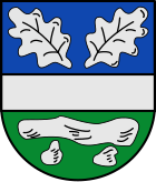
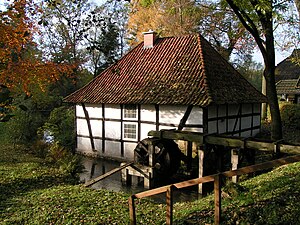
Tapping
| coat of arms | Germany map | |
|---|---|---|

|
Coordinates: 52 ° 35 ' N , 7 ° 44' E |
|
| Basic data | ||
| State : | Lower Saxony | |
| County : | Osnabrück | |
| Joint municipality : | Fürstenau | |
| Height : | 60 m above sea level NHN | |
| Area : | 79.25 km 2 | |
| Residents: | 2932 (Dec. 31, 2019) | |
| Population density : | 37 inhabitants per km 2 | |
| Postal code : | 49626 | |
| Area code : | 05435 | |
| License plate : | OS , BSB, MEL, WTL | |
| Community key : | 03 4 59 011 | |
| LOCODE : | DE GDP | |
| Community structure: | 8 districts | |
| Address of the municipal administration: |
Hauptstrasse 4 49626 Bippen |
|
| Website : | ||
| Mayor : | Helmut Tolsdorf ( SPD ) | |
| Location of the municipality of Bippen in the district of Osnabrück | ||
Bippen is a member community of the Fürstenau integrated community on the north-western border of the Osnabrück district in Lower Saxony .
geography
location
Bippen is located in the north of the Ankumer Höhe and borders in the northeast on Artland and in the west on the district of Emsland .
Community structure
Parish parts:
- Tapping
- Dalum
- Hartlage-Lulle
- Small bokern
- Lonnerbecke
- Heard
- Ohrtermersch
- Vechtel
- Restrup
- Haneberg-Brockhausen
Neighboring communities
Bippen borders mountains to the north, Eggermühlen to the east, Fürstenau to the south and the Emsland district with the communities of Andervenne , Handrup and Wettrup to the west .
climate
Temperate maritime climate influenced by humid northwest winds from the North Sea. On a long-term average, the air temperature in Bippen reaches 8.5–9.0 ° C and around 700 mm of precipitation falls. Between May and August, an average of 20-25 summer days (climatological term for days on which the maximum temperature exceeds 25 ° C) can be expected.
history
In the district of Dalum, a hoard was made for cord ceramics and the individual grave culture in the 19th century . It was an eyelet neck ring and a very rare copper ax. The Dalum stone grave is also located here . During the Second World War there was initially a false airfield in Vechtel . In 1944 it was converted to the Vechtel airfield and a squadron of Jagdgeschwader 26 was stationed there. In 1993 the 900 year celebration was celebrated (mentioned in a document from the Corvey monastery as "bipehem"). Bippen is a stage on the route of megalithic culture .
Place name
Old names of the place are: Bipeheim, Biphem, Bippehem, Bippehen, Byppehem, Bippen, Byphem, Bipham, Bypham, Byppen, Bipphe. Bippen is a name that has not yet been explained. In the second part of the Low German word “hem” means “home, settlement, village”. Maybe the first part belongs to "tremble (earthquake), shiver". The naming could refer to the yielding, vibrating, trembling ground when stepped on; this motif is by no means seldom observed, there are several places that have been named because of these soil properties.
Protestant church
The history of Bippen is closely connected to its St. George's Church. With this Evangelical Lutheran church, Bippen has the oldest church in the north of Osnabrück. As early as 855, the church was under the patronage of the Corvey Monastery . Even before the turn of the millennium, there was a baptism site here for the inhabitants of an area that corresponds relatively precisely to the present-day community of Fürstenau . The reference to water may also be found in the place name. In any case, one theory derives the place name from "bipehem" = "located at moving sources".
The Romanesque predecessor building can still be seen from the outside (walled-up arched windows, Schwagstorfer gate). The church tower was built in 1245. The church was expanded to the east around 1490 and received its Gothic shape in three nave bays and a polygonal 5/8 choir. A sacristy was added around 1700. The furnishings come from the Rococo and have been preserved unchanged (1695/1696). Altar with organ attachment by Gerhard Georg Wessel from Osnabrück (crucifixion, figures of the apostles Simon Petrus and Paulus , tetragram, King David ). The oldest piece of equipment is the Bentheim font (around 1200). There are grooves to the right of the side entrance.
The villages of Hekese, Döthen and Bockraden belong to the evangelical parish of Bippen.
Incorporations
Today's unitary community Bippen was formed on the occasion of the regional reform on July 1, 1972 from the formerly independent communities Bippen, Dalum, Hartlage, Klein Bokern, Lonnerbecke, Ohrte, Ohrtermersch and Vechtel.
Population development
The following overview shows the population of Bippen in the respective territories and on December 31st.
The figures are updates by the State Office for Statistics and Communication Technology Lower Saxony based on the census of May 25, 1987 .
The data from 1961 (June 6) and 1970 (May 27) are the census results including the places that were incorporated on July 1, 1972.
| year | Residents |
|---|---|
| 1961 | 2728 |
| 1970 | 2679 |
| 1987 | 2591 |
| 1990 | 2642 |
| 1995 | 2965 |
| 2000 | 3010 |
| 2005 | 3065 |
| 2010 | 3005 |
| 2011 | 3005 |
| 2015 | 2945 |
| 2017 | 2980 |
| 2018 | 2949 |
politics
Municipal council
The parish council currently has 13 members from three parties or groups. Mayor is Helmut Tolsdorf (SPD).
The following table shows the local election results since 1996.
| Council of the municipality of Bippen: election results and municipal councils | |||||||||||||||||||
|---|---|---|---|---|---|---|---|---|---|---|---|---|---|---|---|---|---|---|---|
| CDU | SPD | Green | FDP | Wählerge- Communities |
Individual applicants |
Others | total | electoral participation |
|||||||||||
| Electoral term | % |
|
% |
|
% |
|
% |
|
% |
|
% |
|
% |
|
% |
|
% | ||
| 1996-2001 | 55.7 | 8th | 37.7 | 5 | 4.3 | 0 | 2.4 | 0 | - | - | - | - | - | - | 100 | 13 | 71.8 | ||
| 2001-2006 | 44.4 | 6th | 47.2 | 7th | 2.4 | 0 | 4.1 | 0 | - | - | 2.0 | 0 | - | - | 100 | 13 | 70.3 | ||
| 2006-2011 | 37.5 | 6th | 57.0 | 9 | 3.1 | 0 | 2.3 | 0 | - | - | - | - | - | - | 100 | 15th | 65.5 | ||
| 2011-2016 | 38.33 | 5 | 55.57 | 7th | 6.1 | 1 | - | - | - | - | - | - | - | - | 100 | 13 | 61.1 | ||
|
Percentages rounded. Sources: State Office for Statistics and Communication Technology Lower Saxony, District Osnabrück. In the case of different information in the sources mentioned, the data from the State Office for Statistics and Communication Technology were used, as they are generally more plausible. |
|||||||||||||||||||
Town twinning
traffic
The federal highway 402 crosses the southwestern parts of the municipality Lonnerbecke and Vechtel. Bippen is on the street of the megalithic culture , which, coming from Eggermühlen , leads to Fürstenau . The "Näpfchenstein", also called "Deuvels Stein", is located on private property in Restrup, about 100 meters from the road. Bippen is also part of the Artland route .
The Rheine – Quakenbrück railway line north of Spelle, which has been closed since 1996 , runs from southwest to northeast through the municipality. Part of this route and the train station in the Bippen district are used for tourist excursions with pedal-operated bicycle trolleys. The Lingen – Berge – Quakenbrück small railway ran from 1904 to 1952 through what is now the municipality with stations in Ohrte, Ohrtermersch and Vechtel. The train station in Vechtel was the deployment point and overnight stop for the trains of the small railroad.
Buses of the Verkehrsgemeinschaft Osnabrück run to Quakenbrück and Fürstenau in regular intervals.
Personalities
Sons and daughters of the church
- Eberhard Ostendorff (1905–1984), geologist and mineralogist
literature
- Eberhard Ostendorff : Bippen. Career and history of an old Germanic settlement and place of worship. (Issue 1-6), 1978.
- 900 years of Bippen. The anniversary year 1993. Ed. Municipality of Bippen, 1995.
- Church leaders.
Web links
Individual evidence
- ↑ State Office for Statistics Lower Saxony, LSN-Online regional database, Table 12411: Update of the population, as of December 31, 2019 ( help ).
- ↑ http://www.strassedermegalithkultur.de/
- ^ Jürgen Udolph (research): The "place name researcher". In: website NDR 1 Lower Saxony . Archived from the original on August 17, 2014 ; accessed on August 3, 2019 .
- ↑ a b Federal Statistical Office (ed.): Historical municipality register for the Federal Republic of Germany. Name, border and key number changes in municipalities, counties and administrative districts from May 27, 1970 to December 31, 1982 . W. Kohlhammer, Stuttgart / Mainz 1983, ISBN 3-17-003263-1 , p. 254 .
- ↑ State Office for Statistics and Communication Technology Lower Saxony, population update ( page no longer available , search in web archives ) Info: The link was automatically marked as defective. Please check the link according to the instructions and then remove this notice.
- ↑ State Office for Statistics and Communication Technology Lower Saxony, Table 5000311
- ↑ Landkreis Osnabrück, official final results of the district election on September 9, 2001 ( Memento from May 25, 2005 in the Internet Archive ) (PDF; 528 kB)
- ^ The local elections for the district of Osnabrück on September 11, 2011 (also includes 2006 results). (PDF 8.0MB p. 23) Osnabrück district, accessed on March 6, 2016 (column "Municipal elections ").
- ↑ Entry on the partnerships of the communities in the joint community of Fürstenau on their homepage.Accessed on May 7, 2019, 3:24 pm
- ↑ Stone pages: Restruper Näpfchenstein ( Memento of the original from April 5, 2016 in the Internet Archive ) Info: The archive link was inserted automatically and has not yet been checked. Please check the original and archive link according to the instructions and then remove this notice.
- ↑ SAGEN.at: Cup stones , cup stones


