Paganico Sabino
| Paganico Sabino | ||
|---|---|---|

|
|
|
| Country | Italy | |
| region | Lazio | |
| province | Rieti (RI) | |
| Coordinates | 42 ° 11 ' N , 13 ° 0' E | |
| height | 720 m slm | |
| surface | 9.20 km² | |
| Residents | 157 (Dec. 31, 2019) | |
| Population density | 17 inhabitants / km² | |
| Post Code | 02020 | |
| prefix | 0765 | |
| ISTAT number | 057048 | |
| Popular name | Paganichesi | |
| Patron saint | San Nicola | |
| Website | Paganico Sabino | |
Paganico Sabino is a municipality with 157 inhabitants (as of December 31, 2019) in the province of Rieti in the Italian region of Lazio .
geography
Paganico Sabino is 79 km northeast of Rome and 38 km southeast of Rieti . It is located on Lake Turano in the Turano Valley in the Sabine Mountains .
The municipal area extends over an altitude difference of 536 to 1,438 meters above sea level. Paganico Sabino is a member of the Comunità Montana del Turano .
The community is located in earthquake zone 2 (medium risk).
The neighboring municipalities are Ascrea , Collegiove , Marcetelli , Pozzaglia Sabina and Varco Sabino .
traffic
Paganico Sabino is 18 km from the Carsoli motorway exit on the A24 Strada dei Parchi .
The nearest train station is also in Carsoli on the Rome - Avezzano line, 16 km away.
history
Archaeological finds show that Paganico Sabino was as early as the 3rd century BC. Was settled.
Population development
| year | 1861 | 1881 | 1901 | 1921 | 1936 | 1951 | 1971 | 1991 | 2001 |
|---|---|---|---|---|---|---|---|---|---|
| Residents | 807 | 772 | 818 | 972 | 900 | 665 | 351 | 196 | 180 |
Source: ISTAT
politics
Clemente Dominici (list of citizens) was elected mayor in June 2004 and confirmed in office in 2009.
coat of arms
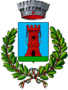
On a blue sign, on a green background, a red tower with two silver keys.
Web links
- Paganico Sabino on www.sabina.it (Italian)
- Paganico Sabino on www.comuni-italiani.it (Italian)
Individual evidence
- ↑ Statistiche demografiche ISTAT. Monthly population statistics of the Istituto Nazionale di Statistica , as of December 31 of 2019.
- ^ Italian civil defense
- ↑ Elezioni amministrative 6-7 giugno 2009 - Comunali La Repubblica on 8 June 2009

