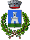
Ascrea
| Ascrea | ||
|---|---|---|

|
|
|
| Country | Italy | |
| region | Lazio | |
| province | Rieti (RI) | |
| Coordinates | 42 ° 12 ' N , 13 ° 0' E | |
| height | 318 m slm | |
| surface | 14 km² | |
| Residents | 216 (Dec. 31, 2019) | |
| Population density | 15 inhabitants / km² | |
| Post Code | 02020 | |
| prefix | 0765 | |
| ISTAT number | 057004 | |
| Popular name | Ascreani | |
| Patron saint | San Nicola | |
Ascrea is a municipality in the province of Rieti in the Italian region of Lazio with 216 inhabitants (as of December 31, 2019). It is located 78 km northeast of Rome and 35 km northwest of Rieti .
geography
Ascrea is located in the valley of Turano above Lake Turano . It is located below Monte Navegna in the Sabine Mountains . A large part of the municipality is part of the Monti Navegna e Cervia nature reserve . The districts are Ascrea, Rigatti and Stìpes.
Ascrea is a member of the Comunità Montana del Turano .
The neighboring towns are Castel di Tora , Collegiove , Longone Sabino , Marcetelli , Paganico Sabino , Pozzaglia Sabina , Rocca Sinibalda and Varco Sabino .
history
Ascrea was only founded in the 14th century and belonged to the noble Collalto family. In 1440 they sold the place to Cola Mareri, who owned the whole valley. From the 17th century the place was a center of the brigands who attacked travelers on the road to the border of the Kingdom of Naples .
Population development
| year | 1861 | 1881 | 1901 | 1921 | 1936 | 1951 | 1971 | 1991 | 2001 |
|---|---|---|---|---|---|---|---|---|---|
| Residents | 827 | 884 | 803 | 856 | 780 | 626 | 423 | 318 | 284 |
Source: ISTAT
politics
Dante D'Angeli (Citizen List) was elected Mayor in May 2006.
literature
- Christoph Henning: Lazio. The land around Rome. With walks in the Eternal City (= DuMont art travel guide ). 3rd updated edition. DuMont-Reiseverlag, Ostfildern 2006, ISBN 3-7701-6031-2 .
swell
- ↑ Statistiche demografiche ISTAT. Monthly population statistics of the Istituto Nazionale di Statistica , as of December 31 of 2019.
Web links
- Ascrea on www.comuni-italiani.it (Italian)
- www.sabina.it (Italian)
- Comunità Montana del Turano (Italian)

