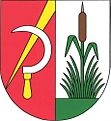
Podbořanský Rohozec
| Podbořanský Rohozec | ||||
|---|---|---|---|---|
|
||||
| Basic data | ||||
| State : |
|
|||
| Region : | Ústecký kraj | |||
| District : | Louny | |||
| Area : | 896.5597 ha | |||
| Geographic location : | 50 ° 13 ' N , 13 ° 16' E | |||
| Height: | 491 m nm | |||
| Residents : | 152 (Jan 1, 2019) | |||
| Postal code : | 441 01 | |||
| License plate : | U | |||
| traffic | ||||
| Street: | Podbořany - Valeč | |||
| structure | ||||
| Status: | local community | |||
| Districts: | 2 | |||
| administration | ||||
| Mayor : | Ladislav Gál (as of 2018) | |||
| Address: | Podbořanský Rohozec 6 441 01 Podbořanský Rohozec |
|||
| Municipality number: | 566608 | |||
| Website : | www.prohozec.snadno.eu | |||
| Location of Podbořanský Rohozec in the Louny district | ||||

|
||||
Podbořanský Rohozec , until 1949 Německý Rohozec (German German Rust , formerly also Teutschenrust ), is a municipality in the Czech Republic . It is located 15 kilometers west of Podbořany on the edge of the Duppau Mountains and belongs to the Okres Louny .
geography
The place is located in the eastern foothills of the Duppau Mountains in the headwaters of the Rohozecký potok. To the west is the Hradiště military training area . State road 221 from Podbořany to Chyše runs through the village .
Neighboring towns are Chmelišťná in the north, Nepomyšl in the east, Dětaň in the southeast, Nová Ves in the south, Ořkov in the south and the military settlement Bukovina in the west.
history
The first documented mention of Rohozec comes from 1424. At that time the place belonged to the Křečov manor and at the beginning of the 17th century the village became part of the Willomitz manor . In 1641 the Swedes devastated the village. The owner Elisabeth von Aryn dissolved Rohozec in 1654 from the Willomitz rule and formed the Rohozec manor, to which the village Dětaň still belonged. She called German settlers to the area for repopulation.
In 1746, under Karoline Countess von Schönkirchen, the church of St. Notburga was renovated. The population was mostly German-speaking and there was a Jewish community. In the course of the 18th century Rohozec was added to the rule Weitentrebetitsch and the toponym German Rust or Německý Rohozec prevailed. In 1816 a synagogue was built. In 1880, Deutsch Rust had 604 inhabitants.
After the Munich Agreement , the place was added to the German Empire and belonged to the Podersam district until 1945 .
After the Second World War, most of the Germans, who make up 98% of the population, were expelled. In 1949 the place was renamed Podbořanský Rohozec. In 1950, the Hradiště military training area was built west of the village and the villages in the mountains were cleared. In 1957 the synagogue was demolished. Since 1961 the community belongs to the Okres Louny . Between 1980 and 1990 it was incorporated into Nepomyšl .
In the course of the downsizing of the military training areas, Bukovina became part of Podbořanský Rohozec in 2015.
Community structure
The municipality Podbořanský Rohozec consists of the districts Bukovina ( Buckwa ) and Podbořanský Rohozec ( German Rust ). The basic settlement unit is Podbořanský Rohozec.
Sons and daughters of the church
- Eduard Glaser (1855–1908), explorer, Arabist and author
Attractions
- Remains of the Křečov castle, southeast of the village on Dolánecký potok
- Church of St. Notburga, built in 1746 in place of a previous building from the 14th century
Web links
Individual evidence
- ↑ http://www.uir.cz/obec/566608/Podboransky-Rohozec
- ↑ Český statistický úřad - The population of the Czech municipalities as of January 1, 2019 (PDF; 7.4 MiB)
- ↑ Directory of places on www.zanikleobce.cz
- ↑ http://zpravy.idnes.cz/v-cesku-vzniknou-ctyri-nove-obce-prvniho-starostu-si-zvoli-i-libava-11v-/domaci.aspx?c=A120213_120805_domaci_jw
- ↑ http://www.uir.cz/casti-obce-obec/566608/Obec-Podboransky-Rohozec

