
Blatno u Podbořan
| Blatno | |||||
|---|---|---|---|---|---|
|
|||||
| Basic data | |||||
| State : |
|
||||
| Region : | Ústecký kraj | ||||
| District : | Louny | ||||
| Area : | 2236.5504 ha | ||||
| Geographic location : | 50 ° 6 ' N , 13 ° 23' E | ||||
| Height: | 412 m nm | ||||
| Residents : | 509 (Jan 1, 2019) | ||||
| Postal code : | 439 83 - 439 84 | ||||
| License plate : | U | ||||
| traffic | |||||
| Street: | Rakovník - Chyše | ||||
| Railway connection: |
Plzeň – Obrnice Rakovník – Bečov nad Teplou |
||||
| structure | |||||
| Status: | local community | ||||
| Districts: | 2 | ||||
| administration | |||||
| Mayor : | Václav Beneš (as of 2013) | ||||
| Address: | Blatno 59 439 84 Blatno u Podbořan |
||||
| Municipality number: | 566004 | ||||
| Website : | www.blatno-lounsko.cz | ||||
| Location of Blatno in the Louny district | |||||

|
|||||


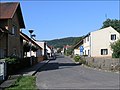
Blatno , formerly Blatno u Jesenice , (German Pladen ), is a municipality in the Czech Republic . It is located 24 kilometers west of Rakovník in the Rakonitzer Uplands and belongs to the Okres Louny .
geography
Blatno is located in the hilly landscape of the Rakonitz mountains. North of the Malměřice district, the European route 48 / state route 6 runs between Nové Strašecí and Bochov . In Blatno the railway lines Plzeň – Žatec – Obrnice and Rakovník – Bečov nad Teplou cross . To the east of the village is the large Blatno pond, which, like the Velečínský rybník in the southeast, is used for irrigation.
Neighboring towns are Malměřice in the north, Stebno in the northeast, Krty in the east, Velečín and Pastuchovice in the south, Tis u Blatna in the west and Ležky in the northwest.
history
Blatno was first mentioned in a document in 1253, when Agnes of Bohemia founded the place together with Tis u Blatna and Balková the Knights of the Cross with the Red Star . A monastery was built in Blatno, from which the villages Pastuchovice , Velečín , Ostrovec, Žďár and Krty were founded. The last news about the monastery is from 1406 and it was destroyed during the Hussite Wars .
In 1420 King Sigismund left Blatno and Tis for loyal service to his follower and master on Rabštejn, Jan Caltov from Kamenná Hora. Several changes of ownership took place in the 16th and 17th centuries and Blatno belonged to the families of Guttenstein, Schlick , Schwanberg , Kolowrat von Liebstein and Chotek von Chotkow . After the battle of the White Mountain Jiří Chotek lost his property and Ferdinand I sold Blatno in 1622 to Hermann Czernin von Chudenitz , who added the place to the rulership of Petersburg .
At Mlýnský vrch (battle hill) there was fighting between rebel subjects and imperial troops on April 26, 1680, in which 50 of the rebels fell and another 50 were injured.
Until the abolition of patrimonial in 1848, Blatno remained subordinate to the Czernin von Chudenitz in Petersburg and then became an independent community.
After the Munich Agreement , the place was added to the German Empire and belonged to the Podersam district until 1945 .
Community structure
The municipality Blatno consists of the districts Blatno ( Pladen ) and Malměřice ( Alberitz ), which also form cadastral districts.
Attractions
- Baroque church of St. Michael, verifiable since 1357
- Statue of St. Immaculate
- Gothic monastery portal in the cellar of house no.10
- Church in Malměřice
view

St. Michael Church

Statue of St. Immaculate
_1.jpg)
_-_kostel_sv._Michala.jpg)
_-_socha_Panny_Marie_Immaculaty.jpg)
Personalities
Sons and daughters
- Franz Simandl (1840–1912), double bass player and music teacher
Web links
Individual evidence
- ↑ http://www.uir.cz/obec/566004/Blatno
- ↑ Český statistický úřad - The population of the Czech municipalities as of January 1, 2019 (PDF; 7.4 MiB)
-
^ Index of names to Andree's Handatlas addendum. 8th edition, Velhagen & Klasing, Bielefeld and Leipzig 1928, p. 596
s. a. Czech WP - ↑ http://www.uir.cz/casti-obce-obec/566004/Obec-Blatno
- ↑ http://www.uir.cz/katastralni-uzemi-obec/566004/Obec-Blatno