Saint-Julien-de-Civry
| Saint-Julien-de-Civry | ||
|---|---|---|
|
|
||
| region | Bourgogne-Franche-Comté | |
| Department | Saône-et-Loire | |
| Arrondissement | Charolles | |
| Canton | Charolles | |
| Community association | Grand Charolais | |
| Coordinates | 46 ° 22 ' N , 4 ° 14' E | |
| height | 264-406 m | |
| surface | 21.01 km 2 | |
| Residents | 487 (January 1, 2017) | |
| Population density | 23 inhabitants / km 2 | |
| Post Code | 71800 | |
| INSEE code | 71433 | |
| Website | https://www.st-julien-de-civry.fr/ | |
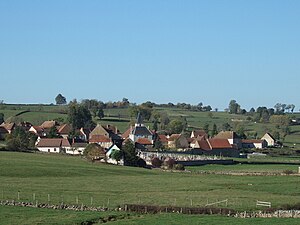
 View of Saint-Julien-de-Civry |
||
Saint-Julien-de-Civry is a French municipality with 487 inhabitants (as of January 1 2017) in the department of Saone-et-Loire in the region of Bourgogne Franche-Comté (before 2016 Bourgogne ). It belongs to the Arrondissement of Charolles and the Canton of Charolles .
geography
Saint-Julien-de-Civry is located about 70 kilometers southwest of Chalon-sur-Saône . Neighboring municipalities of Saint-Julien-de-Civry are Lugny-lès-Charolles in the north, Changy in the northeast, Dyo in the east, Saint-Germain-en-Brionnais in the southeast, Prizy in the south, Oyé in the southwest, Poisson in the west and Nochize in Northwest.
Population development
| year | 1962 | 1968 | 1975 | 1982 | 1990 | 1999 | 2006 | 2011 | 2016 |
| Residents | 664 | 630 | 550 | 515 | 526 | 550 | 519 | 504 | 484 |
| Source: Cassini and INSEE | |||||||||
Attractions
- 13th century Saint-Julien church
- Chapel of Sainte-Geneviève
- Vaulx Castle from the 17th century
- Vaux and Cachot watermills
Personalities
- Bernard Thévenet (* 1948), racing cyclist
- Charles Demôle (1828–1908), lawyer and politician, Minister for Public Infrastructure (1885/1886) and Justice (1886)
Web links
Commons : Saint-Julien-de-Civry - Collection of images, videos and audio files

