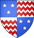
Chenay-le-Châtel
| Chenay-le-Châtel | ||
|---|---|---|

|
|
|
| region | Bourgogne-Franche-Comté | |
| Department | Saône-et-Loire | |
| Arrondissement | Charolles | |
| Canton | Paray-le-Monial | |
| Community association | Communauté de communes de Marcigny | |
| Coordinates | 46 ° 14 ' N , 3 ° 56' E | |
| height | 267-344 m | |
| surface | 32.14 km 2 | |
| Residents | 382 (January 1, 2017) | |
| Population density | 12 inhabitants / km 2 | |
| Post Code | 71340 | |
| INSEE code | 71123 | |
 Town hall (Mairie) of Chenay-le-Châtel |
||
Chenay-le-Chatel is a French commune with a population of 382 (as at 1st January 2017) in the department of Saone-et-Loire in the region of Bourgogne Franche-Comté (before 2016 Bourgogne ). It belongs to the Arrondissement of Charolles and the canton of Paray-le-Monial ( Marcigny until 2015 ).
geography
Chenay-le-Châtel is located in the Charolais countryside . Neighboring municipalities of Chenay-le-Châtel are Céron in the north, Artaix in the north and northeast, Melay in the east and southeast, Vivans in the south and Urbise in the west.
Population development
| year | 1962 | 1968 | 1975 | 1982 | 1990 | 1999 | 2006 | 2011 | 2016 |
| Residents | 646 | 602 | 531 | 477 | 404 | 386 | 396 | 401 | 389 |
| Source: Cassini and INSEE | |||||||||
Attractions
- 19th century Saint Martin church
Web links
Commons : Chenay-le-Châtel - collection of images, videos and audio files

