Sena (Spain)
| Sena municipality | ||
|---|---|---|
 Sena Town Hall (16th century)
|
||
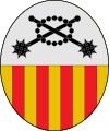
| coat of arms | Map of Spain | |

|
|
|
| Basic data | ||
| Autonomous Community : | Aragon | |
| Province : | Huesca | |
| Comarca : | Monegros | |
| Coordinates | 41 ° 43 ′ N , 0 ° 3 ′ W | |
| Height : | 221 msnm | |
| Area : | 104.7 km² | |
| Residents : | 495 (Jan. 1, 2019) | |
| Population density : | 4.73 inhabitants / km² | |
| Postal code : | 22230 | |
| Municipality number ( INE ): | 22217 | |
Sena is a municipality in the province of Huesca in the autonomous community of Aragon in Spain . It is located in the Comarca of Monegros in the valley of the Río Alcanadre on the road from Sariñena to Fraga (Huesca) .
Population development since 1900
| 1900 | 1910 | 1920 | 1930 | 1940 | 1950 | 1960 | 1970 | 1981 | 1991 | 1996 | 2001 | 2006 |
|---|---|---|---|---|---|---|---|---|---|---|---|---|
| 942 | 992 | 1,225 | 1,206 | 1,065 | 1.011 | 1.014 | 883 | 765 | 610 | 615 | 577 | 556 |
Attractions
- The Casa Consistorial from the 16th century.
- The 16th century church on the site of a Romanesque church.
- The monastery of the Discalced Carmelites from the 16th century, which is dependent on the Sigena monastery .
- Various archaeological sites, including a Visigoth cemetery.
Web links
Commons : Sena (Spain) - Collection of images, videos and audio files
- ( Page no longer available , search in web archives ) Sena in CAI-Aragón
- Website of the Asociación Cultural Senense
Individual evidence
- ↑ Cifras oficiales de población resultantes de la revisión del Padrón municipal a 1 de enero . Population statistics from the Instituto Nacional de Estadística (population update).

