Tolva
| Tolva Municipality | ||
|---|---|---|
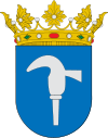
| coat of arms | Map of Spain | |

|
|
|
| Basic data | ||
| Autonomous Community : | Aragon | |
| Province : | Huesca | |
| Comarca : | Ribagorza | |
| Coordinates | 42 ° 7 ' N , 0 ° 34' E | |
| Height : | 696 msnm | |
| Area : | 59.14 km² | |
| Residents : | 121 (Jan. 1, 2019) | |
| Population density : | 2.05 inhabitants / km² | |
| Postal code : | 22585 | |
| Municipality number ( INE ): | 22229 | |
| administration | ||
| Mayor : | Rafael del Pino ( PSOE ) | |
Tolva ( Catalan Tolba ) is a Catalan-speaking municipality belonging to Franja de Aragón in the province of Huesca in the autonomous community of Aragon in Spain . It is located in the south of the Comarca Ribagorza in a typical area of the Pre-Pyrenees, forms the entrance to the Serra del Montsec and includes the middle valley of the Río Cajigar. The municipality is located in an area with a typical pre-Pyrenees climate with cold winters and little snowfall and mild summers in which the population can triple.
Municipal area
The municipality includes the localities:
- Almunia de San Lorenzo
- Luzás
- Tolva
- Sagarras Bajas
history
The name of the municipality is of Romanesque origin. Today's place on a Roman road, which is likely to go back to the time after the Reconquista , was initially known under the name "El Puy". In the following years the history of the place is connected with that of the County of Ribagorza . Intense anarchist activity developed during the Spanish Civil War ; the clashes led to repeated shootings and bombing of the place.
economy
Arable farming (grain, sunflowers, grasses) and cattle breeding (today mostly pigs in large farms, next to cattle) with little olive, nut and almond tree cultivation are predominant. Around 100 hectares have been reforested. The place has a bread factory. Tourism plays a significant role in the town, which is conveniently located on the N-230 road.
Population development
| 1991 | 1996 | 2001 | 2004 |
|---|---|---|---|
| 257 | 220 | 188 | 180 |
Attractions
- Center with a medieval character
- Castle of Fals, 2 km south of the town center, first mentioned in 1052, with a round tower
- Church of Santa Mara del Puy from the 16th century
- Hermitage of Santa Anastasia and San Cristóbal and San Miguel
Individual evidence
- ↑ Cifras oficiales de población resultantes de la revisión del Padrón municipal a 1 de enero . Population statistics from the Instituto Nacional de Estadística (population update).


