Tamarite de Litera
| Tamarite de Litera municipality | ||
|---|---|---|
| coat of arms | Map of Spain | |

|
|
|
| Basic data | ||
| Autonomous Community : | Aragon | |
| Province : | Huesca | |
| Comarca : | La litera | |
| Coordinates | 41 ° 52 ′ N , 0 ° 25 ′ E | |
| Height : | 357 msnm | |
| Area : | 110.6 km² | |
| Residents : | 3,476 (Jan 1, 2019) | |
| Population density : | 31.43 inhabitants / km² | |
| Postal code : | 22550 | |
| Municipality number ( INE ): | 22225 | |
| administration | ||
| Mayor : | Francisco Mateo Rivas ( PSOE ) | |
| Website : | www.tamaritedelitera.es | |
Tamarite de Litera ( Catalan Tamarit de Llitera ) is a Catalan-speaking municipality belonging to the Franja de Aragón in the province of Huesca in the Autonomous Community of Aragon in Spain . It is the historic capital of the Comarca La Litera and lies in the foothills of the Pyrenees .
Municipal area
The municipality includes the localities:
- Tamarite de Litera
- Algayón
- La Melusa
history
It is believed that Tamarite was already settled in Iberian times. In 1064 the place was conquered by the Aragonese, but was lost again two years later. King Alfonso I conquered Tamarite in 1107, but it fell back to the Moors in 1134 . The Reconquista only achieved final success in 1149 through Pedro de Estopiñán. In the Middle Ages, Tamarite was considered one of the most important centers of the kingdom and later the Crown of Aragon . In 1408 the place, which changed its affiliation between Aragon and Catalonia, was given the title of city. In 1642, Tamarite was set on fire and devastated by French-Catalan troops. This turmoil did not end until the Bourbon dynasty came to power in the early 18th century. The connection to Catalonia was ultimately only in the membership of the diocese of Lleida until the end of the 20th century. In 1834 the construction of the Tamarite Canal, later the Aragón and Catalonia Canal, began. This irrigation canal diverts the water from the Ésera and the Cinca to irrigate an area of over 100,000 hectares. During the Spanish Civil War , Tamarite was in Republican territory and bombed by the Spanish National Forces before it was occupied by Franco forces in the spring of 1938. Tamarite finally lost its position as the administrative center of the litera to Binéfar .
economy
The primary sector with pig and cattle breeding and fruit growing (apples, pears, peaches) is predominant. In addition, there are smaller companies in the food industry and agricultural machinery. A metal sintering company has recently set up shop . Agrotourism has developed in the service sector .
Population development
| 1986 | 1991 | 1998 | 2004 | 2008 |
|---|---|---|---|---|
| 4,091 | 3,867 | 3,655 | 3,673 | 3,715 |
Attractions
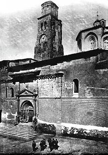
- The three-aisled Romanesque church of Santa María la Mayor from the 13th century, with semicircular apsides, has been rebuilt several times
- Nuestra Señora del Patrocinio from 1703
- Remains of the castle
Individual evidence
- ↑ Cifras oficiales de población resultantes de la revisión del Padrón municipal a 1 de enero . Population statistics from the Instituto Nacional de Estadística (population update).
literature
- Guía Total: Pirineo aragonés , 3rd edition, Grupo Anaya, Madrid 2005, pp. 166/167, ISBN 84-9776-047-6


