Bárcabo
| Bárcabo municipality | ||
|---|---|---|

|
||
| coat of arms | Map of Spain | |
 Help on coat of arms |
|
|
| Basic data | ||
| Autonomous Community : | Aragon | |
| Province : | Huesca | |
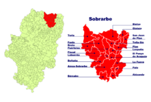
| Comarca : | Sobrarbe | |
| Coordinates | 42 ° 15 ′ N , 0 ° 4 ′ E | |
| Height : | 713 msnm | |
| Area : | 87.92 km² | |
| Residents : | 103 (Jan. 1, 2019) | |
| Population density : | 1.17 inhabitants / km² | |
| Postal code : | 22148 | |
| Municipality number ( INE ): | 22051 | |
| administration | ||
| Website : | www.barcabo.org | |
| Location of the municipality | ||

|
||
Bárcabo ( Aragonese Barcabo ) is a Spanish town and municipality in the north of the province of Huesca in the Aragon region . The municipality belongs to the Comarca Sobrarbe . Bárcabo currently (January 1, 2019) has 103 inhabitants on an area of 88.08 km².
geography
The place is 713 meters above the Vero River .
Community structure
In addition to the main town, the municipality also includes the following villages: Almazorre , Betorz , Eripol , Hospitaled , Lecina , Santa María de la Nuez and Suelves .
Architectural monuments
- Romanesque parish church of Santa Cecilia, built in the 12th century and modified in the 17th century ( Bien de Interés Cultural )
- Ruins of the castle from Roman times (Bien de Interés Cultural)
- Romanesque Bridge over the Vero River (Bien de Interés Cultural)
- Santuario de Santa María de la Nuez (Bien de Interés Cultural)
- Typical houses of the region: Casa Carruesco and Casa Sampietro (Bien de Interés Cultural)
literature
- Cayetano Enríquez de Salamanca : Rutas del Románico en la provincia de Huesca . 2nd Edition. Enríquez de Salamanca Editor, Madrid 1993, ISBN 84-398-9582-8 , p. 95.
Web links
Commons : Bárcabo - collection of images, videos and audio files
- Parish Church of Santa Cecilia at RomanicoAragones.com
Individual evidence
- ↑ Cifras oficiales de población resultantes de la revisión del Padrón municipal a 1 de enero . Population statistics from the Instituto Nacional de Estadística (population update).


