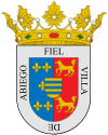
Abiego
| Abiego municipality | ||
|---|---|---|
 Abiego
|
||
| coat of arms | Map of Spain | |

|
|
|
| Basic data | ||
| Autonomous Community : | Aragon | |
| Province : | Huesca | |
| Comarca : | Somontano de Barbastro | |
| Coordinates | 42 ° 7 ′ N , 0 ° 4 ′ W | |
| Height : | 539 msnm | |
| Area : | 38.19 km² | |
| Residents : | 248 (Jan. 1, 2019) | |
| Population density : | 6.49 inhabitants / km² | |
| Postal code : | 22143 | |
| Municipality number ( INE ): | 22001 | |
Abiego is a Spanish municipality in the province of Huesca in the autonomous community of Aragon . It is located in the Comarca Somontano de Barbastro on the Alcanadre River , about 35 kilometers east of Huesca . Parts of the municipality belong to the Natural Park Parque natural de la Sierra y los Cañones de Guara .
Community structure
Alberuela de Laliena was incorporated into the 1960s.
history
The place was called Al-Byego during the Moorish conquest .
population
| 1900 | 1910 | 1930 | 1940 | 1950 | 1960 | 1970 | 1981 | 1986 | 1992 | 1999 | 2006 |
|---|---|---|---|---|---|---|---|---|---|---|---|
| 990 | 930 | 770 | 578 | 495 | 388 | 453 | 352 | 349 | 314 | 290 | 282 |
Attractions
- La Torreta , Arabic watchtower ( Bien de Interés Cultural )
- Parish Church of Santa María la Mayor , late Gothic church from the 16th century
- Ermita de Santo Domingo de Silos
- Ermita de San Sebastian
- Convento de San Joaquín , 19th century monastery
- Roman bridge
- Medieval bridge
- Wash house, built in the 18th century
art
Ulrich Rückriem erected a sculpture made of granite blocks near the site .
literature
- Huesca. Tourist guide of the Altoaragón . Editorial Pirineo, Huesca 2003, ISBN 84-87997-68-6 , p. 275.
Web links
Commons : Abiego - collection of images, videos and audio files
- Abiego in CAI-Aragón (Spanish)
- Albiego at the Comarca Somontano de Barbastro (Spanish, accessed February 9, 2014)
- Abiego on YouTube
Individual evidence
- ↑ Cifras oficiales de población resultantes de la revisión del Padrón municipal a 1 de enero . Population statistics from the Instituto Nacional de Estadística (population update).

