
Aire (Ardennes)
| Aire | ||
|---|---|---|
|
||
| region | Grand Est | |
| Department | Ardennes | |
| Arrondissement | Rethel | |
| Canton | Château-Porcien | |
| Community association | Pays Rethélois | |
| Coordinates | 49 ° 29 ′ N , 4 ° 10 ′ E | |
| height | 61-125 m | |
| surface | 6.29 km 2 | |
| Residents | 220 (January 1, 2017) | |
| Population density | 35 inhabitants / km 2 | |
| Post Code | 08190 | |
| INSEE code | 08004 | |
_Mairie.JPG) Mairie Aire |
||

Aire is a French commune with 220 inhabitants (as of January 1, 2017) in the Ardennes department in the Grand Est region (until 2015 Champagne-Ardenne ). It belongs to the Arrondissement of Rethel and the canton of Château-Porcien .
Neighboring communities are Balham in the north, Blanzy-la-Salonnaise and Saint-Loup-en-Champagne in the east, Roizy in the south and Asfeld in the west.
Population development
| year | 1962 | 1968 | 1975 | 1982 | 1990 | 1999 | 2008 | 2015 |
|---|---|---|---|---|---|---|---|---|
| Residents | 177 | 182 | 180 | 160 | 163 | 205 | 224 | 220 |
Attractions
- Saint-Remi church
- Floor cross
- War memorial

Saint-Remi church

Mural in the church
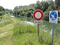
The Canal des Ardennes at Aire
_%C3%89glise.JPG)

_Canal_des_Ardennes.JPG)
Web links
Commons : Aire - collection of pictures, videos and audio files