Coucy
| Coucy | ||
|---|---|---|

|
|
|
| region | Grand Est | |
| Department | Ardennes | |
| Arrondissement | Rethel | |
| Canton | Rethel | |
| Community association | Pays Rethélois | |
| Coordinates | 49 ° 30 ' N , 4 ° 27' E | |
| height | 74-100 m | |
| surface | 6.39 km 2 | |
| Residents | 505 (January 1, 2017) | |
| Population density | 79 inhabitants / km 2 | |
| Post Code | 08300 | |
| INSEE code | 08133 | |
| Website | www.mairie-coucy.fr | |
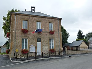
 Mairie (Town Hall) |
||
Coucy is a French commune with 505 inhabitants (as of January 1, 2017) in the Ardennes department in the Grand Est region .
geography
Coucy is 41 kilometers northeast of Reims , 35 kilometers southwest of Charleville-Mézières and 6.5 kilometers east of Rethel about 50 kilometers southwest of the border with Belgium in the Aisne valley on the D30 . The municipality is crossed by the Saulces river. Coucy belongs to the Aire urbaine de Rethel (administrative division by INSEE ).
history
Coucy was first mentioned in a document in the 12th century. The castle, where the Escannevelle family lived for a long time, was also built at that time. In the 19th century the castle was partially destroyed by fire. It was then used as a farm until it was finally destroyed in the 1950s.
Population development
| year | 1962 | 1968 | 1975 | 1982 | 1990 | 1999 | 2007 | 2016 |
| Residents | 434 | 406 | 385 | 460 | 478 | 488 | 511 | 507 |
| Sources: Cassini and INSEE | ||||||||
Attractions
The church was destroyed and rebuilt at the end of the 19th century. In 1967 the bell tower was damaged by a hurricane and replaced by a smaller tower.
economy
The image of the community is characterized by willows. Important branches of the Coucyiens are u. a. Agriculture and cattle breeding.
Web links
Individual evidence
- ^ Coucy on annuaire-mairie.fr (French) Retrieved November 2, 2009.
- ↑ Zonage en aires urbaines 1999 (pdf, French; 1.1 MB) Retrieved on November 2, 2009.
- ↑ Les entreprises on mairie-coucy.fr in French.
