
Ammerndorf
| coat of arms | Germany map | |
|---|---|---|

|
Coordinates: 49 ° 25 ' N , 10 ° 51' E |
|
| Basic data | ||
| State : | Bavaria | |
| Administrative region : | Middle Franconia | |
| County : | Fuerth | |
| Height : | 316 m above sea level NHN | |
| Area : | 5.06 km 2 | |
| Residents: | 2064 (Dec. 31, 2019) | |
| Population density : | 408 inhabitants per km 2 | |
| Postal code : | 90614 | |
| Area code : | 09127 | |
| License plate : | FÜ | |
| Community key : | 09 5 73 111 | |
| LOCODE : | DE AFZ | |
| Market structure: | 2 parts of the community | |
Market administration address : |
Cadolzburger Str. 3 90614 Ammerndorf |
|
| Website : | ||
| First Mayor : | Alexander Fritz ( FW ) | |
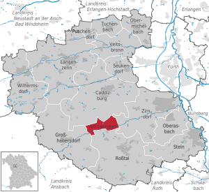
| Location of the Ammerndorf market in the Fürth district | ||
  |
||


Ammerndorf is a market in the central Franconian district of Fürth . The place owns the last private brewery in the Fürth district.
geography
location
Ammerndorf is located in Rangau , about 16 km west of Nuremberg . The Bibert flows through the village and flows into the Rednitz near Zirndorf .
Neighboring communities
The neighboring municipalities are (starting in the north in a clockwise direction):
Community structure
There are two officially named parts of the municipality (the type of settlement is given in brackets ):
- Ammerndorf (main town)
- Bubenmühle ( wasteland )
Natural allocation
The flat, undulating to hilly Keuper landscape of the municipality is located in the natural spatial unit of the Franconian Keuper-Lias-Land and the natural space unit of the Middle Franconian Basin .
geology
In Ammerndorf, rocks from the geological group of the Middle Keuper come to light. Bubble sandstone from the Hassberge Formation are underlain by sandstone and clay / siltstone from the Steigerwald Formation . The rivers such as Reichenbach and Steinbacher Bächl are determined by Quaternary valley fillings. Gravel river gravel also occurs in the Bibert Valley.
climate
The landscape of Ammerndorf is located in the cool, temperate climate zone and has a humid climate . The community is located in the transition area between the humid Atlantic and dry continental climates . According to the Köppen-Geiger climate classification, Ammerndorf is part of the warm, temperate rainy climate (Cfb climate). The mean air temperature of the warmest month remains below 22 ° C and that of the coldest month above -3 ° C.
The average annual rainfall is 656 mm, with an overweight in summer. June is the wettest month with 79 mm. The wettest month is February with 40 mm. The mean temperature over the entire year is 8.8 ° C. From a climatological point of view, July is the warmest month of the year with an average of 18.2 ° C. The lowest temperatures are recorded in January with an average of –0.7 ° C.
history
Until the church is planted
The place was first mentioned in 1246 as "Amelradorf". The defining word of the place name is probably the feminine personal name Amelrad. A person of this name can be assumed to be the founder of the settlement. In 1414 the place was called "Ammerdorff", and in 1438 it was called "Ammerndorf" for the first time in its current form.
The Nuremberg Castle Count Konrad I renounced after a long dispute with the monastery Heilsbronn provide goods and people. Pope Innocent IV confirmed the monastery ownership in 1249. In Ammerndorf the grain trade of the surrounding villages took place. In the First Margrave War (1449–1450), the place was attacked by the imperial city of Nuremberg due to the large stocks of grain.
At the end of the 18th century there were 47 properties in Ammerndorf. The high court exercised the Brandenburg-Ansbach Oberamt Cadolzburg . The Brandenburg-Ansbach monastery administrator's office in Heilsbronn was in charge of the village and community . The landlords were the Heilsbronn monastery administration office (two courtyards, 25 estates, 17 houses) and the Cadolzburg caste office (one estate, two semi-estates).
Ammerndorf belonged to the Hohenzollern principality of Ansbach , which was acquired by Prussia in 1791 and was part of the Franconian Empire from 1500 , and had market rights with extensive proprietary rights. As part of the Prussian Principality of Ansbach, Ammerndorf fell to the Kingdom of Bavaria in the Treaty of Paris (February 1806) by exchange .
As part of the municipal edict , the Ammerndorf tax district was formed in 1808 , to which the Bubenmühle belonged. In the same year the rural community Ammerndorf was founded, which was congruent with the tax district. She was in administration and jurisdiction of the district court Cadolzburg and in the financial administration of the bursary Cadolzburg (in 1920 the tax office Cadolzburg renamed). From 1862 Ammerndorf was administered by the Fürth district office (renamed the Fürth district in 1938 ). Jurisdiction remained with the Cadolzburg District Court until 1879, from 1880 to March 1, 1931 it was with the Cadolzburg District Court , since then it has been exercised by the Fürth District Court . The financial management was taken over on January 1, 1929 by the Fürth tax office .
Administrative community
From 1978 until its dissolution in 1998, Ammerndorf and Großhabersdorf formed the Großhabersdorf administrative community .
21st century
In the competition Our village should become more beautiful , the market was able to win the silver medal at the federal level in 2001.
Population development
Ammerndorf municipality
| year | 1818 | 1840 | 1852 | 1861 | 1867 | 1871 | 1875 | 1880 | 1885 | 1890 | 1895 | 1900 | 1905 | 1910 | 1919 | 1925 | 1933 | 1939 | 1946 | 1950 | 1961 | 1970 | 1987 | 1995 | 2007 | 2016 | 2019 |
|---|---|---|---|---|---|---|---|---|---|---|---|---|---|---|---|---|---|---|---|---|---|---|---|---|---|---|---|
| Residents | 459 | 511 | 540 | 531 | 535 | 533 | 527 | 545 | 525 | 503 | 474 | 452 | 431 | 468 | 521 | 543 | 529 | 557 | 926 | 946 | 758 | 912 | 1286 | 1818 | 2172 | 2057 | 2063 |
| Houses | 66 | 73 | 84 | 86 | 90 | 96 | 123 | 137 | 337 | 565 | |||||||||||||||||
| source |
Ammerndorf part of the municipality
| year | 1818 | 1840 | 1861 | 1871 | 1885 | 1900 | 1925 | 1950 | 1961 | 1970 | 1987 |
|---|---|---|---|---|---|---|---|---|---|---|---|
| Residents | 449 | 504 | 515 | 519 | 516 | 434 | 531 | 935 | 747 | 902 | 1282 |
| Houses | 64 | 71 | 84 | 88 | 94 | 121 | 135 | 335 | |||
| source |
politics
Market council
The municipality council of Ammerndorf has 14 members.
| CSU | SPD | FW | total | |
| 2008 | 4th | 6th | 4th | 14 seats |
| 2014 | 6th | 4th | 4th | 14 seats |
| 2020 | 5 | 4th | 5 | 14 seats |
For the local election on March 15, 2020, the Free Voters received 39.60% of the vote. 32.72% fell on the CSU, while the SPD managed to get 26.80%.
mayor
From 1990 to 2014 Franz Schmuck ( SPD ) was the 1st mayor. Then Alexander Fritz ( FW ) was elected mayor in a runoff election, who was also re-elected for the 2020 local election (again in a runoff) against the CSU candidate Müller.
badges and flags
The municipality of Ammerndorf has had a coat of arms since 1970.
|
|
Blazon : “ Split between gold and red; the front into two rows of red and silver geschachter oblique bar , behind a golden mill wheel . "
Yellow and red municipal flag |
| Justification for the coat of arms: The sloping bar is the so-called Cistercian bar . Ammerndorf was associated with the Heilsbronn monastery for a long time . The mill wheel points to the historic mill on the Bibert. |
Town twinning
-
 Switzerland : There has been a partnership with the municipality of Dulliken since 1996 .
Attractions

Parish Church of St. Peter and Paul
In the middle of the market is the Evangelical Lutheran parish church of St. Peter and Paul. A walled cemetery surrounds the sacred building. The sandstone churchyard wall dates from the 13th and 14th centuries and is now two meters high. The masonry was renewed in the baroque period . The hall church in sandstone block construction with hipped roof represents a late medieval choir tower that was repaired between 1720 and 1730. In this context, the stone-sighted church tower with a bell roof was rebuilt. The interior of the church was designed in the baroque style in 1761 by the margravial agricultural inspector and master builder Johann David Steingruber .
Ammerndorfer mill
The Ammerndorfer Mühle was built in 1607 by the miller Stefan Züll and is located on a Bibert loop south of the church. The two-storey residential and mill building is characterized by a richly decorated half-timbered gable with flat carvings in colored versions. The Ammerndorfer Mühle is one of the most beautiful mills and half-timbered buildings in the Bibert Valley and the surrounding area.
Economy and Infrastructure
Economy including agriculture and forestry
In 1998 there were no employees in the field of agriculture and forestry, 66 in the manufacturing sector and no employees in the field of trade and transport at the place of work. In the other economic sectors 113 people were employed at the place of work subject to social security contributions. There were a total of 770 employees at the place of residence subject to social security contributions. There were four companies in the main construction trade. In 1999 there were nine farms with an agricultural area of 199 hectares. Of this, 166 hectares were arable land and 33 hectares were permanent green.
traffic
The state road 2245 runs southwest through Vincenzenbronn after Großhabersdorf or east via Weinzierlein and winter village to Zirndorf . The state road 2409 runs north to Cadolzburg . The district road FÜ 15 runs south to Buttendorf . A communal road runs northwest to Vogtsreichenbach .
The market is in the VGN transport association . In local transport, buses on line 113 commute regularly via Fürth Süd to the terminus Rothenburger Straße Nuremberg with a connection to the subway. Line 114 runs to Rosstal Bahnhof with connection to the Nuremberg - Ansbach S-Bahn. In addition, buses number 112 to Fürth and number 136 to Langenzenn stop in Ammerndorf. Until 1986, Ammerndorf had the Bibertbahn , a single track stretching to the Nürnberg-Stein train station. In 1986 rail traffic was discontinued and replaced by bus connections. The former route is now used as a footpath and bike path. Gas supply lines were laid under the former railway line between Wintersdorf and Ammerndorf. Some bridge structures along the old route and the square in the town center, still known today as the station square, are reminiscent of the rail connection. In contrast to many other buildings on the station square, the station building was not demolished; it now serves as a medical center.
Sports
Soccer
The soccer department is the largest department of TSV Ammerndorf. The first team of the former district division played in the 2009/2010 season in the district class 3 Nuremberg / Frankenhöhe. TSV Ammerndorf won the championship there and has been playing in the Frankenhöhe district league since the 2010/2011 season. The second team was also able to win the championship title in the reserve round in 2009/2010 and will play in the newly founded B-Class in the 2010/2011 season. In this league she was champion in 2010/2011. The team has been playing in A-Class 9 since 2011. In 2009 the senior A-team (old men) became champions in the Nuremberg / Fürth district and played in the Nuremberg / Fürth district in the 2010 season. There, too, the championship could be won again with a large margin. This makes the promotion to the highest senior class perfect. In 2011 the senior A-team was also champion in the top division, the district league. With three championships in a row, the senior A team of TSV Ammerndorf is one of the most successful teams in its age group in the Middle Franconia district. At the beginning of 2012, the Fürth district championship was won in the hall. For 2012 the team was qualified for the district championship. Holiday soccer camps have been held at TSV Ammerndorf since 2008 in cooperation with the Bavarian Football Association (BFV). TSV Ammerndorf has two grass pitches and a training field. Since July 2011, the club also has a girls' team (U17 juniors). This was 2011 autumn champion and in the same season (2012) champion of group 1 in the Nuremberg / Frankenhöhe district. In the following season (2013), the B-Juniors won the cup.
Table tennis
The table tennis department of TSV Ammerndorf participates in the 2012/2013 season with two men's teams at the district level.
Other clubs
There are among others the following clubs:
- Model train enthusiasts Ammerndorf
- Heimat- und Gartenbauverein Ammerndorf
- Beekeeping Association Ammerndorf
- Ammerndorf volunteer fire brigade
- Gymnastics and sports club Ammerndorf
- Ammerndorf singers' circle
Ammerndorfer beer
The Ammerndorfer Bier brewery has been producing beer for over 280 years. Today it is the only private brewery in the Fürth district.
Architectural monuments
education
There are the following facilities:
- two kindergartens:
- Protestant kindergarten Dandelion
- Montessori Kindergarten Spatzennest
Sons and daughters of the church
- Klaus Rösch (1945–2018), former German politician, member of the Baden-Württemberg state parliament, member of the Bundestag
literature
- Johann Kaspar Bundschuh : Ammerndorf . In: Geographical Statistical-Topographical Lexicon of Franconia . tape 1 : A-egg . Verlag der Stettinische Buchhandlung, Ulm 1799, DNB 790364298 , OCLC 833753073 , Sp. 83 ( digitized version ).
- August Gebeßler : City and District of Fürth (= Bavarian Art Monuments . Volume 18 ). Deutscher Kunstverlag, Munich 1963, DNB 451450957 , p. 70-73 .
- Hanns Hubert Hofmann : Nuremberg-Fürth (= Historical Atlas of Bavaria, part Franconia I, 4). Commission for Bavarian State History, Munich 1954, DNB 452071224 , p. 99 ( digitized version ). Ibid. S. 226 ( digitized version ).
- Georg Muck: History of Heilsbronn Monastery from prehistoric times to modern times . tape 2 . For Kunstreprod. Schmidt, Neustadt an der Aisch 1993, ISBN 3-923006-90-X , p. 142–153 (first edition: Beck, Nördlingen 1879).
- Wolf-Armin von Reitzenstein : Lexicon of Franconian place names. Origin and meaning . Upper Franconia, Middle Franconia, Lower Franconia. CH Beck, Munich 2009, ISBN 978-3-406-59131-0 , p. 24-25 .
- Gottfried Stieber: Ammerndorf . In: Historical and topographical news from the Principality of Brandenburg-Onolzbach . Johann Jacob Enderes, Schwabach 1761, p. 196–197 ( digitized version ).
- Pleikard Joseph Stumpf : Ammerndorf . In: Bavaria: a geographical-statistical-historical handbook of the kingdom; for the Bavarian people . Second part. Munich 1853, p. 700-701 ( digitized version ).
- Wolfgang Wiessner: City and District of Fürth (= Historical Place Name Book of Bavaria, Middle Franconia . Volume 1 ). Commission for Bavarian State History, Munich 1963, DNB 455524629 , p. 6-7 .
Web links
- Homepage of the Ammerndorf market
- Ammerndorf: Official statistics of the LfStat
- Ammerndorf in the Topographia Franconiae of the University of Würzburg , accessed on September 21, 2019.
- Ammerndorf in the historical directory of the association for computer genealogy
Individual evidence
- ↑ "Data 2" sheet, Statistical Report A1200C 202041 Population of the municipalities, districts and administrative districts 1st quarter 2020 (population based on the 2011 census) ( help ).
- ↑ Markt Ammerndorf: administrative management. Retrieved May 16, 2020 .
- ^ Ammerndorf community in the local database of the Bavarian State Library Online . Bavarian State Library, accessed on September 21, 2019.
- ↑ Map of the main natural space units and natural space units in Bavaria. Bavarian State Office for the Environment, accessed on March 8, 2018 .
- ↑ UmweltAtlas Bayern - Geology. Bavarian State Office for the Environment, accessed on March 8, 2018 .
- ↑ Alexander Merkel: Climate & Weather Ammerndorf. AM Online Projects, accessed March 9, 2018 .
- ↑ W.-A. v. Reitzenstein, p. 24 f .; W. Wiessner, p. 6 f.
- ↑ W. Wiessner, p. 6.
- ^ A b c Edmund Zöller, Dieter Dietrich: Franconian fortified churches in Rangau and in Knoblauchsland . Seehars, Uffenheim 1993, ISBN 978-3-927598-11-9 , pp. 26th f .
- ↑ HH Hofmann, p. 99.
- ↑ HH Hofmann, p. 226; Address and statistical handbook for the Rezatkreis in the Kingdom of Baiern . Buchdruckerei Chancellery, Ansbach 1820, p. 27 ( digitized version ).
- ↑ Federal competition “Our village should become more beautiful - Our village has a future” - results 1961–2004
- ↑ a b Only inhabited houses are given. In 1818 these were designated as fireplaces , in 1840 as houses , and from 1871 to 2016 as residential buildings.
- ↑ a b Alphabetical index of all the localities contained in the Rezatkreise according to its constitution by the newest organization: with indication of a. the tax districts, b. Judicial Districts, c. Rent offices in which they are located, then several other statistical notes . Ansbach 1818, p. 5 ( digitized version ). For the municipality of Ammerndorf plus the residents and buildings of Bubenmühle (p. 13).
- ^ A b Eduard Vetter (Ed.): Statistical handbook and address book of Middle Franconia in the Kingdom of Bavaria . Self-published, Ansbach 1846, p. 64-65 ( digitized version ).
- ↑ a b c d e f g h i j k l Bavarian State Statistical Office (Hrsg.): Historical municipality directory: The population of the municipalities of Bavaria from 1840 to 1952 (= contributions to Statistics Bavaria . Issue 192). Munich 1954, DNB 451478568 , p. 172 , urn : nbn: de: bvb: 12-bsb00066439-3 ( digitized version ).
- ↑ a b Joseph Heyberger, Chr. Schmitt, v. Wachter: Topographical-statistical manual of the Kingdom of Bavaria with an alphabetical local dictionary . In: K. Bayer. Statistical Bureau (Ed.): Bavaria. Regional and folklore of the Kingdom of Bavaria . tape 5 . Literary and artistic establishment of the JG Cotta'schen Buchhandlung, Munich 1867, Sp. 1029 , urn : nbn: de: bvb: 12-bsb10374496-4 ( digitized version ).
- ↑ a b Kgl. Statistical Bureau (ed.): Complete list of localities of the Kingdom of Bavaria. According to districts, administrative districts, court districts and municipalities, including parish, school and post office affiliation ... with an alphabetical general register containing the population according to the results of the census of December 1, 1875 . Adolf Ackermann, Munich 1877, 2nd section (population figures from 1871, cattle figures from 1873), Sp. 1193 , urn : nbn: de: bvb: 12-bsb00052489-4 ( digitized version ).
- ↑ a b K. Bayer. Statistical Bureau (Ed.): Localities directory of the Kingdom of Bavaria. According to government districts, administrative districts, ... then with an alphabetical register of locations, including the property and the responsible administrative district for each location. LIV. Issue of the contributions to the statistics of the Kingdom of Bavaria. Munich 1888, Section III, Sp. 1125 ( digitized version ).
- ↑ a b K. Bayer. Statistical Bureau (Ed.): Directory of localities of the Kingdom of Bavaria, with alphabetical register of places . LXV. Issue of the contributions to the statistics of the Kingdom of Bavaria. Munich 1904, Section II, Sp. 1193 ( digitized version ).
- ↑ a b Bavarian State Statistical Office (ed.): Localities directory for the Free State of Bavaria according to the census of June 16, 1925 and the territorial status of January 1, 1928 . Issue 109 of the articles on Bavaria's statistics. Munich 1928, Section II, Sp. 1229 ( digitized version ).
- ↑ a b Bavarian State Statistical Office (ed.): Official place directory for Bavaria - edited on the basis of the census of September 13, 1950 . Issue 169 of the articles on Bavaria's statistics. Munich 1952, DNB 453660975 , Section II, Sp. 1059 ( digitized version ).
- ↑ a b Bavarian State Statistical Office (ed.): Official city directory for Bavaria, territorial status on October 1, 1964 with statistical information from the 1961 census . Issue 260 of the articles on Bavaria's statistics. Munich 1964, DNB 453660959 , Section II, Sp. 779 ( digitized version ).
- ↑ a b Bavarian State Statistical Office (Hrsg.): Official local directory for Bavaria . Issue 335 of the articles on Bavaria's statistics. Munich 1973, DNB 740801384 , p. 174 ( digitized version ).
- ↑ a b Bavarian State Office for Statistics and Data Processing (Ed.): Official local directory for Bavaria, territorial status: May 25, 1987 . Issue 450 of the articles on Bavaria's statistics. Munich November 1991, DNB 94240937X , p. 336 ( digitized version ).
- ↑ a b Ammerndorf: Official statistics of the LfStat
- ↑ Election of the municipal council - municipal elections 2020 in the Ammerndorf market - overall result. Retrieved March 30, 2020 .
- ↑ Run-off election for the mayor - 2020 municipal elections in the Ammerndorf market - overall result. Retrieved March 30, 2020 .
- ↑ Entry on the coat of arms of Ammerndorf in the database of the House of Bavarian History
- ↑ Ammerndorf. In: Kommunalflaggen.eu. Retrieved June 23, 2020 .
- ↑ a b List of monuments for Ammerndorf. Bavarian State Office for Monument Preservation, February 2, 2018, accessed on March 6, 2018 .
- ↑ a b Bavarian Monument Atlas. State Office for Digitization, Broadband and Surveying, accessed on March 6, 2018 .
- ^ Website of the Ammerndorfer Bier brewery

Ammerndorf | Cadolzburg | Großhabersdorf | Langenzenn | Oberasbach | Obermichelbach | Puschendorf | Ross Valley | Seukendorf | Stone | Tuchenbach | Veitsbronn | Wilhermsdorf | Zirndorf