
Obermichelbach
| coat of arms | Germany map | |
|---|---|---|

|
Coordinates: 49 ° 32 ' N , 10 ° 55' E |
|
| Basic data | ||
| State : | Bavaria | |
| Administrative region : | Middle Franconia | |
| County : | Fuerth | |
| Management Community : | Obermichelbach-Tuchenbach | |
| Height : | 328 m above sea level NHN | |
| Area : | 9.28 km 2 | |
| Residents: | 3314 (Dec. 31, 2019) | |
| Population density : | 357 inhabitants per km 2 | |
| Postal code : | 90587 | |
| Area code : | 0911 | |
| License plate : | FÜ | |
| Community key : | 09 5 73 123 | |
| LOCODE : | DE OBM | |
| Community structure: | 3 parts of the community | |
| Address of the municipal administration: |
Vacher Str. 25 90587 Obermichelbach |
|
| Website : | ||
| Mayor : | Bernd Zimmermann ( CSU ) | |
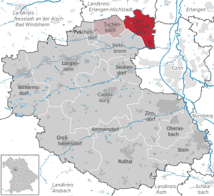
| Location of the municipality of Obermichelbach in the Fürth district | ||
  |
||

.jpg)

Obermichelbach (colloquially: "Michlbach") is a municipality in the Middle Franconian district of Fürth and the seat of the Obermichelbach-Tuchenbach administrative community .
geography
Geographical location
Obermichelbach is located on a plateau between the valleys of the Middle Aurach in the north, the Regnitz in the east and the Zenn in the south.
Neighboring communities
The neighboring communities are:
(List: starting in the north and clockwise)
Community structure
The municipality has three officially named municipal parts (the type of settlement is indicated in brackets ):
- Obermichelbach ( parish village )
- Untermichelbach ( village )
- Rothenberg (village)
history
Until the church is planted
In 1337 the parish of Herzogenaurach transferred 22 places to the Heilig-Geist-Spital Nürnberg, including very probably Obermichelbach, Untermichelbach and Rothenberg. In 1348 the place was first mentioned in a document as "Grozzenmichelbach". The place name is derived from the name of the water body "Michelbach", whose defining word is the Middle High German "michel" (= large, wide).
1360/1370 the place was listed in the land register of the burgraviate of Nuremberg . In the Salbuch of the Cadolzburg office of 1414, the names of the feudal subjects of the Burgrave of Nuremberg were named in "Obernmichelbach". In the Salbuch of the Cadolzburg office of 1464, "Obermichelbach", "Nydernmichelbach" and "Rotperg" were named. In a description of Nuremberg and its surrounding area in 1504, "Obernmichelbach", "Unter-Michelbach", "Zum Rotenperg" were also mentioned. In 1634 Obermichelbach and Rothenberg burned down during the Thirty Years' War . The first schoolmaster was mentioned in 1664, the skin carver Thomas Haindel . In the Oberamtsbeschreibung by Johann Georg Vetter in 1732 Obermichelbach, Untermichelbach and Rothenberg were described. A copper engraving by Obermichelbach from 1759 is the oldest surviving picture of the place.
At the end of the 18th century there were 20 properties in Obermichelbach. The high court and the village and community rulership was exercised by the Brandenburg-Ansbach municipal bailiff's office in Langenzenn . The Brandenburg-Bayreuth City Bailiff's Office in Markt Erlbach exercised the high court over the Bavarian subjects to a limited extent. The landlords were the Neuhof caste office in Brandenburg-Bayreuth (2 courtyards), the Langenzenn hospital and von Fürer together (5 courtyards, 1 estate, 1 house, 1 shepherd's house), the imperial city of Nuremberg : Spitalamt (1 courtyard, 1 house), Landesalmosenamt (1st floor) Half yard) and Nuremberg owners: von Muffel (2 half yards, 2 estates), von Praun (2 half yards, 1 estate).
1792 the Principality of Ansbach - and thus also Obermichelbach - to Prussia . In 1806 this was incorporated into the Kingdom of Bavaria .
19th century
As part of the municipal edict, the Obermichelbach tax district was formed in 1808 . The first section included the places Rothenberg and Untermichelbach , the second section included the places Burgstall , Galgenhof , Hauptendorf , Schleifmühle and Steinbach . In the same year the rural community of Obermichelbach was founded, which was congruent with the I. section of the tax district. The municipality was under the administration and jurisdiction of the Cadolzburg Regional Court and the Cadolzburg Rent Office for the financial administration . From 1862 Obermichelbach was administered by the Fürth district office (renamed the Fürth district in 1938 ). In 1872 jurisdiction was transferred to the Fürth District Court , and since 1880 it has been with the Fürth District Court . The financial administration was taken over by the Rentamt Fürth (renamed Finanzamt Fürth in 1920 ) in 1870 .
In 1835 the community received cadastre with parcels and house numbers. There were 35 farms.
The planning of a railway line from Siegelsdorf station via Obermichelbach to Herzogenaurach was finally rejected in 1883. In 1869 the office of mayor was created on the basis of a new municipal code and in 1870 a municipal committee.
20th century
In 1909 Obermichelbach received a public telephone and in 1912 it was connected to the power grid. A parish hall was built in Obermichelbach in 1911. Self-government was introduced in 1919 by a new municipal code and the municipality committee was replaced by a municipality council.
In 1921 the school community took over the school building from the church foundation. A post office was set up in 1936. In 1942 two church bells were delivered and melted down. In 1943 there were air raids on Ober- and Untermichelbach. On April 17, 1945 the troops of the United States Army occupied the three places of the municipality. The land consolidation was completed in 1967. The Obermichelbach elementary school was dissolved in 1969 and incorporated into the Veitsbronn Association School. In 1974 the Protestant kindergarten was inaugurated. In the course of the regional reform in Bavaria, Obermichelbach, together with Tuchenbach and Puschendorf, left the Veitsbronn administrative association in 1980 to found the Obermichelbach-Puschendorf-Tuchenbach administrative association. This became in 1998 when the municipality of Puschendorf left the administrative community of Obermichelbach-Tuchenbach . In 1979 the multi-purpose building with town hall and fire station was inaugurated. In 1997 the citizens' hall was built, into which the town hall is also integrated.
21st century
The administrative headquarters of the Obermichelbach-Tuchenbach administrative association was relocated from Tuchenbach to the Obermichelbach administrative building in 2002.
Population development
Obermichelbach community
| year | 1818 | 1840 | 1852 | 1861 | 1867 | 1871 | 1875 | 1880 | 1885 | 1890 | 1895 | 1900 | 1905 | 1910 | 1919 | 1925 | 1933 | 1939 | 1946 | 1950 | 1961 | 1970 | 1987 | 2007 | 2011 | 2016 |
|---|---|---|---|---|---|---|---|---|---|---|---|---|---|---|---|---|---|---|---|---|---|---|---|---|---|---|
| Residents | 283 | 413 | 371 | 372 | 372 | 402 | 402 | 437 | 436 | 402 | 419 | 408 | 422 | 411 | 378 | 376 | 385 | 342 | 471 | 531 | 411 | 449 | 1795 | 2988 | 3141 | 3252 |
| Houses | 47 | 43 | 60 | 61 | 64 | 63 | 63 | 74 | 491 | 1029 | ||||||||||||||||
| source |
Part of the municipality Obermichelbach
| year | 1818 | 1840 | 1861 | 1871 | 1885 | 1900 | 1925 | 1950 | 1961 | 1970 | 1987 |
|---|---|---|---|---|---|---|---|---|---|---|---|
| Residents | 152 | 219 | 196 | 216 | 242 | 222 | 213 | 318 | 258 | 270 | 1306 |
| Houses | 27 | 20th | 34 | 35 | 37 | 37 | 43 | 358 | |||
| source |
Religions

The St. Jakob chapel was first mentioned in 1414. In 1483 two altars were consecrated in the church of St. Jakob in Obermichelbach. Obermichelbach was 1,528 evangelical church of the Holy Spirit Hospital and was eliminated from the parish of Herzogenaurach, the pastor received in 1566 their own parsonage. The Church of the Holy Spirit was rebuilt and consecrated in 1660. In 1698 the parishes of Obermichelbach and Veitsbronn merged, the seat was Obermichelbach. In 1829 the church in Obermichelbach was renovated and received a new organ in 1878. The church bells melted down in 1942 were replaced by the three bells donated by Mayor Hans Tauber and his sister Anna Abendschein; in 1983 these were consecrated.
politics
Municipal council
The municipal council of Obermichelbach has 16 members since the 2014 local elections.
For the local elections on March 15, 2020, the CSU received the most votes with 44.59%. With 27.78%, the free voters move into the municipal council in Obermichelbach as the second largest group. The Greens achieved 13.34%, while 12.73% of the Obermichelbacher voted for the SPD. With 1.55%, the FDP did not get a seat in the local council.
| Electoral roll | CSU a | SPD | Green | FW b | total | |
| 1946 | 8th | 8 seats | ||||
| 1948 | 6th | 6 seats | ||||
| 1952 | 8th | 8 seats | ||||
| 1956 | 6th | 6 seats | ||||
| 1960 | 4th | 2 | 6 seats | |||
| 1966 | 5 | 1 | 6 seats | |||
| 1972 | 5 | 3 | 8 seats | |||
| 1978 | 7th | 3 | 2 | 12 seats | ||
| 1984 | 7th | 3 | 2 | 12 seats | ||
| 1990 | 6th | 4th | 2 | 12 seats | ||
| 1996 | 7th | 3 | 2 | 2 | 14 seats | |
| 2002 | 7th | 2 | 2 | 3 | 14 seats | |
| 2008 | 7th | 1 | 2 | 4th | 14 seats | |
| 2014 | 7th | 2 | 2 | 5 | 16 seats | |
| 2020 | 7th | 2 | 2 | 5 | 16 seats |
mayor
In 1946 Johann Brummer was elected mayor from the electoral roll, he was replaced in 1948 by Hans Tauber from the CSU / voter community and confirmed in office in 1952, 1956, 1960, 1966, 1972, 1978 and most recently in 1984. Hans Lämmermann (CSU / Voting Association) replaced him in 1990 after serving as a substitute for 18 years and was re-elected in 1996. He was followed in 2002 by Reinhold Hum (CSU / voter community), who did not run again in 2008. In 2008 Herbert Jäger from the Free Voters won the election and in 2014 he was re-elected.
On May 1, 2020, Bernd Zimmermann (CSU) took office as mayor in Obermichelbach. On March 15, 2020 he was able to prevail against his opponent Ulla Schwarte (Free Voters / SPD) with 54.95%.
badges and flags
The municipality of Obermichelbach was granted the right to carry a coat of arms and a flag after a resolution by the municipal council in a letter from the government of Middle Franconia dated October 13, 1977.
|
|
Blazon : “In the tin cut diagonally divided by gold and black; above a red ploughshare , below a silver sloping beam . "
Red and white municipal flag |
| Establishment of the coat of arms: Since 1504 the Linck von Schwabach family has been verifiable as landlords in Obermichelbach. The diagonal division in pewter cut was adopted from their coat of arms. The red plowshare stands for agriculture, the shaft bar is speaking for Michelbach, which gives the place its name. The colors silver and black are the colors of the Principality of Ansbach , which held sovereignty. |
Town twinning
![]() Since October 10, 1992, Obermichelbach has been twinned with Hormersdorf in the Saxon Erzgebirgskreis .
Since October 10, 1992, Obermichelbach has been twinned with Hormersdorf in the Saxon Erzgebirgskreis .
Architectural monuments
traffic
The district road FÜ 17 / FÜs 3 runs southwest to Veitsbronn or northeast to state road 2263 approx. 1.5 km northwest of Vach . The FÜ 21 / ERH 25 leads to Niederndorf to the state road 2263. Municipal roads lead to Tuchenbach to the FÜ 8 , to Untermichelbach and to Rothenberg .
The planning of a railway line from Siegelsdorf station via Obermichelbach to Herzogenaurach is finally rejected in 1883.
In 1967 the Deutsche Bundesbahn introduced the rail bus route from Fürth via Obermichelbach and Tuchenbach to Herzogenaurach, on which a connection from Erlangen via Herzogenaurach to Fürth will run in winter 2007. As part of a reorganization of bus traffic in the northern district, line 126 of the OVF has been connecting Fürth with Tuchenbach via Obermichelbach and Veitsbronn since the timetable change in winter 2007. Line 123 has been set up as a ring line serving the route Herzogenaurach – Obermichelbach – Tuchenbach – Puschendorf – Tuchenbach – Herzogenaurach, alternating clockwise and counterclockwise every hour.
In the evenings and on weekends there is a collective taxi to the train station in Siegelsdorf.
The Franconian Marienweg runs through the village .
Sons and daughters of the church
- Georg Andreas Will (1727–1798), professor and historian
literature
- Johann Kaspar Bundschuh : Michelbach, the upper and lower . In: Geographical Statistical-Topographical Lexicon of Franconia . tape 3 : I-Ne . Verlag der Stettinische Buchhandlung, Ulm 1801, DNB 790364301 , OCLC 833753092 , Sp. 595 ( digitized version ).
- Johann Kaspar Bundschuh : Obermichelbach . In: Geographical Statistical-Topographical Lexicon of Franconia . tape 4 : Ni-R . Verlag der Stettinische Buchhandlung, Ulm 1801, DNB 790364301 , OCLC 833753101 , Sp. 199 ( digitized version ).
- August Gebeßler : City and District of Fürth (= Bavarian Art Monuments . Volume 18 ). Deutscher Kunstverlag, Munich 1963, DNB 451450957 , p. 135-136 .
- Hanns Hubert Hofmann : Nuremberg-Fürth (= Historical Atlas of Bavaria, part Franconia I, 4). Commission for Bavarian State History, Munich 1954, DNB 452071224 , p. 155-156 ( digitized version ). Ibid. S. 232 ( digitized version ).
- Wolf-Armin von Reitzenstein : Lexicon of Franconian place names. Origin and meaning . Upper Franconia, Middle Franconia, Lower Franconia. CH Beck, Munich 2009, ISBN 978-3-406-59131-0 , p. 168 .
- Wolfgang Wiessner: City and District of Fürth (= Historical Place Name Book of Bavaria, Middle Franconia . Volume 1 ). Commission for Bavarian State History, Munich 1963, DNB 455524629 , p. 67-68 .
Web links
- Pictures from Obermichelbach
- Obermichelbach: Official statistics of the LfStat
- Obermichelbach in the Topographia Franconiae of the University of Würzburg , accessed on September 21, 2019.
- Obermichelbach in the historical directory of the association for computer genealogy
Individual evidence
- ↑ "Data 2" sheet, Statistical Report A1200C 202041 Population of the municipalities, districts and administrative districts 1st quarter 2020 (population based on the 2011 census) ( help ).
- ↑ W. Wiessner, p. 67f.
- ↑ Municipality of Obermichelbach in the local database of the Bavarian State Library Online . Bavarian State Library, accessed on September 21, 2019.
- ↑ W.-A. v. Reitzenstein, p. 168.
- ↑ HH Hofmann, p. 155f.
- ↑ HH Hofmann, p. 232; Address and statistical handbook for the Rezatkreis in the Kingdom of Baiern . Buchdruckerei Chancellery, Ansbach 1820, p. 28 ( digitized version ).
- ↑ a b Only inhabited houses are given. In 1818 these were designated as fireplaces , in 1840 as houses , and from 1871 to 2016 as residential buildings.
- ↑ a b Alphabetical index of all the localities contained in the Rezatkreise according to its constitution by the newest organization: with indication of a. the tax districts, b. Judicial Districts, c. Rent offices in which they are located, then several other statistical notes . Ansbach 1818, p. 67 ( digitized version ). For the municipality of Obermichelbach plus the residents and buildings of Rothenberg (p. 78) and Untermichelbach (p. 95).
- ^ A b Eduard Vetter (Ed.): Statistical handbook and address book of Middle Franconia in the Kingdom of Bavaria . Self-published, Ansbach 1846, p. 68 ( digitized version ). According to the historical municipality register , the municipality had 417 inhabitants.
- ↑ a b c d e f g h i j k l Bavarian State Statistical Office (Hrsg.): Historical municipality directory: The population of the municipalities of Bavaria from 1840 to 1952 (= contributions to Statistics Bavaria . Issue 192). Munich 1954, DNB 451478568 , p. 172 , urn : nbn: de: bvb: 12-bsb00066439-3 ( digitized version ).
- ↑ a b Joseph Heyberger, Chr. Schmitt, v. Wachter: Topographical-statistical manual of the Kingdom of Bavaria with an alphabetical local dictionary . In: K. Bayer. Statistical Bureau (Ed.): Bavaria. Regional and folklore of the Kingdom of Bavaria . tape 5 . Literary and artistic establishment of the JG Cotta'schen Buchhandlung, Munich 1867, Sp. 1028 , urn : nbn: de: bvb: 12-bsb10374496-4 ( digitized version ).
- ↑ a b Kgl. Statistical Bureau (ed.): Complete list of localities of the Kingdom of Bavaria. According to districts, administrative districts, court districts and municipalities, including parish, school and post office affiliation ... with an alphabetical general register containing the population according to the results of the census of December 1, 1875 . Adolf Ackermann, Munich 1877, 2nd section (population figures from 1871, cattle figures from 1873), Sp. 1193 , urn : nbn: de: bvb: 12-bsb00052489-4 ( digitized version ).
- ↑ a b K. Bayer. Statistical Bureau (Ed.): Localities directory of the Kingdom of Bavaria. According to government districts, administrative districts, ... then with an alphabetical register of locations, including the property and the responsible administrative district for each location. LIV. Issue of the contributions to the statistics of the Kingdom of Bavaria. Munich 1888, Section III, Sp. 1123 ( digitized version ).
- ↑ a b K. Bayer. Statistical Bureau (Ed.): Directory of localities of the Kingdom of Bavaria, with alphabetical register of places . LXV. Issue of the contributions to the statistics of the Kingdom of Bavaria. Munich 1904, Section II, Sp. 1191 ( digitized version ).
- ↑ a b Bavarian State Statistical Office (ed.): Localities directory for the Free State of Bavaria according to the census of June 16, 1925 and the territorial status of January 1, 1928 . Issue 109 of the articles on Bavaria's statistics. Munich 1928, Section II, Sp. 1229 ( digitized version ).
- ↑ a b Bavarian State Statistical Office (ed.): Official place directory for Bavaria - edited on the basis of the census of September 13, 1950 . Issue 169 of the articles on Bavaria's statistics. Munich 1952, DNB 453660975 , Section II, Sp. 1063 ( digitized version ).
- ↑ a b Bavarian State Statistical Office (ed.): Official city directory for Bavaria, territorial status on October 1, 1964 with statistical information from the 1961 census . Issue 260 of the articles on Bavaria's statistics. Munich 1964, DNB 453660959 , Section II, Sp. 781 ( digitized version ).
- ↑ a b Bavarian State Statistical Office (Hrsg.): Official local directory for Bavaria . Issue 335 of the articles on Bavaria's statistics. Munich 1973, DNB 740801384 , p. 174 ( digitized version ).
- ↑ a b Bavarian State Office for Statistics and Data Processing (Ed.): Official local directory for Bavaria, territorial status: May 25, 1987 . Issue 450 of the articles on Bavaria's statistics. Munich November 1991, DNB 94240937X , p. 337 ( digitized version ).
- ↑ a b c Obermichelbach: Official statistics of the LfStat
- ↑ a b List of mayors and councilors of the municipality of Obermichelbach since 1946 ( Memento of November 11, 2007 in the Internet Archive )
- ↑ Election of the municipal council - municipal elections 2020 in the municipality of Obermichelbach - overall result. Retrieved March 30, 2020 .
- ↑ Election of the first mayor - municipal elections 2020 in the municipality of Obermichelbach - overall result. Retrieved March 30, 2020 .
- ^ Entry on the coat of arms of Obermichelbach in the database of the House of Bavarian History
- ↑ Obermichelbach. In: Kommunalflaggen.eu. Retrieved June 27, 2020 .
- ^ Municipality of Obermichelbach: Our partner municipality of Hormersdorf in the Ore Mountains ( Memento from October 22, 2007 in the Internet Archive )

Ammerndorf | Cadolzburg | Großhabersdorf | Langenzenn | Oberasbach | Obermichelbach | Puschendorf | Ross Valley | Seukendorf | Stone | Tuchenbach | Veitsbronn | Wilhermsdorf | Zirndorf